Country:
Region:
City:
Latitude and Longitude:
Time Zone:
Postal Code:
IP information under different IP Channel
ip-api
Country
Region
City
ASN
Time Zone
ISP
Blacklist
Proxy
Latitude
Longitude
Postal
Route
Luminati
Country
Region
13
City
porto
ASN
Time Zone
Europe/Lisbon
ISP
Nos Comunicacoes, S.A.
Latitude
Longitude
Postal
IPinfo
Country
Region
City
ASN
Time Zone
ISP
Blacklist
Proxy
Latitude
Longitude
Postal
Route
db-ip
Country
Region
City
ASN
Time Zone
ISP
Blacklist
Proxy
Latitude
Longitude
Postal
Route
ipdata
Country
Region
City
ASN
Time Zone
ISP
Blacklist
Proxy
Latitude
Longitude
Postal
Route
Popular places and events near this IP address
Portuguese Football Federation
Governing body of football in Portugal
Distance: Approx. 876 meters
Latitude and longitude: 38.72111111,-9.15305556
The Portuguese Football Federation (Portuguese: Federação Portuguesa de Futebol [fɨðɨɾɐˈsɐ̃w puɾtuˈɣezɐ ðɨ futɨˈβɔl], FPF) is the governing body of football in Portugal. The federation was formed in 1914 as Portuguese Football Union (Portuguese: União Portuguesa de Futebol, UPF) by the three existing regional associations of Lisbon, Portalegre and Porto, before adopting its current name in 1926, and is based in the city of Oeiras. The (FPF) joined FIFA in 1923 and is also a founding member of UEFA. The Portuguese Federation oversees all aspects of the game of football in Portugal, both professional, amateur and administers the competition committee (including the handling of the trophy) of the Campeonato de Portugal, the Taça de Portugal and the Supertaça Cândido de Oliveira.

NOVA University Lisbon
University in Portugal
Distance: Approx. 861 meters
Latitude and longitude: 38.73361111,-9.16027778
NOVA University Lisbon (Portuguese: Universidade NOVA de Lisboa, pronounced [univɨɾsiˈðaðɨ ˈnɔvɐ ðɨ liʒˈβoɐ]), or just NOVA, is a Portuguese public university whose rectorate is located in Campolide, Lisbon. Founded in 1973, it is the newest of the public universities in the Portuguese capital city, earning its name as the "New" (NOVA) University of Lisbon. The institution has more than 20,000 students, 1,800 professors and staff members distributed through five faculties, three institutes and one school, providing a variety of courses in several fields of knowledge.

Águas Livres Aqueduct
Historic aqueduct in Lisbon, Portugal
Distance: Approx. 494 meters
Latitude and longitude: 38.72666667,-9.16666667
The Águas Livres Aqueduct (Portuguese: Aqueduto das Águas Livres, pronounced [ɐkɨˈðutu ðɐz ˈaɣwɐʒ ˈlivɾɨʃ], "Aqueduct of the Free Waters") is a historic aqueduct in the city of Lisbon, Portugal. It is one of the most remarkable examples of 18th-century Portuguese engineering. The main course of the aqueduct covers 18 km, but the whole network of canals reaches nearly 58 km.
Estádio das Amoreiras
Distance: Approx. 276 meters
Latitude and longitude: 38.724124,-9.16328
Estádio das Amoreiras, also known as Campo das Amoreiras, was a multi-use stadium in Lisbon, Portugal. It was used mostly for football matches and hosted the home games of S.L. Benfica. Opened in 1925, the stadium was able to hold 20,000 spectators.

Nova School of Business and Economics
Business school in Portugal
Distance: Approx. 792 meters
Latitude and longitude: 38.733,-9.16046
Nova School of Business & Economics (Nova SBE) is a business school located in Portugal that offers a wide range of academic programs including Bachelor's, Master's, Ph.D., MBA, Executive Education programs. The school has approximately 3,000 students from over 70 countries. Its programs have received recognition from various academic rankings, such as the Financial Times Ranking, The Economist, Eduniversal, Times Higher Education and QS World Rankings.

Lisbon Synagogue
Synagogue in Lisbon, Portugal
Distance: Approx. 912 meters
Latitude and longitude: 38.72033333,-9.15336111
The Lisbon Synagogue, formally the Synagogue Shaaré Tikvah, (Portuguese: Sinagoga Portuguesa Shaaré Tikvah; Hebrew: שערי תקווה, lit. 'Gates of Hope') is a Jewish congregation and synagogue, located at 59 Rua Alexandre Herculano, in the civil parish of Santo António, in the municipality of Lisbon, Portugal. The synagogue was completed in 1904 in a mix of the Romanesque Revival and Byzantine Revival styles.

Edward VII Park
Park in Lisbon, Portugal
Distance: Approx. 769 meters
Latitude and longitude: 38.728333,-9.152778
Edward VII Park (Portuguese: Parque Eduardo VII) is a public park in Lisbon, Portugal. The park occupies an area of 26 hectares (64 acres) to the north of Avenida da Liberdade and Marquis of Pombal Square in Lisbon's city center. The park is named for King Edward VII of the United Kingdom, who visited Portugal in 1903 to strengthen relations between the two countries and reaffirm the Anglo-Portuguese Alliance.

Campolide
Civil parish in Lisbon, Portugal
Distance: Approx. 147 meters
Latitude and longitude: 38.727,-9.162
Campolide (European Portuguese pronunciation: [kɐ̃puˈliðɨ]) is a freguesia (civil parish) and district of Lisbon, the capital of Portugal. Located in central Lisbon, Campolide is west of Avenidas Novas, north of Campo de Ourique, east of Benfica, and south of São Domingos de Benfica.
Lycée français Charles Lepierre
School in Portugal
Distance: Approx. 304 meters
Latitude and longitude: 38.7242,-9.1638
Lycée français Charles Lepierre is an international school in Lisbon, Portugal. The medium of instruction is French. In 1907, a French-medium school was opened on Rua da Emenda by the Société de l’École Française de Lisbonne.

Estufa Fria
Distance: Approx. 614 meters
Latitude and longitude: 38.7293,-9.1555
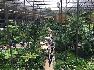
The Estufa Fria ([iʃˈtufɐ ˈfɾi.ɐ]; lit. "Cold Greenhouse") is a greenhouse with three distinct gardens located in Eduardo VII Park between the streets Alameda Engenheiro Edgar Cardoso and Alameda Cardeal Cerejeira in Lisbon, Portugal.

Rato Station
Metro station in Lisbon, Portugal
Distance: Approx. 798 meters
Latitude and longitude: 38.72,-9.15583333
Rato station is the southern terminus of the Yellow Line of the Lisbon Metro.

Jorge Álvares Foundation
Portuguese Foundation
Distance: Approx. 857 meters
Latitude and longitude: 38.72293,-9.1519617
Jorge Álvares Foundation is a non-profit organization with public utility status established in Lisbon on 14 December 1999. It was recognized by the Portuguese government in 2002, and received its public utility status in 2004. It received its initial funding from the Fundação para a Cooperação e o Desenvolvimento de Macau (MOP 50 million) and Stanley Ho (MOP 100 million).
Weather in this IP's area
clear sky
16 Celsius
16 Celsius
15 Celsius
17 Celsius
1019 hPa
83 %
1019 hPa
1006 hPa
10000 meters
3.09 m/s
320 degree
07:22:42
17:21:23