Country:
 Great Britain
Region:
City:
Latitude and Longitude:
Time Zone:
Postal Code:
IP information under different IP Channel
ip-api
Country
Region
City
ASN
Time Zone
ISP
Blacklist
Proxy
Latitude
Longitude
Postal
Route
IPinfo
Country
Region
City
ASN
Time Zone
ISP
Blacklist
Proxy
Latitude
Longitude
Postal
Route
MaxMind
Country
Region
City
ASN
Time Zone
ISP
Blacklist
Proxy
Latitude
Longitude
Postal
Route
Luminati
Country
GBASN
Time Zone
Europe/London
ISP
Iomart Managed Services Limited
Latitude
Longitude
Postal
db-ip
Country
Region
City
ASN
Time Zone
ISP
Blacklist
Proxy
Latitude
Longitude
Postal
Route
ipdata
Country
Region
City
ASN
Time Zone
ISP
Blacklist
Proxy
Latitude
Longitude
Postal
Route
Popular places and events near this IP address

Smethwick
Town in West Midlands, England
Distance: Approx. 88 meters
Latitude and longitude: 52.49305556,-1.96861111
Smethwick () is an industrial town in Sandwell, West Midlands, England. It lies 4 miles (6 km) west of Birmingham city centre. Historically it was in Staffordshire and then Worcestershire before being placed into then West Midlands county.

Smethwick Rolfe Street railway station
Railway station in Smethwick, England
Distance: Approx. 439 meters
Latitude and longitude: 52.496,-1.971
Smethwick Rolfe Street is one of two railway stations serving the town of Smethwick, West Midlands, England. It is situated on the Rugby–Birmingham–Stafford line 3¼ miles (5 km) north west of Birmingham New Street. The station, and all trains serving it, are operated by West Midlands Railway.

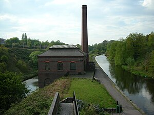
Engine Arm Aqueduct
Bridge in Smethwick
Distance: Approx. 582 meters
Latitude and longitude: 52.4979,-1.9665
The Engine Arm Aqueduct near Smethwick, West Midlands, England, was built in 1825 by Thomas Telford to carry a water feeder, the Engine Arm, from Edgbaston Reservoir over the BCN New Main Line canal to the adjacent and parallel Old Main Line. The structure is maintained by the Canal & River Trust. It is a Scheduled Ancient Monument and is Grade II* listed.
Soho railway station
Former railway station in England
Distance: Approx. 825 meters
Latitude and longitude: 52.4964,-1.9569
Soho railway station was a railway station in England, built by the London and North Western Railway on their Stour Valley Line in 1853. It served Soho in the eastern part of Smethwick, and included goods sheds and sidings. The station was rebuilt on a new site to the west of Soho Street during the 1880s.

Smethwick Junction (canal)
Distance: Approx. 902 meters
Latitude and longitude: 52.4988,-1.9587
Smethwick Junction (grid reference SP028890) is the name of the canal junctions where the Birmingham Canal Navigations Main Line Canal from Birmingham splits into the BCN Old Main Line and the BCN New Main Line near to Smethwick, West Midlands, England.

Guru Nanak Gurdwara Smethwick
Distance: Approx. 437 meters
Latitude and longitude: 52.4958,-1.9714
Guru Nanak Gurdwara Smethwick (ਗੁਰੂ ਨਾਨਕ ਗੁਰਦੁਆਰਾ ਸਮੈਦਿਕ) is a Sikh gurdwara in Smethwick, in Sandwell, near Birmingham in the West Midlands of England.
Cape Hill
Area in West Midlands, England
Distance: Approx. 855 meters
Latitude and longitude: 52.487,-1.959
Cape Hill is an area of Smethwick, in the Metropolitan Borough of Sandwell, West Midlands, England, 2+3⁄4 miles (4.4 km) west of Birmingham City Centre. The area includes Waterloo Road near Shireland Collegiate Academy and the High Street near Victoria Park; it borders Birmingham at the A457 Dudley Road. Cape Hill is Smethwick's busiest shopping area.
Galton Valley Canal Heritage Centre
Canal museum in Smethwick, England
Distance: Approx. 744 meters
Latitude and longitude: 52.4987,-1.9723
Galton Valley Canal Museum is a small museum, located in Smethwick, England, on the border with Birmingham and alongside the BCN Main Line canals. The Museum tells the story of the development of the Galton Valley canals and those who designed, built and worked on them. In 2009 it won the Silver award in the 'Best Small Visitor Attraction' at the Black Country Tourism Awards.

Smethwick Old Church
Church
Distance: Approx. 733 meters
Latitude and longitude: 52.4867,-1.9719
Smethwick Old Church is an Anglican parish church, located in the town of Smethwick, West Midlands. It is located on the junction of The Uplands and Church Road, adjacent to the Dorothy Parkes Community Centre and the 18th-century Old Chapel Public House.

Lions of the Great War
War memorial in Smethwick, Sandwell, England
Distance: Approx. 407 meters
Latitude and longitude: 52.49583333,-1.97055556
The Lions of the Great War is a war memorial in Smethwick, in Sandwell in the West Midlands of England, dedicated to the memory of the Sikh soldiers from the British Indian Army who fought in the First World War. It was unveiled on 4 November 2018 as part of the centenary of the end of the war. The bronze sculpture is a 10 ft (3 metres) high depiction of a Sikh soldier of the First World War on a 5 ft granite plinth; it was created by Luke Perry.

Smethwick Council House
Municipal building in Smethwick, West Midlands, England
Distance: Approx. 200 meters
Latitude and longitude: 52.4909,-1.9674
Smethwick Council House is a municipal building in Smethwick, West Midlands, England. The building, which is located on High Street and was once the headquarters of Smethwick Borough Council, is now a Grade II listed building.

Holy Trinity Church, Smethwick
Church in West Midlands, United Kingdom
Distance: Approx. 351 meters
Latitude and longitude: 52.49478694,-1.97133806
Holy Trinity Church is an Anglican church in Smethwick, West Midlands, England, and in the Diocese of Birmingham. The building is Grade II listed. The church dates originally from 1837, and was rebuilt on a larger scale in 1889.
Weather in this IP's area
overcast clouds
14 Celsius
14 Celsius
14 Celsius
15 Celsius
1024 hPa
88 %
1024 hPa
1005 hPa
8000 meters
5.14 m/s
30 degree
100 %
06:50:58
19:11:31