194.71.156.26 - IP Lookup: Free IP Address Lookup, Postal Code Lookup, IP Location Lookup, IP ASN, Public IP
Country:
Region:
City:
Location:
Time Zone:
Postal Code:
IP information under different IP Channel
ip-api
Country
Region
City
ASN
Time Zone
ISP
Blacklist
Proxy
Latitude
Longitude
Postal
Route
Luminati
Country
ASN
Time Zone
Europe/Stockholm
ISP
InformationsTeknik i Norrbotten AB
Latitude
Longitude
Postal
IPinfo
Country
Region
City
ASN
Time Zone
ISP
Blacklist
Proxy
Latitude
Longitude
Postal
Route
IP2Location
194.71.156.26Country
Region
stockholms lan
City
tyreso
Time Zone
Europe/Stockholm
ISP
Language
User-Agent
Latitude
Longitude
Postal
db-ip
Country
Region
City
ASN
Time Zone
ISP
Blacklist
Proxy
Latitude
Longitude
Postal
Route
ipdata
Country
Region
City
ASN
Time Zone
ISP
Blacklist
Proxy
Latitude
Longitude
Postal
Route
Popular places and events near this IP address

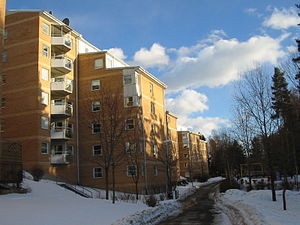
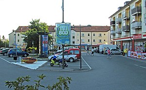
Tyresö Municipality
Municipality in Stockholm County, Sweden
Distance: Approx. 4 meters
Latitude and longitude: 59.23333333,18.21666667
Tyresö Municipality (Tyresö kommun) is a municipality in Stockholm County in east central Sweden on the coast of the Baltic Sea. Most of Tyresö Municipality lies within the Stockholm urban area.

Bollmora
Distance: Approx. 926 meters
Latitude and longitude: 59.24083333,18.22361111
Bollmora is the central district and municipal seat of Tyresö Municipality in Sweden. Together with major parts of the other two main districts of Tyresö, Trollbäcken and Gamla Tyresö, Bollmora forms a conurbation with Stockholm. Bollmora derives its name from Bollmora farm (Bollmora gård) which was located near current day Njupkärrsvägen–Industrivägen intersection.

Trollbäcken
Distance: Approx. 1553 meters
Latitude and longitude: 59.22138889,18.2025
Trollbäcken is a district of Tyresö Municipality in Sweden. It is located south of Bollmora along county road 260. Trollbäcken contains almost exclusively detached houses.

Tyresö centre
Distance: Approx. 1414 meters
Latitude and longitude: 59.24444444,18.22861111
Tyresö centre (Tyresö centrum) is the municipal centre of Tyresö Municipality, Sweden, located in the Bollmora district. The municipal hall (kommunhus) is located there inside Tyresö Centrum, an enclosed shopping mall. A bus terminal is placed next to the shopping mall, providing bus lines to and from the various parts of Tyresö Municipality, and the neighbouring municipalities, including Stockholm, Haninge and Nacka.

Tyresö Centrum
Shopping mall
Distance: Approx. 1414 meters
Latitude and longitude: 59.24444444,18.22861111
Tyresö Centrum (Tyresö Centre) is an enclosed shopping centre in Tyresö centre, Bollmora, the municipal centre of Tyresö, Sweden. It has 74 stores and other social or commercial units.

Tyresö-Flaten
Distance: Approx. 2860 meters
Latitude and longitude: 59.22163889,18.26144444
Tyresö-Flaten is a lake in Tyresö Municipality, south of Stockholm, Sweden. The lake forms part of the Tyresån lake system and as such is considered important for recreational activities such as angling and bathing. Common fish species include perch, zander pike, lake trout, carp bream, and roach.
Barnsjön
Distance: Approx. 1306 meters
Latitude and longitude: 59.22655556,18.23547222
Barnsjön (Swedish for "the Child Lake") is a small lake within the Tyresån Lake System in Tyresö Municipality south of Stockholm, Sweden. The lake, situated between the residential areas Trollbäcken and Bollmora, empties into Lake Tyresö-Flaten through the brook Prästängsdiket. It is regarded as an important local recreational milieu.

Långsjön (Skälsätra-Tutviken)
Lake in Tyresö Municipality, Sweden
Distance: Approx. 2198 meters
Latitude and longitude: 59.21555556,18.23361111
Långsjön (Swedish for "Long Lake") is a lake in the Tyresån Lake System located on the border between Haninge and Tyresö Municipalities in Stockholm County, Sweden. Flowing west to east, the lake receives water from Lake Drevviken and empties into Tyresö-Flaten, and separates two residential areas — Skälsätra north of it and Tutviken south of it. It is a shallow lake with step shores surrounded by flat rock terrain.

Skrubba
Distance: Approx. 2307 meters
Latitude and longitude: 59.23771944,18.17711667
Skrubba is a district (Swedish: stadsdel) in the Skarpnäck borough of Stockholm, Sweden. Skrubba borders in the north to the district of Flaten, in the east to Trollbäcken in Tyresö municipality and in the west and south to Lake Drevviken. As of 2017, Skrubba has 14 permanent residents.

Älta
Place in Södermanland, Sweden
Distance: Approx. 2658 meters
Latitude and longitude: 59.25,18.18333333
Älta is a locality situated in Nacka Municipality, Stockholm County, Sweden with 14,103 inhabitants in 2019.

Tyresån lake system
Distance: Approx. 2849 meters
Latitude and longitude: 59.23333333,18.16666667
Tyresån Lake System (Swedish: Tyresåns sjösystem) is a number of lakes in Sweden with a common basin of 251.5 km2.

Tyresövallen
Sports ground in Tyresö, Sweden
Distance: Approx. 1657 meters
Latitude and longitude: 59.2477,18.2241
Tyresövallen, previous known as Bollmoravallen, is a football stadium in Tyresö, Sweden. The main tenants of the stadium are the football team Tyresö FF and the American football team Tyresö AFF Royal Crowns. The stadium holds least 2,700 people.
Weather in this IP's area
overcast clouds
-1 Celsius
-4 Celsius
-2 Celsius
-1 Celsius
994 hPa
96 %
994 hPa
990 hPa
10000 meters
2.04 m/s
5.2 m/s
260 degree
85 %