194.70.37.171 - IP Lookup: Free IP Address Lookup, Postal Code Lookup, IP Location Lookup, IP ASN, Public IP
Country:
Region:
City:
Location:
Time Zone:
Postal Code:
IP information under different IP Channel
ip-api
Country
Region
City
ASN
Time Zone
ISP
Blacklist
Proxy
Latitude
Longitude
Postal
Route
Luminati
Country
ASN
Time Zone
Europe/London
ISP
CW Vodafone Group PLC
Latitude
Longitude
Postal
IPinfo
Country
Region
City
ASN
Time Zone
ISP
Blacklist
Proxy
Latitude
Longitude
Postal
Route
IP2Location
194.70.37.171Country
Region
england
City
rotherham
Time Zone
Europe/London
ISP
Language
User-Agent
Latitude
Longitude
Postal
db-ip
Country
Region
City
ASN
Time Zone
ISP
Blacklist
Proxy
Latitude
Longitude
Postal
Route
ipdata
Country
Region
City
ASN
Time Zone
ISP
Blacklist
Proxy
Latitude
Longitude
Postal
Route
Popular places and events near this IP address

Metropolitan Borough of Rotherham
Metropolitan borough in South Yorkshire, England
Distance: Approx. 160 meters
Latitude and longitude: 53.43083333,-1.35472222
The Metropolitan Borough of Rotherham is a metropolitan borough of South Yorkshire, England. It is named after its main settlement of Rotherham. The wider borough spans a larger area and covers the outlying towns of Maltby, Swinton, Wath-upon-Dearne, Dinnington.

Rotherham (UK Parliament constituency)
Parliamentary constituency in the United Kingdom, 1885 onwards
Distance: Approx. 213 meters
Latitude and longitude: 53.43,-1.36
Rotherham is a constituency represented in the House of Commons of the UK Parliament. since 2012 by Sarah Champion of the Labour Party.

Rotherham Central station
Railway station and tram stop in Rotherham, South Yorkshire, England
Distance: Approx. 339 meters
Latitude and longitude: 53.4322,-1.3605
Rotherham Central railway station is in Rotherham, South Yorkshire, England. The station was originally named "Rotherham", becoming "Rotherham and Masborough" in January 1889 and finally "Rotherham Central" on 25 September 1950. The station has retained its "Central" suffix, despite being the only railway station in Rotherham since the closure of Rotherham Masborough in 1988.

Rotherham Westgate railway station
Former railway station in England
Distance: Approx. 147 meters
Latitude and longitude: 53.42922,-1.35845
Rotherham Westgate railway station was the eastern terminus of the five-mile-long Sheffield and Rotherham Railway, the first passenger-carrying railway in the Sheffield/Rotherham area. In central Rotherham on the eastern bank of the River Don, it was a single-platform terminus that opened on 31 October 1838 and closed on 4 October 1952.
Kiveton Park Rural District
Distance: Approx. 17 meters
Latitude and longitude: 53.43,-1.357
Kiveton Park was a rural district in the West Riding of Yorkshire from 1894 to 1974. It was formed under the Local Government Act 1894 from that part of the Worksop rural sanitary district which was in the West Riding – the rest going to form Worksop Rural District in Nottinghamshire and Clowne Rural District in Derbyshire. The rural district took its name from the village of Kiveton Park.

Rotherham Civic Theatre and Arts Centre
Theatre in Rotherham, South Yorkshire, England
Distance: Approx. 350 meters
Latitude and longitude: 53.4311,-1.3518
Rotherham Civic Theatre is a converted Congregational church in Rotherham, South Yorkshire, England which is now a medium-scale proscenium arch theatre playing host to a wide program of professional and amateur dance, drama, musicals, children's theatre, comedy, music and pantomime.

Rotherham
Town in South Yorkshire, England
Distance: Approx. 17 meters
Latitude and longitude: 53.43,-1.357
Rotherham ( RODH-ər-əm) is a Minster town in South Yorkshire, England. It lies at the confluence of the River Rother, from which the town gets its name, and the River Don. It is the largest settlement of the Metropolitan Borough of Rotherham.

Rotherham Bridge
Grade I listed bridge in England
Distance: Approx. 297 meters
Latitude and longitude: 53.43263889,-1.35816667
Rotherham Bridge crosses the River Don in central Rotherham, South Yorkshire. It is known for its bridge chapel, considered the best preserved in England. A document of 1385 refers to Bridgegate in the town, which implies that a previous bridge existed on the same site.

Doncaster Gate Hospital
Hospital in South Yorkshire, England
Distance: Approx. 319 meters
Latitude and longitude: 53.43,-1.352
Doncaster Gate Hospital was a hospital located in Rotherham in South Yorkshire, England.

Rotherham Minster
Church in South Yorkshire, England
Distance: Approx. 100 meters
Latitude and longitude: 53.431,-1.3569
The Minster Church of All Saints or Rotherham Minster is the Anglican minster church of Rotherham, South Yorkshire, England. The Minster is a prominent example of Perpendicular Gothic architecture and various architectural historians have rated it highly. Nikolaus Pevsner describes it as "one of the largest and stateliest churches in Yorkshire", Simon Jenkins states it is "the best work in the county", and Alec Clifton-Taylor calls it the "glory of Rotherham".

Rotherham child sexual exploitation scandal
Sexual abuse scandal in Rotherham, England
Distance: Approx. 17 meters
Latitude and longitude: 53.43,-1.357
The Rotherham child sexual exploitation scandal consists of the organised child sexual abuse that occurred in the town of Rotherham, South Yorkshire, Northern England, from the late 1980s until 2013 and the failure of local authorities to act on reports of the abuse throughout most of that period. Researcher Angie Heal, who was hired by local officials and warned them about child exploitation occurring between 2002 and 2007, has since described it as the "biggest child protection scandal in UK history", with one report estimating that 1,400 girls were abused by "grooming gangs" between 1997 and 2013. Evidence of the abuse was first noted in the early 1990s, when care home managers investigated reports that children in their care were being picked up by taxi drivers.

Rotherham Town Hall
Municipal building in Rotherham, South Yorkshire, England
Distance: Approx. 154 meters
Latitude and longitude: 53.429,-1.3554
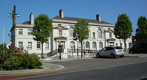
Rotherham Town Hall is a municipal building in The Crofts, off Moorgate Street in Rotherham, South Yorkshire, England.
Weather in this IP's area
overcast clouds
12 Celsius
12 Celsius
10 Celsius
12 Celsius
1022 hPa
92 %
1022 hPa
1018 hPa
10000 meters
5.7 m/s
14.03 m/s
274 degree
100 %