194.70.33.59 - IP Lookup: Free IP Address Lookup, Postal Code Lookup, IP Location Lookup, IP ASN, Public IP
Country:
Region:
City:
Location:
Time Zone:
Postal Code:
IP information under different IP Channel
ip-api
Country
Region
City
ASN
Time Zone
ISP
Blacklist
Proxy
Latitude
Longitude
Postal
Route
Luminati
Country
ASN
Time Zone
Europe/London
ISP
CW Vodafone Group PLC
Latitude
Longitude
Postal
IPinfo
Country
Region
City
ASN
Time Zone
ISP
Blacklist
Proxy
Latitude
Longitude
Postal
Route
IP2Location
194.70.33.59Country
Region
england
City
brentford
Time Zone
Europe/London
ISP
Language
User-Agent
Latitude
Longitude
Postal
db-ip
Country
Region
City
ASN
Time Zone
ISP
Blacklist
Proxy
Latitude
Longitude
Postal
Route
ipdata
Country
Region
City
ASN
Time Zone
ISP
Blacklist
Proxy
Latitude
Longitude
Postal
Route
Popular places and events near this IP address
Brentford
Suburb of West London
Distance: Approx. 120 meters
Latitude and longitude: 51.486,-0.31
Brentford is a suburban town in West London, England and part of the London Borough of Hounslow. It lies at the confluence of the River Brent and the Thames, 8 miles (13 km) west of Charing Cross. Its economy has diverse company headquarters buildings which mark the start of the M4 corridor; in transport it also has two railway stations and Boston Manor Underground station on its north-west border with Hanwell.

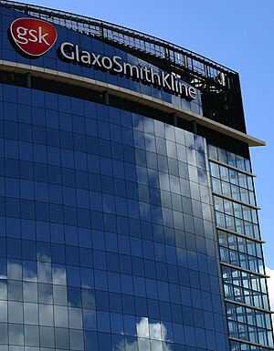
GSK plc
British pharmaceutical and biotechnology company
Distance: Approx. 634 meters
Latitude and longitude: 51.48805556,-0.31694444
GSK plc (an acronym from its former name GlaxoSmithKline plc) is a British multinational pharmaceutical and biotechnology company with headquarters in London. It was established in 2000 by a merger of Glaxo Wellcome and SmithKline Beecham, which was itself a merger of a number of pharmaceutical companies around the Smith, Kline & French firm. GSK is the tenth largest pharmaceutical company and No.
River Brent
River in London, England
Distance: Approx. 554 meters
Latitude and longitude: 51.482,-0.304
The River Brent is a river in west and northwest London, England, and a tributary of the River Thames. 17.9 miles (28.8 km) in length, it rises in the Borough of Barnet and flows in a generally south-west direction before joining the Tideway stretch of the Thames at Brentford.

Griffin Park
Football stadium in London, England
Distance: Approx. 450 meters
Latitude and longitude: 51.48818333,-0.30263889
Griffin Park was a football ground in Brentford in the London Borough of Hounslow, England. It was the home ground of Brentford F.C. from its opening in September 1904 to August 2020. The ground was in a predominantly residential area and was known for being the only English league football ground to have a pub on each corner.

Brentford railway station
National Rail station in London, England
Distance: Approx. 170 meters
Latitude and longitude: 51.4875,-0.3096
Brentford is a railway station in the town of Brentford, in Hounslow, London. It is on the Hounslow Loop Line and in Travelcard Zone 4. The station and all trains serving it are operated by South Western Railway.
Brentford Urban District
Distance: Approx. 582 meters
Latitude and longitude: 51.487,-0.3
Brentford was a local government district in the county of Middlesex, England from 1874 to 1927. Brentford Local Government District was created in 1874 under the Local Government Act 1858 and covered the civil parish of New Brentford and the chapelry of Old Brentford in the parish of Ealing. The district was governed by a local board of twelve members.

Brentford railway station (1860–1942)
Former railway station in London, England
Distance: Approx. 560 meters
Latitude and longitude: 51.4824,-0.3136
Brentford railway station opened on 1 May 1860 on the Brentford Branch Line (the only line of the Great Western and Brentford Railway Company) which had opened in 1859 from Southall to Brentford Dock. It stood immediately north of Brentford High Street (the A315 road) on the embankment leading to the viaduct into the dock. The station closed on 22 March 1915 as a wartime economy measure, re-opened on 12 April 1920 and closed permanently on 4 May 1942.
Brentford School for Girls
Academy in Brentford, Greater London, England
Distance: Approx. 165 meters
Latitude and longitude: 51.4853,-0.3064
Brentford School for Girls is a secondary school and sixth form with academy status for girls aged 11–18, in Brentford, Greater London, England.

Brentford Library
Public library in Brentford, London, England
Distance: Approx. 67 meters
Latitude and longitude: 51.48658,-0.30755
Brentford Library is a Grade II listed building at Boston Manor Road, Brentford, London. It was built in 1903 by Joseph Dorey and Co; for the then Brentford District Council. The benefactor was Andrew Carnegie and the architect was Nowell Parr.

Brentford Baths
Distance: Approx. 124 meters
Latitude and longitude: 51.4868,-0.3068
Brentford Baths is a Grade II listed building at Clifden Road, Brentford, in the London Borough of Hounslow. It was built in 1895–96, and the architect was Nowell Parr. The Baths closed in 1990 and later became a residential building.

Richmond War Memorial, London
War memorial in Whittaker Avenue, Richmond
Distance: Approx. 106 meters
Latitude and longitude: 51.4857,-0.307
The Richmond War Memorial is located in front of Whittaker Avenue, between the Old Town Hall and the Riverside in Richmond, London. It marks the deaths of local individuals who died fighting in World War I and World War II. The memorial was designed by the local architects Messrs Goodale and Co of Richmond and was unveiled by Field Marshal Sir William Robertson on 23 November 1921. The Mayor of Richmond and the corporation attended the ceremony.

St John the Evangelist Church, Brentford
Church in Brentford, England
Distance: Approx. 446 meters
Latitude and longitude: 51.4896,-0.3117
St John the Evangelist Church is a Catholic parish church in Brentford, Borough of Hounslow, London. It was built in 1866 by Mr Jackman, but has parts of it designed by John Francis Bentley, Nathaniel Westlake and Paul Woodroffe. It is a Gothic Revival church and a Grade II listed building.
Weather in this IP's area
overcast clouds
11 Celsius
11 Celsius
10 Celsius
12 Celsius
1029 hPa
92 %
1029 hPa
1027 hPa
10000 meters
2.57 m/s
300 degree
100 %

