Country:
 Great Britain
Region:
City:
Latitude and Longitude:
Time Zone:
Postal Code:
IP information under different IP Channel
ip-api
Country
Region
City
ASN
Time Zone
ISP
Blacklist
Proxy
Latitude
Longitude
Postal
Route
IPinfo
Country
Region
City
ASN
Time Zone
ISP
Blacklist
Proxy
Latitude
Longitude
Postal
Route
MaxMind
Country
Region
City
ASN
Time Zone
ISP
Blacklist
Proxy
Latitude
Longitude
Postal
Route
Luminati
Country
GBASN
Time Zone
Europe/London
ISP
CW Vodafone Group PLC
Latitude
Longitude
Postal
db-ip
Country
Region
City
ASN
Time Zone
ISP
Blacklist
Proxy
Latitude
Longitude
Postal
Route
ipdata
Country
Region
City
ASN
Time Zone
ISP
Blacklist
Proxy
Latitude
Longitude
Postal
Route
Popular places and events near this IP address

Hammersmith tube station (District and Piccadilly lines)
London Underground station
Distance: Approx. 103 meters
Latitude and longitude: 51.4927,-0.2244
Hammersmith is a London Underground station in Hammersmith providing cross-platform interchange between District line and Piccadilly line. It is on the District line between Barons Court and Ravenscourt Park, and on the Piccadilly line between Barons Court and Acton Town or Turnham Green at very early morning and late evening hours. The station is in Travelcard Zone 2.

Polish University Abroad
Distance: Approx. 50 meters
Latitude and longitude: 51.492912,-0.225577
The Polish University Abroad, or Polish University in Exile (Polish: Polski Uniwersytet na Obczyźnie, abbreviated PUNO), was initially established in London in 1949 (de facto 1952). The Polish University Abroad has a B.A. programme and does research. It has outposts in Paris, France, and Munich, Germany.

Lyric Theatre (Hammersmith)
Theatre
Distance: Approx. 73 meters
Latitude and longitude: 51.49306,-0.22639
The Lyric Theatre, also known as the Lyric Hammersmith, is a nonprofit theatre on Lyric Square, off King Street, Hammersmith, London.

Hammersmith Broadway
Shopping mall in London, England
Distance: Approx. 149 meters
Latitude and longitude: 51.49194444,-0.22388889
Hammersmith Broadway is a major transport node and shopping centre in Hammersmith, London.
Klub Foot
Nightclub in London, England
Distance: Approx. 81 meters
Latitude and longitude: 51.492,-0.225
Klub Foot was a London nightclub in the psychobilly scene of the early and mid-1980s. It started in the heyday of the psychobilly scene in 1982. It was hosted at the Ballroom of the Clarendon Hotel in Hammersmith until the venue was demolished as part of the redevelopment of Hammersmith Town Centre.

Hammersmith bus station
Bus station in London, England
Distance: Approx. 136 meters
Latitude and longitude: 51.4921,-0.224
Hammersmith bus station is located adjacent to the District & Piccadilly and Circle and Hammersmith & City lines London Underground stations in Hammersmith. It is owned and maintained by Transport for London. The bus station is divided into two sections (lower and upper stations).

The Hop Poles
Pub in Hammersmith, London
Distance: Approx. 31 meters
Latitude and longitude: 51.49277778,-0.22583333
The Hop Poles is a Grade II listed public house at 17–19 King Street, Hammersmith, London. It was built in 1857, the amalgamation of two earlier houses, and the architect is not known".

The Swan, Hammersmith
Pub in Hammersmith, London
Distance: Approx. 85 meters
Latitude and longitude: 51.49305556,-0.225
The Swan is a Grade II listed public house at 46 Hammersmith Broadway, Hammersmith, London. It was built in 1901, by the architect Frederick Miller, and is in the Free Jacobean style.

The George, Hammersmith
Former pub in Hammersmith, London
Distance: Approx. 126 meters
Latitude and longitude: 51.493293,-0.224562
The George is a Grade II listed public house at 28 Hammersmith Broadway, Hammersmith, London. It was built in 1911, by the architects Nowell Parr and A E Kates. It is now a branch of the bar/restaurant chain Belushi's.

St Paul's, Hammersmith
Church in Hammersmith, London
Distance: Approx. 115 meters
Latitude and longitude: 51.491507,-0.22538
St Paul's (also known as the Church of Saint Paul's) is a Grade II* listed Anglican church on Queen Caroline Street, Hammersmith, London. The church is adjacent to Hammersmith flyover and a short walk from Hammersmith tube station.

King Street, Hammersmith
Distance: Approx. 76 meters
Latitude and longitude: 51.49276111,-0.22686111
King Street, Hammersmith is the main shopping street in Hammersmith, London. It runs west–east, and forms part of the A315, and is the eastern continuation of Chiswick High Road, where it meets Goldhawk Road (the A402), close to Stamford Brook tube station. At the eastern end it meets Hammersmith Broadway and continues east as Hammersmith Road where it forms a crossroads with the A219, the Shepherd's Bush Road running northwards, and the Fulham Palace Road running south.
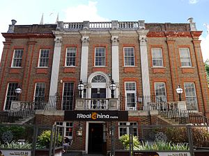
Bradmore House
Distance: Approx. 121 meters
Latitude and longitude: 51.491782,-0.224548
Bradmore House is a Grade II listed building in Queen Caroline Street, Hammersmith, London. The original house had two storeys. The building was dismantled and rebuilt on a plinth with an external staircase at the front, forming a three-storey structure.
Weather in this IP's area
scattered clouds
14 Celsius
14 Celsius
13 Celsius
15 Celsius
1004 hPa
95 %
1004 hPa
1003 hPa
6000 meters
3.09 m/s
100 degree
40 %
06:25:18
19:32:02