Country:
 Great Britain
Region:
City:
Latitude and Longitude:
Time Zone:
Postal Code:
IP information under different IP Channel
ip-api
Country
Region
City
ASN
Time Zone
ISP
Blacklist
Proxy
Latitude
Longitude
Postal
Route
IPinfo
Country
Region
City
ASN
Time Zone
ISP
Blacklist
Proxy
Latitude
Longitude
Postal
Route
MaxMind
Country
Region
City
ASN
Time Zone
ISP
Blacklist
Proxy
Latitude
Longitude
Postal
Route
Luminati
Country
GBASN
Time Zone
Europe/London
ISP
CW Vodafone Group PLC
Latitude
Longitude
Postal
db-ip
Country
Region
City
ASN
Time Zone
ISP
Blacklist
Proxy
Latitude
Longitude
Postal
Route
ipdata
Country
Region
City
ASN
Time Zone
ISP
Blacklist
Proxy
Latitude
Longitude
Postal
Route
Popular places and events near this IP address

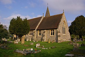
Royal Earlswood Hospital
Hospital in Surrey, England
Distance: Approx. 2508 meters
Latitude and longitude: 51.22277778,-0.16694444
The Royal Earlswood Hospital, formerly The Asylum for Idiots and The Royal Earlswood Institution for Mental Defectives, in Redhill, Surrey, was the first establishment to cater specifically for people with developmental disabilities. Previously they had been housed either in asylums for the mentally ill or in workhouses.
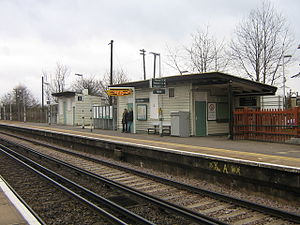
Salfords railway station
Railway station in Surrey, England
Distance: Approx. 259 meters
Latitude and longitude: 51.202,-0.162
Salfords railway station serves the village of Salfords in Surrey, England. The station is sometimes shown as Salfords (Surrey) in timetables to differentiate it from the two stations in Salford, Greater Manchester. It is on the Brighton Main Line, 23 miles 37 chains (37.8 km) down the line from London Bridge via Redhill and is managed by Southern.
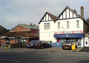
Salfords
Human settlement in England
Distance: Approx. 290 meters
Latitude and longitude: 51.2014,-0.1683
Salfords SAL-fudz) is a village in the borough of Reigate and Banstead in Surrey, England. It lies approximately 3 miles (4.8 km) south of Redhill on the A23 London to Brighton road. The village is within the civil parish of Salfords and Sidlow which covers a population of 3,069, and has a parish council.
Redhill F.C.
Association football club in England
Distance: Approx. 2142 meters
Latitude and longitude: 51.21916667,-0.17055556
Redhill F.C. is an English football club based in Redhill, Surrey. The club are currently members of the Combined Counties League Premier Division South and play at Kiln Brow. The club is affiliated to the Surrey County Football Association.
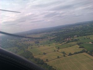
Redhill Aerodrome
Aerodrome in Surrey, England
Distance: Approx. 2337 meters
Latitude and longitude: 51.21361111,-0.13861111
Redhill Aerodrome (ICAO: EGKR) is an operational general aviation aerodrome located 1.5 NM (2.8 km; 1.7 mi) south-east of Redhill, Surrey, England, in green belt land. It also serves as an important reliever airport for Gatwick airport. Redhill Aerodrome has a CAA Ordinary Licence (Number P421) that allows flights for the public transport of passengers or for flying instruction as authorised by the licensee (Redhill Aerodrome Limited).
Salfords and Sidlow
Distance: Approx. 1428 meters
Latitude and longitude: 51.2,-0.185
Salfords and Sidlow is a civil parish in the Reigate and Banstead borough of Surrey, England. It has a population of 3,069. The parish includes the villages of Salfords and Sidlow.
Reigate Hundred
Distance: Approx. 1960 meters
Latitude and longitude: 51.204,-0.192
Reigate was a hundred in the historic county of Surrey, England. It was geographically consonant with the southern two thirds of the current Borough of Reigate and Banstead together with two parishes in Tandridge and fractions of former parishes in the London Borough of Croydon and Borough of Crawley, West Sussex. Accordingly, it included the medieval-established town of Reigate with its motte castle and land which became the towns of Redhill and Horley.
Sidlow
Village in England
Distance: Approx. 2552 meters
Latitude and longitude: 51.208,-0.199
Sidlow is a mainly rural, lightly populated village in the parish of Salfords and Sidlow, in the south of the borough of Reigate and Banstead in Surrey, England.
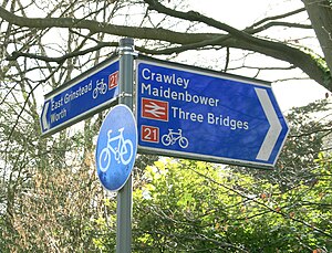
National Cycle Route 21
Cycle route in the United Kingdom
Distance: Approx. 1807 meters
Latitude and longitude: 51.18611111,-0.15194444
National Cycle Route 21 (or NCR 21) is part of the United Kingdom's National Cycle Network. It runs from Greenwich in South-East London south to Crawley, then east to Groombridge and south to Eastbourne, with a short final loop northwards again to its end at Pevensey. The route is approximately 150 km (93 miles) long.

Earlswood Common
Distance: Approx. 2776 meters
Latitude and longitude: 51.223,-0.181
Earlswood Common is an 89.1-hectare (220-acre) Local Nature Reserve in Redhill in Surrey. It is owned and managed by Reigate and Banstead Borough Council. Habitats on the common include woodland, semi-improved grassland, two large lakes, several ponds and wetland corridors.

East Surrey Hospital
Hospital in Surrey, England
Distance: Approx. 2059 meters
Latitude and longitude: 51.2188,-0.1643
East Surrey Hospital is a National Health Service hospital in the Whitebushes area to the south of Redhill, in Surrey, England. It is managed by the Surrey and Sussex Healthcare NHS Trust.

Mercers Lake
Lake in Surrey, UK
Distance: Approx. 2001 meters
Latitude and longitude: 51.2175,-0.1562
Mercers Lake is a body of water in Mercers Park, Merstham, near Redhill, Surrey. It is a former quarry that has been adapted for water sports, such as sailing, kayaking, and paddle boarding.
Weather in this IP's area
mist
14 Celsius
14 Celsius
13 Celsius
15 Celsius
1005 hPa
84 %
1005 hPa
997 hPa
10000 meters
2.06 m/s
100 degree
40 %
06:25:23
19:31:27