Country:
Region:
City:
Latitude and Longitude:
Time Zone:
Postal Code:
IP information under different IP Channel
ip-api
Country
Region
City
ASN
Time Zone
ISP
Blacklist
Proxy
Latitude
Longitude
Postal
Route
Luminati
Country
ASN
Time Zone
Europe/Berlin
ISP
FREE RANGE CLOUD
Latitude
Longitude
Postal
IPinfo
Country
Region
City
ASN
Time Zone
ISP
Blacklist
Proxy
Latitude
Longitude
Postal
Route
db-ip
Country
Region
City
ASN
Time Zone
ISP
Blacklist
Proxy
Latitude
Longitude
Postal
Route
ipdata
Country
Region
City
ASN
Time Zone
ISP
Blacklist
Proxy
Latitude
Longitude
Postal
Route
Popular places and events near this IP address
Milton, Delaware
Town in Delaware, United States
Distance: Approx. 1335 meters
Latitude and longitude: 38.7775,-75.31
Milton is a town in Sussex County, Delaware, United States, on the Delmarva Peninsula. It is located on the Broadkill River, which empties into Delaware Bay. The population was 3,291 at the 2020 census.

New Market, Delaware
Unincorporated community in Delaware, United States
Distance: Approx. 7482 meters
Latitude and longitude: 38.80722222,-75.39694444
New Market was a small town in the U.S. state of Delaware located between Ellendale and Milton. At the current crossroads of Holly Tree Road and Reynolds Pond Road just east of Ellendale was the New Market Church, around which the town was located. None of the town exists today, although the cemetery from the church yard is still at the intersection.
Harbeson, Delaware
Unincorporated community in Delaware, United States
Distance: Approx. 7593 meters
Latitude and longitude: 38.72472222,-75.285
Harbeson is an unincorporated community in east central Sussex County, Delaware, United States. It lies at the intersection of U.S. Route 9/Delaware Route 404 and Delaware Route 5, east of the town of Georgetown, the county seat of Sussex County. Its elevation is 36 feet (11 m).

Prime Hook National Wildlife Refuge
Distance: Approx. 7698 meters
Latitude and longitude: 38.84777778,-75.26694444
Prime Hook National Wildlife Refuge is a sanctuary for migratory birds located east of Milton, Delaware, United States. It was established by President John F. Kennedy in 1963 on 10,000 acres (40 km2) along the western shore of Delaware Bay. The refuge contains a variety of habitats, including freshwater and salt marshes, woodlands, grasslands, ponds, and forested areas, supporting 267 species of birds and a variety of reptiles, amphibians and mammals.
Draper–Adkins House
Historic house in Delaware, United States
Distance: Approx. 1401 meters
Latitude and longitude: 38.77666667,-75.31138889
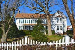
Draper–Adkins House, also known as the Jenny Adkins House, is a historic home located at Milton, Sussex County, Delaware. It was built about 1840, and is a 2+1⁄2-story, five-bay, single pile, wood frame dwelling clad in weatherboard. The interior has Greek Revival style details.
Hazzard House
Historic house in Delaware, United States
Distance: Approx. 802 meters
Latitude and longitude: 38.78194444,-75.31277778
Hazzard House is a historic home located at Milton, Sussex County, Delaware. The original section dates to the 18th century, and is a two-story, three-bay, single pile dwelling, of timber-frame construction on a brick foundation. It was expanded in the first half of the 19th century with a two-room, double pile addition.
Gov. James Ponder House
Historic house in Delaware, United States
Distance: Approx. 1693 meters
Latitude and longitude: 38.77388889,-75.31361111
Gov. James Ponder House is a historic home located at Milton, Sussex County, Delaware. It was built about 1875, and is a three-story, five-bay, Victorian townhouse.
Milton Historic District (Milton, Delaware)
Historic district in Delaware, United States
Distance: Approx. 1461 meters
Latitude and longitude: 38.77638889,-75.30972222
Milton Historic District is a national historic district located at Milton, Sussex County, Delaware. It includes 188 contributing buildings and 1 contributing site in the central business district and surrounding residential areas of Milton. The district includes much of Union, Federal, Broad, Chestnut, and Mill Streets, and encompasses a wide variety of residential, commercial, and institutional buildings from the late-18th century to the early-20th century.
David Robbins Homestead
Historic house in Delaware, United States
Distance: Approx. 2204 meters
Latitude and longitude: 38.79444444,-75.28944444
The David Robbins House is a historic house at 26285 Broadkill Road in Milton, Delaware. The two story vernacular wood-frame house was built c. 1850, and is one of a few from the period to survive in the area.

Sowbridge Branch (Primehook Creek tributary)
Stream in Delaware, USA
Distance: Approx. 3544 meters
Latitude and longitude: 38.82083333,-75.31722222
Sowbridge Branch is a 5.44 mi (8.75 km) long 2nd order tributary to Primehook Creek in Sussex County, Delaware.
Beaverdam Creek (Broadkill River tributary)
Stream in Delaware, USA
Distance: Approx. 5263 meters
Latitude and longitude: 38.789,-75.25324444
Beaverdam Creek is a 3.24 mi (5.21 km) long first-order tributary to the Broadkill River in Sussex County, Delaware.
Round Pole Branch
Stream in Delaware, USA
Distance: Approx. 1706 meters
Latitude and longitude: 38.77622222,-75.30324722
Round Pole Branch is a 5.24 mi (8.43 km) long first-order tributary to the Broadkill River in Sussex County, Delaware. This is the only stream of this name in the United States.
Weather in this IP's area
clear sky
6 Celsius
3 Celsius
3 Celsius
7 Celsius
1029 hPa
63 %
1029 hPa
1027 hPa
10000 meters
3.6 m/s
10 degree
06:42:06
16:49:19


