Country:
Region:
City:
Latitude and Longitude:
Time Zone:
Postal Code:
IP information under different IP Channel
ip-api
Country
Region
City
ASN
Time Zone
ISP
Blacklist
Proxy
Latitude
Longitude
Postal
Route
Luminati
Country
Region
an
City
alhendin
ASN
Time Zone
Europe/Madrid
ISP
Radiocable Ingenieros S.l.
Latitude
Longitude
Postal
IPinfo
Country
Region
City
ASN
Time Zone
ISP
Blacklist
Proxy
Latitude
Longitude
Postal
Route
db-ip
Country
Region
City
ASN
Time Zone
ISP
Blacklist
Proxy
Latitude
Longitude
Postal
Route
ipdata
Country
Region
City
ASN
Time Zone
ISP
Blacklist
Proxy
Latitude
Longitude
Postal
Route
Popular places and events near this IP address
Puerto del Suspiro del Moro
Mountain pass in the Sierra Nevada, Spain
Distance: Approx. 4043 meters
Latitude and longitude: 37.07027778,-3.65111111
Puerto del Suspiro del Moro or Pass of the Moor's Sigh is a mountain pass in the Spanish Sierra Nevada.

Armilla, Granada
Municipality in Andalusia, Spain
Distance: Approx. 8882 meters
Latitude and longitude: 37.15,-3.61666667
Armilla is a municipality of Spain located in the province of Granada, in the autonomous community of Andalusia. It lies on the Vega de Granada, 4 km from the provincial capital's city centre. Armilla limits with the municipalities of Granada, Ogíjares, Alhendín and Churriana de la Vega.
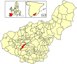
Alhendín
Place in Granada, Spain
Distance: Approx. 6460 meters
Latitude and longitude: 37.11666667,-3.65
Alhendín is a city located in the province of Granada, Spain. According to the 2005 census (INE), the city had a population of 5,200 inhabitants.
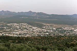
Cájar
Place in Granada, Spain
Distance: Approx. 7782 meters
Latitude and longitude: 37.13333333,-3.56666667
Cájar is a city located in the province of Granada, Spain. According to the 2005 census (INE), the city has a population of 4,051 inhabitants.
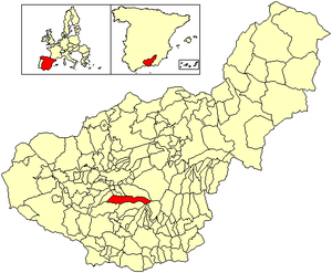
Dílar
City in Granada, Spain
Distance: Approx. 670 meters
Latitude and longitude: 37.06666667,-3.6
Dílar is a municipality located in the province of Granada, Spain. According to the 2005 census (INE), the city has a population of 1,620 inhabitants.

Gójar
City in Granada, Spain
Distance: Approx. 3299 meters
Latitude and longitude: 37.1,-3.6
Gójar is a municipality located in the province of Granada, Spain. According to the 2005 census (INE), the city has a population of 4,946 inhabitants.

Ogíjares
City in Granada, Spain
Distance: Approx. 5141 meters
Latitude and longitude: 37.11666667,-3.6
Ogíjares is a municipality located in the central-southern part of the province of Granada, Spain. According to the 2005 census (INE), the city had a population of 11,877 inhabitants.
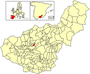
Víznar
Town in Granada, Spain
Distance: Approx. 5486 meters
Latitude and longitude: 37.11666667,-3.58333333
Víznar is a municipality located in the province of Granada, Spain, only a few miles from the city of Granada itself. According to the 2005 census (INE), the town has a population of 789 inhabitants. Site of the exquisite neo-classical Summer palace of an 18th-century archbishop of Granada, Don José Manuel Moscoso y Peralta, (1723–1811), an important figure in the history of Peru, the near-vicinity of Víznar was the place of execution, in 1936, of the noted Spanish poet, Federico García Lorca, at the beginning of the Spanish Civil War.
La Zubia
Place in Andalusia, Spain
Distance: Approx. 5844 meters
Latitude and longitude: 37.12055556,-3.585
La Zubia is a municipality located in the province of Granada, Spain. According to the 2010 census (INE), the city has a population of 18,240 inhabitants.

El Padul
Municipality in Andalusia, Spain
Distance: Approx. 5479 meters
Latitude and longitude: 37.02444444,-3.62666667
El Padul is a municipality of south-eastern Spain, in the province of Granada, within the comarca of el Valle de Lecrín. The population on 2008 was 8.440 inhabitants. This town is situated 13 km at the south of the city of Granada.

Monachil
Municipality in Granada, Spain
Distance: Approx. 9031 meters
Latitude and longitude: 37.13194444,-3.53888889
Monachil is a municipality in the province of Granada, Spain. As of 2018, it has a population of 7,826 inhabitants. It lies around 8 km from the city of Granada.
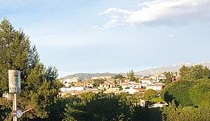
Villa de Otura
Place in Andalusia, Spain
Distance: Approx. 5141 meters
Latitude and longitude: 37.11666667,-3.6
Villa de Otura is a municipality in the province of Granada, Spain. As of 2010, it has a population of 6,598 inhabitants.
Weather in this IP's area
clear sky
19 Celsius
18 Celsius
17 Celsius
19 Celsius
1018 hPa
46 %
1018 hPa
920 hPa
10000 meters
1.03 m/s
07:56:43
18:02:55