Country:
Region:
City:
Latitude and Longitude:
Time Zone:
Postal Code:
IP information under different IP Channel
ip-api
Country
Region
City
ASN
Time Zone
ISP
Blacklist
Proxy
Latitude
Longitude
Postal
Route
Luminati
Country
Region
vc
City
crevillent
ASN
Time Zone
Europe/Madrid
ISP
Cable Aireworld S.A.U.
Latitude
Longitude
Postal
IPinfo
Country
Region
City
ASN
Time Zone
ISP
Blacklist
Proxy
Latitude
Longitude
Postal
Route
db-ip
Country
Region
City
ASN
Time Zone
ISP
Blacklist
Proxy
Latitude
Longitude
Postal
Route
ipdata
Country
Region
City
ASN
Time Zone
ISP
Blacklist
Proxy
Latitude
Longitude
Postal
Route
Popular places and events near this IP address

Elche
Municipality in Valencian Community, Spain
Distance: Approx. 9405 meters
Latitude and longitude: 38.26694444,-0.69833333
Elche (, Spanish: [ˈeltʃe]; Valencian: Elx, UK: , US: , Valencian: [ˈɛʎtʃ] is a city and municipality of Spain, belonging to the province of Alicante, in the Valencian Community. According to 2024's data, Elche has a population of 234,800 inhabitants, making it the third most populated municipality in the region (after Valencia and Alicante) and the 20th largest Spanish municipality. It is part of the comarca of Baix Vinalopó.
Crevillent
Municipality in Valencian Community, Spain
Distance: Approx. 474 meters
Latitude and longitude: 38.24861111,-0.80888889
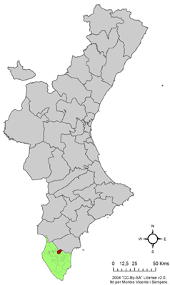
Crevillent (Valencian: [kɾeviˈʎent]; Spanish: Crevillente [kɾeβiˈʎente]) is a town and municipality located in the Alicante province, part of the Valencian Community, Spain. It is situated in the comarca of Baix Vinalopó, and lies at the foot of the hill range known locally as Serra de Crevillent. As of 2009, it has a total population of 28,609 inhabitants.

Baix Vinalopó
Comarca in Valencian Community, Spain
Distance: Approx. 8891 meters
Latitude and longitude: 38.26166667,-0.70305556
The Baix Vinalopó (Valencian: [ˈbajʒ vinaloˈpo], also [ˈbaʒ-]; Spanish: Bajo Vinalopó [ˈbaxo βinaloˈpo]; lit. "Lower Vinalopó") is a comarca in the province of Alicante (Valencian Community, Spain). It is bordered by the comarques of Vinalopó Mitjà and Alacantí on the north and Vega Baja del Segura on the south.

Albatera
Municipality in Valencian Community, Spain
Distance: Approx. 9667 meters
Latitude and longitude: 38.17861111,-0.86805556
Albatera (Spanish pronunciation: [alβaˈteɾa]) is a town and municipality located in the comarca of Vega Baja del Segura, in the province of Alicante, part of the Valencian Community, Spain. Albatera has an area of 66.5 km2 and, according to the 2005 census, a total population of 10,499 inhabitants. The economy of Albatera is mainly based on trade, confección costura (Clothing Manufacture) and agriculture.

Catral
Municipality in Valencian Community, Spain
Distance: Approx. 9981 meters
Latitude and longitude: 38.15944444,-0.805
Catral (Spanish pronunciation: [kaˈtɾal]) is a town in the Valencian Community, Spain. Located in the south of the province of Alicante, in the region of Vega Baja del Segura. It had 8,105 inhabitants in 2007 according to the National Statistics Institute of Spain.
Mystery Play of Elche
Cultural property in Elche, Spain
Distance: Approx. 9405 meters
Latitude and longitude: 38.26694444,-0.69833333
The Mystery Play of Elche or Elche Mystery Play (Valencian: Misteri d'Elx [misˈtɛɾi ˈðɛʎtʃ]; Spanish: Misterio de Elche [misˈteɾjo ˈð(e) ˈeltʃe]), is a liturgical drama from the Middle Ages that reenacts the Dormition and Assumption of the Blessed Virgin Mary. The two-act mystery play is performed annually on 14 and 15 August in the Basilica de Santa María in the city of Elche. In 2001, UNESCO declared it one of the Masterpieces of the Oral and Intangible Heritage of Humanity and, in 2008, inscribed it on its Representative List.

Palmeral of Elche
System of orchards in Elche, Spain
Distance: Approx. 9511 meters
Latitude and longitude: 38.27,-0.698
The Palmeral or Palm Grove of Elche (Spanish: Palmeral de Elche; Valencian: Palmerar d'Elx) is the generic name for a system of date palm orchards in the city of Elche, Spain. The Palmeral was planted in Roman times and underwent modifications in the medieval period under Islamic and Christian rulers. The Roman empire introduced water management techniques to Elche, but the 10th c.
Don Francisco Mira Cánovas Dam
Distance: Approx. 8382 meters
Latitude and longitude: 38.28381,-0.88861
Francisco Mira Dam is a reservoir in the Valencian Community, Spain.
Serra de Crevillent
Mountain range in southern Spain
Distance: Approx. 5575 meters
Latitude and longitude: 38.28361111,-0.84972222
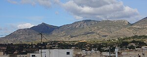
The Serra de Crevillent (Spanish: Sierra de Crevillente) is a mountain range in the Baetic System, southern Spain. It spans the region of Murcia and the province of Alicante. The highest peak is Sant Gaietà at 835 meters, near the town of Crevillent.
San Isidro, Alicante
Municipality in Valencia, Spain
Distance: Approx. 9687 meters
Latitude and longitude: 38.166944,-0.84
San Isidro is a village in the province of Alicante and autonomous community of Valencia, Spain. The municipality covers an area of 11.69 square kilometres (4.51 sq mi) and as of 2011 had a population of 1,934 people.

Els Pontets
Aqueduct in Crevillent, Spain
Distance: Approx. 2569 meters
Latitude and longitude: 38.26468,-0.82518
Els Pontets is a Spanish aqueduct located in the municipality of Crevillent, Alicante. The aqueduct is part of the qanat that supplied water during the Al-Andalus era to the population from the Sierra de Crevillente. The infrastructure of the aqueduct dates back to the 13th century, although the stone arches only date back to the early 20th century.
Weather in this IP's area
overcast clouds
17 Celsius
17 Celsius
17 Celsius
18 Celsius
1020 hPa
82 %
1020 hPa
1004 hPa
10000 meters
1.79 m/s
6.26 m/s
38 degree
100 %
07:44:52
17:51:06


