194.59.31.123 - IP Lookup: Free IP Address Lookup, Postal Code Lookup, IP Location Lookup, IP ASN, Public IP
Country:
Region:
City:
Location:
Time Zone:
Postal Code:
ISP:
ASN:
language:
User-Agent:
Proxy IP:
Blacklist:
IP information under different IP Channel
ip-api
Country
Region
City
ASN
Time Zone
ISP
Blacklist
Proxy
Latitude
Longitude
Postal
Route
db-ip
Country
Region
City
ASN
Time Zone
ISP
Blacklist
Proxy
Latitude
Longitude
Postal
Route
IPinfo
Country
Region
City
ASN
Time Zone
ISP
Blacklist
Proxy
Latitude
Longitude
Postal
Route
IP2Location
194.59.31.123Country
Region
ile-de-france
City
tremblay-en-france
Time Zone
Europe/Paris
ISP
Language
User-Agent
Latitude
Longitude
Postal
ipdata
Country
Region
City
ASN
Time Zone
ISP
Blacklist
Proxy
Latitude
Longitude
Postal
Route
Popular places and events near this IP address

Sevran
Commune in Île-de-France, France
Distance: Approx. 3143 meters
Latitude and longitude: 48.9333,2.5333
Sevran (French pronunciation: [səvʁɑ̃] ) is a commune in the French department of Seine-Saint-Denis, northeastern suburbs of Paris, Île-de-France. It is located 16.2 km (10.1 mi) from the center of Paris.

Tremblay-en-France
Commune in Île-de-France, France
Distance: Approx. 281 meters
Latitude and longitude: 48.95,2.5722
Tremblay-en-France (French pronunciation: [tʁɑ̃blɛ ɑ̃ fʁɑ̃s] , lit. 'Tremblay in France'; before 1989: Tremblay-lès-Gonesse, lit. 'Tremblay near Gonesse') is a commune in the north-eastern suburbs of Paris, France. It is located 19.5 km (12.1 mi) from the centre of Paris. More than one-quarter of Charles de Gaulle Airport lies within the territory of the commune of Tremblay-en-France, in particular terminals 2A, 2B, 2C and 2D (the other terminals lie in the territory of other communes).

Villepinte, Seine-Saint-Denis
Commune in Île-de-France, France
Distance: Approx. 2091 meters
Latitude and longitude: 48.955,2.541
Villepinte (French pronunciation: [vilpɛ̃t] ) is a commune in the northeastern suburbs of Paris, France. It is located 18.3 km (11.4 mi) from the centre of Paris. It is near the Charles de Gaulle Airport.

Vaujours
Commune in Île-de-France, France
Distance: Approx. 1819 meters
Latitude and longitude: 48.9333,2.5667
Vaujours (French pronunciation: [voʒuʁ] ) is a commune in the northeastern suburbs of Paris, France. It is located 18.2 km (11.3 mi) from the center of Paris, in the département of Seine-Saint-Denis. Known for its wines and fruit until the end of the 19th century, Vaujours is now one of the world's premier producers of plaster of Paris.

Villeparisis
Commune in Île-de-France, France
Distance: Approx. 2494 meters
Latitude and longitude: 48.9503,2.6025
Villeparisis (French pronunciation: [vilpaʁizi] ) is a commune in the Seine-et-Marne department in the Île-de-France region in north-central France. It is located in the north-eastern suburbs of Paris 21.8 km (13.5 mi) from the centre. Inhabitants of Villeparisis are called Villeparisiens.

Canton of Tremblay-en-France
Canton in Île-de-France, France
Distance: Approx. 281 meters
Latitude and longitude: 48.95,2.5722
The Canton of Tremblay-en-France (French: canton de Tremblay-en-France) is a French administrative division, located in the arrondissement of Le Raincy, Seine-Saint-Denis, Île-de-France. Its borders were modified at the French canton reorganisation which came into effect in March 2015. Its seat is in Tremblay-en-France.

Canton of Sevran
Canton in Île-de-France, France
Distance: Approx. 3143 meters
Latitude and longitude: 48.9333,2.5333
The Canton of Sevran is a French administrative division, located in the arrondissement of Le Raincy, in the Seine-Saint-Denis département (Île-de-France région). Its borders were modified at the French canton reorganisation which came into effect in March 2015. Its seat is in Sevran.

Sevran–Livry station
Railway station in Paris, France
Distance: Approx. 2917 meters
Latitude and longitude: 48.9361,2.5342
Sevran–Livry station is an RER station in Sevran and near Livry-Gargan, a northerly suburb of Paris, in Seine-Saint-Denis department, France. The station is in Zone 4 of the Carte orange. It is situated on the RER B suburban railway line.

Villeparisis–Mitry-le-Neuf station
Railway station in Mitry-Mory, France
Distance: Approx. 2542 meters
Latitude and longitude: 48.953062,2.602765
Villeparisis–Mitry-le-Neuf station is an RER station between Mitry-Mory and Villeparisis in northeast Paris, in Seine-et-Marne department, France. The station is in Zone 5 of the Carte orange. It is on the RER B suburban railway line.
Vert-Galant station
Railway station in Villepinte, France
Distance: Approx. 614 meters
Latitude and longitude: 48.944167,2.566944
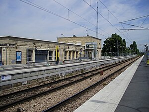
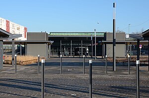
Vert-Galant (French pronunciation: [vɛʁ ɡalɑ̃]) is an RER station in Villepinte, Seine-Saint-Denis, a northeastern suburb of Paris. It is on RER B between Villeparisis – Mitry-le-Neuf and Sevran–Livry.

Sevran Beaudottes station
Railway station in Sevran, France
Distance: Approx. 3245 meters
Latitude and longitude: 48.947222,2.524167
Sevran Beaudottes station is an RER station in Sevran, Seine-Saint-Denis, a northeastern suburb of Paris. It is on RER B between Villepinte and Aulnay-sous-Bois.

Church of Saint-Médard, Tremblay-en-France
Church in Tremblay-en-France, Seine-Saint-Denis, France
Distance: Approx. 3437 meters
Latitude and longitude: 48.97972222,2.55805556
The Church of Saint-Médard (French: église Saint-Médard) is a Roman Catholic church located in Tremblay-en-France in the department of Seine-Saint-Denis, France. It is dedicated to Saint Medard and listed as a Class Historic Monument.
Weather in this IP's area
broken clouds
5 Celsius
2 Celsius
4 Celsius
5 Celsius
1012 hPa
88 %
1012 hPa
1001 hPa
10000 meters
3.6 m/s
240 degree
75 %
