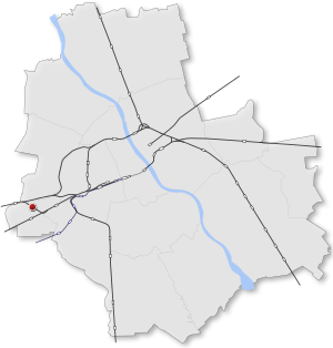
Country:
 Poland
Region:
City:
Latitude and Longitude:
Time Zone:
Postal Code:
IP information under different IP Channel
ip-api
Country
Region
City
ASN
Time Zone
ISP
Blacklist
Proxy
Latitude
Longitude
Postal
Route
IPinfo
Country
Region
City
ASN
Time Zone
ISP
Blacklist
Proxy
Latitude
Longitude
Postal
Route
MaxMind
Country
Region
City
ASN
Time Zone
ISP
Blacklist
Proxy
Latitude
Longitude
Postal
Route
Luminati
Country
PLASN
Time Zone
Europe/Warsaw
ISP
Atman Sp. z o.o.
Latitude
Longitude
Postal
db-ip
Country
Region
City
ASN
Time Zone
ISP
Blacklist
Proxy
Latitude
Longitude
Postal
Route
ipdata
Country
Region
City
ASN
Time Zone
ISP
Blacklist
Proxy
Latitude
Longitude
Postal
Route
Popular places and events near this IP address

Battle of Białołęka
Distance: Approx. 2168 meters
Latitude and longitude: 52.192881,20.889731
The Battle of Białołęka was fought from 24 to 25 February 1831 in the village of Białołęka, Poland, during the November Uprising. Though the Polish forces were victorious over the Russians, the outcome was not decisive, and was inconclusive in the scope of the larger Russo-Polish War.

Ursus, Warsaw
Warsaw District in Masovian Voivodeship, Poland
Distance: Approx. 2178 meters
Latitude and longitude: 52.19277778,20.88972222
Ursus is a district (dzielnica) of Warsaw, one of the 18 such units into which the city is divided. Between 1952 and 1977 it was a separate city. Until 1954 it was known as Czechowice.

Włochy
Warsaw District in Masovian Voivodeship, Poland
Distance: Approx. 1272 meters
Latitude and longitude: 52.2,20.91666667
Włochy (Polish pronunciation: [ˈvwɔxɨ] ) is one of the districts of Warsaw, located in the south-western part of city. Włochy borders districts Bemowo and Wola from the north, Ochota and Mokotów from the east, and Ursus and Ursynów from the south. It is one of 3 neighborhoods with the title of a garden town (pol.

Warszawa Włochy railway station
Railway station in Warsaw, Poland
Distance: Approx. 719 meters
Latitude and longitude: 52.20611111,20.91527778
Warszawa Włochy railway station is a railway station in the Włochy district of Warsaw, Poland. It stands on the junction of lines 1 and 3: from here trains can either run on Line 1 towards Łódź or Line 3 towards Poznań. It comprises two platforms connected by an underground pedestrian tunnel and a station building complete with ticket machines and bicycle parking.

Warszawa Ursus railway station
Railway station in Warsaw, Poland
Distance: Approx. 2095 meters
Latitude and longitude: 52.19611111,20.88472222
Warszawa Ursus railway station is a railway station in the Ursus district of Warsaw, Poland. The station is served by Koleje Mazowieckie, who run trains from Skierniewice to Warszawa Wschodnia, and Szybka Kolej Miejska, who run trains from Pruszków PKP to Otwock. The station was opened in 1926 as Ursus.
Warszawa Ursus Północny railway station
Railway station in Warsaw, Poland
Distance: Approx. 1213 meters
Latitude and longitude: 52.20555556,20.88972222
Warszawa Ursus Północny railway station is a railway station in the Ursus district of Warsaw, Poland. The station is served by Koleje Mazowieckie, who run trains from Kutno to Warszawa Wschodnia.

Połczyńska Street, Warsaw
Street in Warsaw
Distance: Approx. 914 meters
Latitude and longitude: 52.2169,20.9005
Połczyńska Street (Polish: ulica Połczyńska, lit. Połczyn Street) is a major thoroughfare in Warsaw, Poland. Located in the western part of the city, in the borough of Bemowo, the street crosses the neighbourhoods of Chrzanów and Jelonki.

Jelonki, Warsaw
Neighbourhood and City Information System areas in Warsaw, Masovian Voivodeship, Poland
Distance: Approx. 2109 meters
Latitude and longitude: 52.22833333,20.90972222
Jelonki, prior to 1951 known as Jelonek, is a residential neighbourhood in the city of Warsaw, Poland, located within the district of Bemowo. The City Information System divides the neighbourhood into two areas, Jelonki Północne (North Jelonki) and Jelonki Południowe (South Jelonki).

Chrzanów, Warsaw
Neighbourhood and Municipal Information System area in Warsaw, Masovian Voivodeship, Poland
Distance: Approx. 2100 meters
Latitude and longitude: 52.22338056,20.88545556
Chrzanów is a residential neighbourhood, and an area of the Municipal Information System, in the city of Warsaw, Poland, located within the district of Bemowo.

Wiktoryn, Warsaw
Neighbourhood of Warsaw, Poland
Distance: Approx. 1922 meters
Latitude and longitude: 52.20361111,20.93277778
Wiktoryn is a residential neighbourhood in the city of Warsaw, Poland, located within the district of Włochy, in the City Information System area of Stare Włochy.

Chrzanów metro station
Metro station in Warsaw, Poland
Distance: Approx. 2257 meters
Latitude and longitude: 52.22694444,20.88944444
Chrzanów is a future metro station on the western part of Line M2 of the Warsaw Metro. It is located in the vicinity of Rayskiego and Szeligowska streets, in the Bemowo district. The opening of the station is planned for 2026.

Karolin metro station
Metro station in Warsaw, Poland
Distance: Approx. 1576 meters
Latitude and longitude: 52.21638889,20.88611111
Karolin is the future terminus of the western part of Line M2 of the Warsaw Metro. It is located in the vicinity of Połczyńska and Sochaczewska streets, in the Bemowo district. The opening of the station is planned for 2026.
Weather in this IP's area
clear sky
29 Celsius
28 Celsius
28 Celsius
31 Celsius
1016 hPa
27 %
1016 hPa
1004 hPa
10000 meters
7.72 m/s
140 degree
05:59:51
19:08:28