194.50.187.206 - IP Lookup: Free IP Address Lookup, Postal Code Lookup, IP Location Lookup, IP ASN, Public IP
Country:
Region:
City:
Location:
Time Zone:
Postal Code:
ISP:
ASN:
language:
User-Agent:
Proxy IP:
Blacklist:
IP information under different IP Channel
ip-api
Country
Region
City
ASN
Time Zone
ISP
Blacklist
Proxy
Latitude
Longitude
Postal
Route
db-ip
Country
Region
City
ASN
Time Zone
ISP
Blacklist
Proxy
Latitude
Longitude
Postal
Route
IPinfo
Country
Region
City
ASN
Time Zone
ISP
Blacklist
Proxy
Latitude
Longitude
Postal
Route
IP2Location
194.50.187.206Country
Region
baden-wurttemberg
City
talstrasse
Time Zone
Europe/Berlin
ISP
Language
User-Agent
Latitude
Longitude
Postal
ipdata
Country
Region
City
ASN
Time Zone
ISP
Blacklist
Proxy
Latitude
Longitude
Postal
Route
Popular places and events near this IP address

Gundelfingen
Municipality in Baden-Württemberg, Germany
Distance: Approx. 5296 meters
Latitude and longitude: 48.05,7.86666667
Gundelfingen im Breisgau (Low Alemannic: Gundelfinge im Brisgau) is a municipality directly north of the city Freiburg in Baden-Württemberg in southern Germany. Gundelfingen is one of the larger municipalities in the Breisgau-Hochschwarzwald district. It consists of the old place Gundelfingen and the village Wildtal, which was included in the municipality in the 1970s.

Glottertal
Municipality in Baden-Württemberg, Germany
Distance: Approx. 2348 meters
Latitude and longitude: 48.04861111,7.955
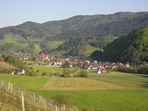
Glottertal is a municipality in the district of Breisgau-Hochschwarzwald in Baden-Württemberg in southern Germany.

Heuweiler
Municipality in Baden-Württemberg, Germany
Distance: Approx. 3041 meters
Latitude and longitude: 48.05166667,7.90305556
Heuweiler is a village in the district of Breisgau-Hochschwarzwald in the southwest of Baden-Württemberg near Freiburg in southern Germany. The village has to a large extent retained its rural character. Whereas many communities in the vicinity of Freiburg have grown rapidly in recent decades a slow, organic change occurred in Heuweiler.

Roßkopf (Breisgau)
Distance: Approx. 3481 meters
Latitude and longitude: 48.01027778,7.90166667
Roßkopf (Breisgau) is a mountain of Baden-Württemberg, Germany. The 737 m (2,418 ft) high Rosskopf is a mountain in the Black Forest in the northeast of Freiburg and the southeast of Gundelfingen. It is on the edge of the territory of the city between the Glotter valley and the Dreisam valley.
Zähringen (Freiburg)
Distance: Approx. 5315 meters
Latitude and longitude: 48.0239,7.8633
Zähringen is the northernmost suburb of Freiburg im Breisgau in Baden-Württemberg, Germany. Its population is 9,196 (2020).

Zähringen Castle
Ruin in Baden-Württemberg, Germany
Distance: Approx. 3765 meters
Latitude and longitude: 48.02527778,7.88416667
The ruins of Zähringen castle is what remains of the ancestral seat of the Zähringer Alemannic noble family, located near Freiburg im Breisgau. The Zähringer became a powerful ducal dynasty in the area of what is now South Germany and Switzerland in the high medieval period and the founder of several cities, including Freiburg im Breisgau, Villingen, Neuenburg, Freiburg im Üechtland, Bern, Thun, Rheinfelden and Murten. The name Zähringen is mentioned for the first time in records dating back to the early 11th century.
Roßkopfturm
Distance: Approx. 3481 meters
Latitude and longitude: 48.01027778,7.90166667
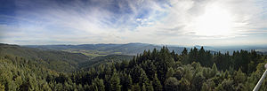
The Roßkopf tower (actually Friedrichsturm or Frederick's tower after Frederick I, Grand Duke of Baden) is a 34.4 m (113 ft) high observation tower of steel frame structure commissioned and financed by the Schwarzwaldverein (Black Forest Club) and built by the Freiburg architect Philipp Anton Lazy in 1889 on the 737 m (2,418 ft) high Roßkopf near Freiburg between the Dreisam valley and the Glotter valley. It is one of the oldest steel lattice towers in Germany. Panoramic views of the Black Forest and the Rhine Valley can be seen from the observation platform above the treetops of the wooded hilltop, and in good visibility to the south until the Alps and the west the Kaiserstuhl and the Vosges.

Schwarzenburg (Breisgau)
Distance: Approx. 4668 meters
Latitude and longitude: 48.07017222,7.96318056
The Schwarzenburg (Black Castle), historically called Schwarzenberg (Black Mountain), is a castle near Waldkirch in the district Emmendingen in the southwest of Baden-Württemberg in southern Germany.

St. Odile (Freiburg)
Distance: Approx. 4204 meters
Latitude and longitude: 48.0031,7.8994
St. Odile is a forest sanctuary in Freiburg's suburb Waldsee. It is located at a height of 480 m in a forest clearing in the upper St.

Musbach valley
Distance: Approx. 4243 meters
Latitude and longitude: 48.00277778,7.89916667
The Musbachtal is a small 2.6 km long steep and narrow carved valley with a creek at the bottom.

St. Wendelin's Chapel
Distance: Approx. 4312 meters
Latitude and longitude: 47.999366,7.905389
The small St. Wendelin's Chapel is located about 750 metres east of St. Odile above the Musbach valley, Germany, on the Small Roßkopf, a spur of the Roßkopf, at a height of 540 m.

Gundelfingen (Breisgau) station
Railway station in Breisgau, Germany
Distance: Approx. 4561 meters
Latitude and longitude: 48.04459,7.87439
Gundelfingen station is a railway station in Gundelfingen in Baden-Württemberg, Germany. It lies on the Mannheim–Karlsruhe–Basel railway (Rhine Valley Railway). The Freiburg bypass, which is reserved for freight traffic, branches off south of the station.
Weather in this IP's area
clear sky
4 Celsius
4 Celsius
4 Celsius
4 Celsius
1021 hPa
59 %
1021 hPa
955 hPa
10000 meters
1.17 m/s
1.13 m/s
279 degree
2 %