Country:
Region:
City:
Latitude and Longitude:
Time Zone:
Postal Code:
IP information under different IP Channel
ip-api
Country
Region
City
ASN
Time Zone
ISP
Blacklist
Proxy
Latitude
Longitude
Postal
Route
Luminati
Country
ASN
Time Zone
Europe/Brussels
ISP
Unix-Solutions BV
Latitude
Longitude
Postal
IPinfo
Country
Region
City
ASN
Time Zone
ISP
Blacklist
Proxy
Latitude
Longitude
Postal
Route
db-ip
Country
Region
City
ASN
Time Zone
ISP
Blacklist
Proxy
Latitude
Longitude
Postal
Route
ipdata
Country
Region
City
ASN
Time Zone
ISP
Blacklist
Proxy
Latitude
Longitude
Postal
Route
Popular places and events near this IP address

Kessel-Lo
Sub-municipality of the city of Leuven, Belgium
Distance: Approx. 2658 meters
Latitude and longitude: 50.88527778,4.73583333
Kessel-Lo (Dutch pronunciation: [ˈkɛsəˌloː]) is a sub-municipality of the city of Leuven located in the province of Flemish Brabant, Flemish Region, Belgium. It was a separate municipality until 1977. On 1 January 1977, it was merged into Leuven.

Groep T
College in Leuven, Belgium
Distance: Approx. 3077 meters
Latitude and longitude: 50.874986,4.707685
Group T (Groep T) is a college (formerly hogeschool (college)) in Leuven, Belgium. The school was formed by a fusion of an existing school for technical (industrial) engineers and the Provinciale Normaalschool. Nowadays the school offers two main branches: The Engineering College: a Bachelor and Master in industrial sciences.
Institute of Philosophy, KU Leuven
Distance: Approx. 3192 meters
Latitude and longitude: 50.87599,4.70667
The Institute of Philosophy (Dutch: Hoger Instituut voor Wijsbegeerte) is the faculty of philosophy at the KU Leuven in the Belgian city of Leuven. It was founded in 1968 when the Institut supérieur de Philosophie - Hoger Instituut voor Wijsbegeerte of the Catholic University of Leuven (1835–1968) was split into a Dutch-speaking entity and a French-speaking entity. Its main buildings are located in the center of Leuven at the Kardinaal Mercier Square, named for the founder of the original institute.

Park Abbey
Distance: Approx. 2023 meters
Latitude and longitude: 50.864,4.718
Park Abbey (Dutch: Abdij van Park; also Parc Abbey) is a Premonstratensian abbey in Belgium, at Heverlee just south of Leuven, in Flemish Brabant. The Annales Parchenses were written here in the 12th century.

Haasrode Research-Park
Distance: Approx. 2542 meters
Latitude and longitude: 50.84845,4.71805
The Haasrode Research-Park business and research park in Haasrode (Heverlee, Leuven, Belgium) with a total area of 136 hectares (336 acres), accommodates dozens of high-technology businesses, employing well over 5,000 people in total. International companies such as Siemens, Terumo, KLA Corporation, 3D Systems, Tomra, Nikon, Sony, NXP,... have important, often research oriented branches in Leuven.

Jardin du Maelbeek
Park in Brussels, Belgium
Distance: Approx. 2540 meters
Latitude and longitude: 50.84388889,4.72555556
The Jardin de la vallée du Maelbeek (French) or Maalbeekdaltuin (Dutch) is a small green space on the corner of the Rue de la Loi/Wetstraat and the Chaussée d'Etterbeek/Etterbeeksesteenweg at the heart of the European Quarter of Brussels, Belgium. It was inaugurated on 13 May 1951. The park is testimony to the local residents' struggle against the rapid urbanisation (also known as Brusselisation) in the quarter that lacked urban planning and new green spaces.

Korbeek-Lo
Sub-municipality of Bierbeek in Flemish Community, Belgium
Distance: Approx. 1338 meters
Latitude and longitude: 50.86083333,4.76555556
Korbeek-Lo (Dutch pronunciation: [ˈkɔrbeːkˌloː]) is a sub-municipality of the municipality of Bierbeek located in the province of Flemish Brabant, Flemish Region, Belgium. As a result of extensive local government boundary changes in 1977 Korbeek-Lo, as a municipality, was abolished. Since then the more built up western part of Korbeek-Lo has been subsumed into Leuven while the more rural eastern part of the former municipality is now part of Bierbeek.

Leuven railway station
Railway station in Flemish Brabant, Belgium
Distance: Approx. 3035 meters
Latitude and longitude: 50.8814,4.7157
Leuven railway station (Dutch: Station Leuven; French: Gare de Louvain) is the main railway station in Leuven, Flemish Brabant, Belgium. The station is operated by the National Railway Company of Belgium (NMBS/SNCB) and is located on railway line 36. In 2007, it was the fifth-busiest station in Belgium, only preceded by the three main Brussels stations and Gent-Sint-Pieters railway station.

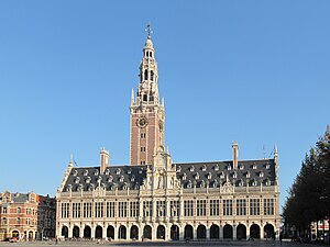
Academic libraries in Leuven
Present and former academic libraries in Leuven, Belgium
Distance: Approx. 3258 meters
Latitude and longitude: 50.87805556,4.7075
The city of Leuven in Belgium was the seat of three successive universities, each of which had a notable academic library.

Vlierbeek Abbey
Former Benedictine abbey
Distance: Approx. 3350 meters
Latitude and longitude: 50.8917,4.73583056
Vlierbeek Abbey (Dutch: Abdij van Vlierbeek) is a former Benedictine abbey to the north-east of Leuven in Belgium, in the sub-district Kessel-Lo.

Korbeek-Lo, Leuven
Suburb of the city of Leuven, Belgium
Distance: Approx. 1051 meters
Latitude and longitude: 50.86666667,4.73333333
The western part of the former municipality of Korbeek-Lo (Dutch pronunciation: [ˈkɔrbeːkˌloː]) is now a part of the city of Leuven, Belgium. According to the official website of Leuven, Korbeek-Lo is a part of the sub-municipality of Leuven. As a result of extensive local government boundary changes in 1977 Korbeek-Lo, as a municipality, was abolished.

Haasrode, Leuven
Suburb of the city of Leuven, Belgium
Distance: Approx. 1762 meters
Latitude and longitude: 50.85027778,4.73055556
The northern part of the former municipality of Haasrode (Dutch pronunciation: [ˈɦaːsroːdə]) is now a part of the city of Leuven, Belgium. According to the official website of Leuven, Haasrode is a part of the sub-municipality of Heverlee. In 1977, Haasrode was merged with Oud-Heverlee, Blanden, Vaalbeek and Sint-Joris-Weert to form the municipality of Oud-Heverlee.
Weather in this IP's area
moderate rain
6 Celsius
4 Celsius
6 Celsius
7 Celsius
1004 hPa
91 %
1004 hPa
999 hPa
10000 meters
3.09 m/s
160 degree
100 %
08:02:21
16:50:27