194.45.77.25 - IP Lookup: Free IP Address Lookup, Postal Code Lookup, IP Location Lookup, IP ASN, Public IP
Country:
Region:
City:
Location:
Time Zone:
Postal Code:
ISP:
ASN:
language:
User-Agent:
Proxy IP:
Blacklist:
IP information under different IP Channel
ip-api
Country
Region
City
ASN
Time Zone
ISP
Blacklist
Proxy
Latitude
Longitude
Postal
Route
db-ip
Country
Region
City
ASN
Time Zone
ISP
Blacklist
Proxy
Latitude
Longitude
Postal
Route
IPinfo
Country
Region
City
ASN
Time Zone
ISP
Blacklist
Proxy
Latitude
Longitude
Postal
Route
IP2Location
194.45.77.25Country
Region
syddanmark
City
kolding
Time Zone
Europe/Copenhagen
ISP
Language
User-Agent
Latitude
Longitude
Postal
ipdata
Country
Region
City
ASN
Time Zone
ISP
Blacklist
Proxy
Latitude
Longitude
Postal
Route
Popular places and events near this IP address
Kolding
Town in Denmark
Distance: Approx. 1765 meters
Latitude and longitude: 55.49166667,9.5
Kolding (Danish pronunciation: [ˈkʰʌle̝ŋ]) is a Danish seaport located at the head of Kolding Fjord in the Region of Southern Denmark. It is the seat of Kolding Municipality. It is a transportation, commercial, and manufacturing centre and has numerous industrial companies, principally geared towards shipbuilding.

Kolding Municipality
Municipality in Southern Denmark, Denmark
Distance: Approx. 140 meters
Latitude and longitude: 55.49,9.47
Kolding Municipality (Danish: Kolding Kommune) is a kommune in the Region of Southern Denmark on the east coast of the Jutland peninsula in southeast Denmark. The municipality covers an area of 640 km2, and has a total population of 94,932 (2024). Its mayor is Knud Erik Langhoff, a member of the Conservative People's Party.

Koldinghus
Distance: Approx. 192 meters
Latitude and longitude: 55.49166667,9.47416667
Koldinghus is a Danish royal castle in the town of Kolding on the south central part of the Jutland peninsula. The castle was founded in the 13th century and was expanded since with many functions ranging from fortress, royal residency, ruin, museum, and the location of numerous wartime negotiations. Today the restored castle functions as a museum containing collections of furniture from the 16th century to present, Roman and Gothic church culture, older Danish paintings, crafts focused on ceramics and silver and shifting thematized exhibitions.

Seest fireworks disaster
Fireworks warehouse explosion in Denmark in 2004
Distance: Approx. 2269 meters
Latitude and longitude: 55.4879,9.4364
The fireworks accident in Seest was a disaster that occurred on 3 November 2004, when the N. P. Johnsens Fyrværkerifabrik fireworks warehouse exploded in Seest, a suburb of Kolding, Denmark. One firefighter died; seven from the rescue team as well as 17 locals were injured. In addition 34 rescuers, 8 police officers, and 27 from the Danish Emergency Management Agency were treated for smoke inhalation.

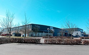
Sydbank Arena
Sports arena in Kolding, Denmark
Distance: Approx. 2907 meters
Latitude and longitude: 55.46444444,9.47722222
Sydbank Arena (formerly known as Kolding Hallerne and Tre-For Arena) is an indoor sports arena in Kolding, Denmark primarily used for handball. The arena has a capacity of 5,001 spectators and is home to Danish Handball League team KIF Kolding, one of the most successful teams in the history of Danish handball.
Kolding Storcenter
Distance: Approx. 2726 meters
Latitude and longitude: 55.51391667,9.46005556
Kolding Storcenter is a shopping mall in the town of Kolding in Southern Denmark. It is the largest shopping mall in Jutland and one of the largest in Denmark. It covers 62.000m² and has over 120 shops and restaurants.

Sønder Bjert
Town in Denmark
Distance: Approx. 6662 meters
Latitude and longitude: 55.45,9.55
Sønder Bjert is a Danish town in the Region of Southern Denmark with a population of 2,292 (1 January 2024). It is located approximately 7 km southeast of Kolding and is a part of Kolding Municipality.

Hotel Koldingfjord
Hotel and conference center in Denmark
Distance: Approx. 5321 meters
Latitude and longitude: 55.49808611,9.55537778
Hotel Koldingfjord is a hotel and conference centre located on the north side of Kolding Fjord near Kolding, Denmark.
Design School Kolding
Design school in Kolding, Denmark
Distance: Approx. 690 meters
Latitude and longitude: 55.4863,9.4803
Design School Kolding (Danish: Designskolen Kolding) is a design school located in Kolding, Denmark. It delivers undergraduate and postgraduate degrees in the areas of fashion, textiles, communication design, industrial design, accessory design, and design for people, design for planet and design for play (people, planet and play are offered only as part of the MA programme). It was founded in 1967, and received university status in 2010.

Kolding railway station
Railway station in Kolding, Denmark
Distance: Approx. 678 meters
Latitude and longitude: 55.49111389,9.48277778
Kolding station (Danish: Kolding Banegård or Kolding Station) is a railway station serving the city of Kolding in Denmark. It is located in central Kolding, situated between the historic town centre and the Port of Kolding, and immediately adjacent to the Kolding bus station. Kolding station is located on the Fredericia–Padborg railway line.

Siege of Kolding (1368–1369)
Siege in Denmark, 1369
Distance: Approx. 192 meters
Latitude and longitude: 55.49166667,9.47416667
The siege of Kolding (Danish: Belejringen af Kolding) also known as the siege of Koldinghus, was a siege by the County of Holstein on the Danish castle of Koldinghus in 1368 during the Danish–Hanseatic War (1361–1370). The siege would end inconclusive for both sides, however, the commander of the castle, Peder Iversøn, promised to surrender if King Valdemar IV of Denmark would die, abdicate, or lose the kingdom. Presumeably, Iversøn surrendered at last, since he would not be mentioned in the later peace talks.

Siege of Kolding (1341)
1341 siege in Denmark
Distance: Approx. 192 meters
Latitude and longitude: 55.49166667,9.47416667
The siege of Kolding (Danish: Belejringen af Kolding) also known as the siege of Koldinghus, was a siege by Jutish rebels on the Holsteinian-held Castle of Koldinghus in 1341. The siege ended unsuccessful, and Count Henry II of Holstein-Rendsburg retaliated by raiding much of Jutland.
Weather in this IP's area
broken clouds
1 Celsius
1 Celsius
1 Celsius
1 Celsius
1031 hPa
93 %
1031 hPa
1025 hPa
10000 meters
75 %


