194.41.43.57 - IP Lookup: Free IP Address Lookup, Postal Code Lookup, IP Location Lookup, IP ASN, Public IP
Country:
Region:
City:
Location:
Time Zone:
Postal Code:
ISP:
ASN:
language:
User-Agent:
Proxy IP:
Blacklist:
IP information under different IP Channel
ip-api
Country
Region
City
ASN
Time Zone
ISP
Blacklist
Proxy
Latitude
Longitude
Postal
Route
db-ip
Country
Region
City
ASN
Time Zone
ISP
Blacklist
Proxy
Latitude
Longitude
Postal
Route
IPinfo
Country
Region
City
ASN
Time Zone
ISP
Blacklist
Proxy
Latitude
Longitude
Postal
Route
IP2Location
194.41.43.57Country
Region
republika srpska
City
zvornik
Time Zone
Europe/Sarajevo
ISP
Language
User-Agent
Latitude
Longitude
Postal
ipdata
Country
Region
City
ASN
Time Zone
ISP
Blacklist
Proxy
Latitude
Longitude
Postal
Route
Popular places and events near this IP address

Zvornik
City in Bosnia and Herzegovina
Distance: Approx. 317 meters
Latitude and longitude: 44.38416667,19.1025
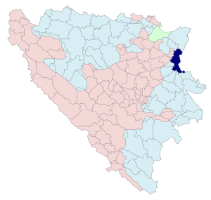
Zvornik (Serbian Cyrillic: Зворник, pronounced [zʋɔ̌rniːk]) is a city in Republika Srpska, Bosnia and Herzegovina. In 2013, it had a population of 58,856 inhabitants. Zvornik is located on the Drina River, on the eastern slopes of Majevica mountain, at the altitude of 146m.

Mali Zvornik
Town and municipality in Šumadija and Western Serbia, Serbia
Distance: Approx. 1898 meters
Latitude and longitude: 44.4,19.11666667
Mali Zvornik (Serbian Cyrillic: Мали Зворник, pronounced [mâːliː zʋɔ̌rniːk]) is a town and municipality located in the Mačva District of western Serbia. In 2022, the population of the town is 4,297, while the population of the municipality is 11,219. It lays on the Drina river opposite of the town of Zvornik, in Bosnia and Herzegovina.
Karakaj
Distance: Approx. 3555 meters
Latitude and longitude: 44.41472222,19.12333333
Karakaj (Cyrillic: Каракај) is a town located 2 km (1.2 mi) north of the city Zvornik in Bosnia and Herzegovina on the Drina River. It also has a border checkpoint with Serbia.

Sakar, Mali Zvornik
Village in Serbia
Distance: Approx. 3395 meters
Latitude and longitude: 44.36666667,19.13333333
Sakar (Сакар) is a small village next to Mali Zvornik in the Mačva District of Serbia. It has a population of 504 people. The village is on Lake Zvornik (Зворнико језеро).
Zvornik Lake
Reservoir in Mali Zvornik, Mačva District
Distance: Approx. 2909 meters
Latitude and longitude: 44.364,19.119
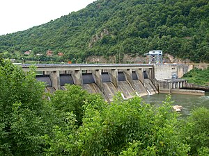
Zvornik Lake (Serbian: Зворничко језеро, Bosnian: Zvorničko jezero) is an artificial lake located on the border of Bosnia and Herzegovina and Serbia. It was created after construction of a hydroelectric power station in 1954 on the Drina river.
Divič
Place in Republika Srpska, Bosnia
Distance: Approx. 2539 meters
Latitude and longitude: 44.3656,19.1128
Divič (Serbian Cyrillic: Дивич) is a village by the city of Zvornik, Bosnia and Herzegovina. It is located on the Drina River, by an artificial lake created to form a reservoir for the HPP Zvornik hydro-electric power plant. The Drina River and the lake are a natural and administrative border between Bosnia and Herzegovina and Serbia and during the international armed conflict of 1992–95 the village was "ethnically cleansed" of its Bosniak inhabitants by Serb forces.

Zvornik massacre
1992 mass killing during the Bosnian War
Distance: Approx. 317 meters
Latitude and longitude: 44.38416667,19.1025
The Zvornik massacre refers to acts of mass murder and violence committed against Bosniaks and other non-Serb civilians in Zvornik by Serb paramilitary groups (Arkanovci, Territorial Defence units, White Eagles, Yellow Wasps) at the beginning of the Bosnian War in 1992. It was part of a wider campaign of ethnic cleansing in the Bosnian War: by one estimate, 40,000 Bosniaks were expelled from the Zvornik district. It was the second city in Bosnia and Herzegovina that was forcefully taken over by Serb forces during the Bosnian War.
Sanjak of Zvornik
Distance: Approx. 317 meters
Latitude and longitude: 44.38416667,19.1025
The Sanjak of Zvornik (Turkish: İzvornik Sancağı, Serbo-Croatian: Zvornički sandžak) was one of the sanjaks in the Ottoman Empire with Zvornik (in modern-day Bosnia and Herzegovina) as its administrative centre. It was divided into 4 different districts: Žepče, Maglaj, Tuzla and Kladanj. The sanjak was created between 1478 and 1483.

Zvornik Fortress
Fortress in Bosnia and Herzegovina
Distance: Approx. 2109 meters
Latitude and longitude: 44.3697,19.0903
Zvornik Castle (Bosnian, Croatian and Serbian: Zvornička tvrđava / Зворничка тврђава), also known as the Old Town of Zvornik (Stari grad Zvornik / Стари град Зворник) and Kula Grad (Кула Град, English: Tower City), is a medieval castle located in Zvornik, Bosnia and Herzegovina, on the mountain Mlađevac overlooking Drina Valley. Zvornik fortress is 147 metres (482 ft) above sea level.
Liplje, Zvornik
Village in Zvornik, Bosnia and Herzegovina
Distance: Approx. 3367 meters
Latitude and longitude: 44.36444444,19.07305556
Liplje is a mountain village located in the municipality of Zvornik, Bosnia and Herzegovina, neighboring Snagovo. Within Liplje there are 14 settlements: Bajrići, Bećirovići, Čamlija, Hadžići, Husići, Jašići, Jošanica, Kadrići, Korin Brijeg, Liplje, Salihovići, Samari, Sultanovići and Velja Glava.
Liplje camp
Concentration camp in Bosnia and Herzegovina
Distance: Approx. 248 meters
Latitude and longitude: 44.38555556,19.10388889
The Liplje camp (Serbo-Croatian: Logor Liplje) was a concentration camp operated between 25 May 1992 and 2 June 1992 by Army of Republika Srpska in the village Liplje near Zvornik during the Bosnian War. It was set up for Bosniak men, women and children, in an effort to ethnically cleanse the area of all non-Serb residents. The Liplje concentration camp was liberated after one week of operation; it is known for being the only camp with Bosniak victims to be liberated during the war.
Crni Vrh mass grave
Distance: Approx. 5128 meters
Latitude and longitude: 44.35555556,19.05416667
The Crni Vrh mass grave, discovered in 2003, is among the largest mass graves found in Bosnia and Herzegovina after the Bosnian War of the 1990's. It was discovered on the mountain Crni Vrh, and contained the remains of 629 Bosniak victims, killed by Serb forces in the villages surrounding Zvornik in 1992 and Srebrenica in 1995. The International Commission on Missing Persons said that the victims had originally been buried in other locations, but were reburied in the remote grave on Crni Vrh after the war in an effort to conceal the crimes.
Weather in this IP's area
overcast clouds
2 Celsius
2 Celsius
2 Celsius
2 Celsius
1020 hPa
97 %
1020 hPa
972 hPa
10000 meters
0.67 m/s
0.58 m/s
148 degree
100 %

