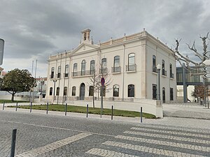
Country:
Region:
City:
Latitude and Longitude:
Time Zone:
Postal Code:
IP information under different IP Channel
ip-api
Country
Region
City
ASN
Time Zone
ISP
Blacklist
Proxy
Latitude
Longitude
Postal
Route
Luminati
Country
ASN
Time Zone
Europe/Lisbon
ISP
Servicos De Comunicacoes E Multimedia S.A.
Latitude
Longitude
Postal
IPinfo
Country
Region
City
ASN
Time Zone
ISP
Blacklist
Proxy
Latitude
Longitude
Postal
Route
db-ip
Country
Region
City
ASN
Time Zone
ISP
Blacklist
Proxy
Latitude
Longitude
Postal
Route
ipdata
Country
Region
City
ASN
Time Zone
ISP
Blacklist
Proxy
Latitude
Longitude
Postal
Route
Popular places and events near this IP address

Fátima, Portugal
Civil parish in Oeste e Vale do Tejo, Portugal
Distance: Approx. 8494 meters
Latitude and longitude: 39.62555556,-8.66583333
Fátima (Portuguese pronunciation: [ˈfatimɐ] ) is a city in the municipality of Ourém and district of Santarém in the Oeste e Vale do Tejo Region of Portugal, with 71.29 km2 of area and 13,212 inhabitants (2021). The homonymous civil parish encompasses several villages and localities of which the city of Fátima is the largest. The civil parish has been permanently associated with Our Lady of Fátima, a series of 1917 Marian apparitions that were purportedly witnessed by three local shepherd children at the Cova da Iria.

Ourém
Municipality in Oeste e Vale do Tejo, Portugal
Distance: Approx. 845 meters
Latitude and longitude: 39.65,-8.56666667
Ourém (European Portuguese: [oˈɾɐ̃j] , locally [ɔˈɾɐ̃j]), formerly known as Vila Nova de Ourém, is a municipality in the district of Santarém in Portugal. The population in 2011 was 45,932, in an area of 416.68 km2. The municipality of Ourém contains two cities: Ourém (about 12,000 residents) and Fátima (about 11,000 inhabitants).
Castle of Ourém
Portuguese castle
Distance: Approx. 2081 meters
Latitude and longitude: 39.642,-8.592
The Ourém Castle is a Portuguese castle in Ourém, Santarém. It has been listed as a National monument since 1910. The Ourém Castle holds the Regalis Lipsanotheca (Relic Repository).
Caranguejeira Conglomerate
Distance: Approx. 5492 meters
Latitude and longitude: 39.7,-8.6
The Caranguejeira Conglomerate (Portuguese: Conglomerados de Caranguejeira) is an Aptian to Cenomanian geologic formation in Portugal. Dinosaur remains diagnostic to the genus level are among the fossils that have been recovered from the formation.

Calcários Micríticos da Serra de Aire
Portuguese Formation
Distance: Approx. 6486 meters
Latitude and longitude: 39.6,-8.6
The Calcários Micríticos da Serra de Aire is a Bathonian geologic formation in Portugal. Fossil sauropod tracks have been reported from the formation.

Caxarias
Civil parish in Oeste e Vale do Tejo, Portugal
Distance: Approx. 6760 meters
Latitude and longitude: 39.707,-8.534
Caxarias (European Portuguese: [kɐʃɐˈɾi.ɐʃ]) is a civil parish and a village in the municipality of Ourém, Portugal. The population in 2011 was 2,166, in an area of 18.03 km².

Atouguia
Civil parish in Oeste e Vale do Tejo, Portugal
Distance: Approx. 4282 meters
Latitude and longitude: 39.64638889,-8.62305556
Atouguia (European Portuguese: [ɐtoˈɣi.ɐ]) is a civil parish in the municipality of Ourém, Portugal. The population in 2011 was 2,454, in an area of 19.55 km².
Alburitel
Civil parish in Oeste e Vale do Tejo, Portugal
Distance: Approx. 4585 meters
Latitude and longitude: 39.6475,-8.52166667
Alburitel is a civil parish in the municipality of Ourém, Portugal. The population in 2011 was 1,179, in an area of 11.51 km2.

Gondemaria e Olival
Civil parish in Oeste e Vale do Tejo, Portugal
Distance: Approx. 6362 meters
Latitude and longitude: 39.70722222,-8.60388889
Gondemaria e Olival is a civil parish in the municipality of Ourém, Portugal. It was formed in 2013 by the merger of the former parishes of Gondemaria and Olival. The population in 2011 was 3,170, in an area of 30.11 km2.

Nossa Senhora da Piedade
Civil parish in Oeste e Vale do Tejo, Portugal
Distance: Approx. 1763 meters
Latitude and longitude: 39.67055556,-8.57638889
Nossa Senhora da Piedade is a civil parish in the municipality of Ourém, Portugal. The population in 2021 was 7,250, up from 7,217 in 2011, in an area of 20.52 km2.

Nossa Senhora das Misericórdias
Civil parish in Oeste e Vale do Tejo, Portugal
Distance: Approx. 3997 meters
Latitude and longitude: 39.61916667,-8.58
Nossa Senhora das Misericórdias is a civil parish in the municipality of Ourém, Portugal. The population in 2011 was 5,077, in an area of 42.35 km2.

Seiça
Civil parish in Oeste e Vale do Tejo, Portugal
Distance: Approx. 4850 meters
Latitude and longitude: 39.675,-8.52416667
Seiça (European Portuguese: [ˈsɐjsɐ]) is a civil parish in the municipality of Ourém, Portugal. The population in 2021 was 1,879, down from 2,076 in 2011, in an area of 25.14 km2.
Weather in this IP's area
few clouds
19 Celsius
19 Celsius
15 Celsius
19 Celsius
1018 hPa
80 %
1018 hPa
1001 hPa
10000 meters
1.1 m/s
1.38 m/s
246 degree
11 %
07:22:32
17:16:51
