194.33.108.88 - IP Lookup: Free IP Address Lookup, Postal Code Lookup, IP Location Lookup, IP ASN, Public IP
Country:
Region:
City:
Location:
Time Zone:
Postal Code:
ISP:
ASN:
language:
User-Agent:
Proxy IP:
Blacklist:
IP information under different IP Channel
ip-api
Country
Region
City
ASN
Time Zone
ISP
Blacklist
Proxy
Latitude
Longitude
Postal
Route
db-ip
Country
Region
City
ASN
Time Zone
ISP
Blacklist
Proxy
Latitude
Longitude
Postal
Route
IPinfo
Country
Region
City
ASN
Time Zone
ISP
Blacklist
Proxy
Latitude
Longitude
Postal
Route
IP2Location
194.33.108.88Country
Region
oberosterreich
City
ulrichsberg
Time Zone
Europe/Vienna
ISP
Language
User-Agent
Latitude
Longitude
Postal
ipdata
Country
Region
City
ASN
Time Zone
ISP
Blacklist
Proxy
Latitude
Longitude
Postal
Route
Popular places and events near this IP address

Breitenberg, Lower Bavaria
Municipality in Bavaria, Germany
Distance: Approx. 8584 meters
Latitude and longitude: 48.7,13.8
Breitenberg is a municipality in the district of Passau in Bavaria in Germany. It lies on the border with Austria, and is the easternmost municipality of Bavaria.

Aigen im Mühlkreis
Former municipality in Upper Austria, Austria
Distance: Approx. 5543 meters
Latitude and longitude: 48.64666667,13.9725
Aigen im Mühlkreis is a village and a former municipality in Rohrbach District in the Austrian state of Upper Austria. On 1 May 2015 Aigen im Mühlkreis municipality was merged with Schlägl to form Aigen-Schlägl municipality. As of 1 January 2018, population of the town was 1778.

Ulrichsberg
Municipality in Upper Austria, Austria
Distance: Approx. 141 meters
Latitude and longitude: 48.67555556,13.91222222
Ulrichsberg is a municipality in the district of Rohrbach in the Austrian state of Upper Austria.

Schwarzenberg am Böhmerwald
Municipality in Upper Austria, Austria
Distance: Approx. 8504 meters
Latitude and longitude: 48.73194444,13.83333333
Schwarzenberg am Böhmerwald is a municipality in the district of Rohrbach in the Austrian state of Upper Austria.

Julbach, Austria
Municipality in Upper Austria, Austria
Distance: Approx. 3599 meters
Latitude and longitude: 48.65888889,13.86805556
Julbach is a municipality in the district of Rohrbach in the Austrian state of Upper Austria.

Schlägl
Former municipality in Upper Austria, Austria
Distance: Approx. 5995 meters
Latitude and longitude: 48.63722222,13.96861111
Schlägl is a town and a former municipality in Rohrbach District in the Austrian state of Upper Austria. On 1 May 2015 Schlägl municipality was merged with Aigen im Mühlkreis to form Aigen-Schlägl municipality. As of 1 January 2018, population of the town was 430.

Klaffer am Hochficht
Municipality in Upper Austria, Austria
Distance: Approx. 2810 meters
Latitude and longitude: 48.69444444,13.88611111
Klaffer am Hochficht is a municipality in the district of Rohrbach in the Austrian state of Upper Austria.

Peilstein im Mühlviertel
Municipality in Upper Austria, Austria
Distance: Approx. 6414 meters
Latitude and longitude: 48.61833333,13.89472222
Peilstein im Mühlviertel is a municipality in the district of Rohrbach in the Austrian state of Upper Austria.

Oepping
Municipality in Upper Austria, Austria
Distance: Approx. 8338 meters
Latitude and longitude: 48.60388889,13.94611111
Oepping is a municipality in the district of Rohrbach in the Austrian state of Upper Austria.

Nebelberg
Municipality in Upper Austria, Austria
Distance: Approx. 6915 meters
Latitude and longitude: 48.62888889,13.8475
Nebelberg is a municipality in the district of Rohrbach in the Austrian state of Upper Austria.

Hochficht
Distance: Approx. 6878 meters
Latitude and longitude: 48.73638889,13.92111111
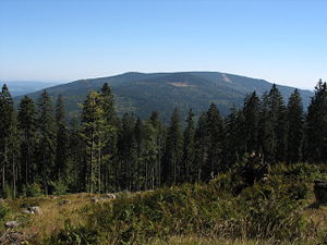
The Hochficht (Czech: Smrčina) is a mountain on the border between Austria and the Czech Republic with an elevation of 1,338 m (4,390 ft). It is situated in the Bohemian Forest mountain range. The Austrian side belongs to the Klaffer am Hochficht municipality and there is a rock outcrop with a summit cross, a ski lift station and a weather station.

Aigen-Schlägl
Distance: Approx. 5568 meters
Latitude and longitude: 48.63916667,13.96333333
Aigen-Schlägl is a municipality in Rohrbach District of Upper Austria, Austria. As of 1 January 2019, population was 3196. The municipality was formed on 1 May 2015 by merging two municipalities, Aigen im Mühlkreis and Schlägl.
Weather in this IP's area
overcast clouds
2 Celsius
2 Celsius
2 Celsius
2 Celsius
1007 hPa
99 %
1007 hPa
917 hPa
1234 meters
1.16 m/s
3.8 m/s
162 degree
100 %