194.32.174.28 - IP Lookup: Free IP Address Lookup, Postal Code Lookup, IP Location Lookup, IP ASN, Public IP
Country:
Region:
City:
Location:
Time Zone:
Postal Code:
ISP:
ASN:
language:
User-Agent:
Proxy IP:
Blacklist:
IP information under different IP Channel
ip-api
Country
Region
City
ASN
Time Zone
ISP
Blacklist
Proxy
Latitude
Longitude
Postal
Route
db-ip
Country
Region
City
ASN
Time Zone
ISP
Blacklist
Proxy
Latitude
Longitude
Postal
Route
IPinfo
Country
Region
City
ASN
Time Zone
ISP
Blacklist
Proxy
Latitude
Longitude
Postal
Route
IP2Location
194.32.174.28Country
Region
trentino-alto adige
City
cavalese
Time Zone
Europe/Rome
ISP
Language
User-Agent
Latitude
Longitude
Postal
ipdata
Country
Region
City
ASN
Time Zone
ISP
Blacklist
Proxy
Latitude
Longitude
Postal
Route
Popular places and events near this IP address

1998 Cavalese cable car crash
1998 incident involving a US Marine Corps aircraft and a cable car in Italy
Distance: Approx. 1055 meters
Latitude and longitude: 46.2837,11.4672
The Cavalese cable car crash, also known as the Cermis massacre (Italian: Strage del Cermis), occurred on 3 February 1998, near the Italian town of Cavalese, a ski resort in the Dolomites some 40 kilometres (25 mi) northeast of Trento. Twenty people were killed when a United States Marine Corps EA-6B Prowler aircraft, flying too low and against regulations, cut a cable supporting a cable car of an aerial lift. The pilot, Captain Richard J. Ashby, and his navigator, Captain Joseph Schweitzer, were put on trial in the United States and found not guilty of involuntary manslaughter and negligent homicide.
Val di Stava dam collapse
1985 dam structural failure near Tesero, Italy
Distance: Approx. 4533 meters
Latitude and longitude: 46.32058056,11.50066944
The Val di Stava Dam collapse occurred on 19 July 1985, when two tailings dams above the village of Stava, near Tesero, Italy, failed. It resulted in one of Italy's worst disasters, killing 268 people, destroying 63 buildings and demolishing eight bridges. The upper dam broke first, leading to the collapse of the lower dam.

Cavalese
Comune in Trentino-Alto Adige/Südtirol, Italy
Distance: Approx. 99 meters
Latitude and longitude: 46.29111111,11.46055556
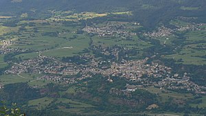
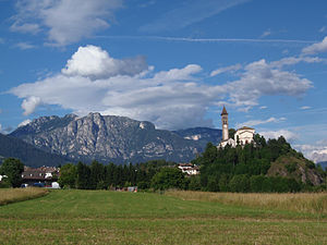
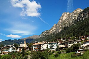
Cavalese (Cavalés in local dialect, Gablöss in local german dialect) is a comune of 4,004 inhabitants in Trentino, northern Italy, a ski resort and the main center in the Fiemme Valley. It is part of the Magnifica Comunità di Fiemme (Magnificent Community of Fiemme) and, together with Predazzo, is the administrative, cultural and historical center of the valley. The town is a renowned tourist location, during winter for cross-country and alpine skiing, and during summer for excursions.

Altrei
Comune in Trentino-Alto Adige/Südtirol, Italy
Distance: Approx. 7191 meters
Latitude and longitude: 46.28333333,11.36666667
Altrei (German: [alˈtraɪ]; Italian: Anterivo [anteˈriːvo]) is a comune (municipality) and a village in South Tyrol in northern Italy.

Castello-Molina di Fiemme
Comune in Trentino-Alto Adige/Südtirol, Italy
Distance: Approx. 2202 meters
Latitude and longitude: 46.28333333,11.43333333
Castello-Molina di Fiemme (Castèl e Molina in local dialect) is a comune (municipality) in Trentino in the northern Italian region Trentino-Alto Adige/Südtirol, located about 35 km (22 mi) northeast of Trento. As of 31 December 2004, it had a population of 2,172 and an area of 54.5 km2 (21 sq mi). The municipality of Castello-Molina di Fiemme contains the frazioni (subdivisions, mainly villages and hamlets) Predaia and Stramentizzo.

Panchià
Comune in Trentino-Alto Adige/Südtirol, Italy
Distance: Approx. 7029 meters
Latitude and longitude: 46.28333333,11.55
Panchià (Pancià in local dialect) is a comune (municipality) in Trentino in the northern Italian region Trentino-Alto Adige/Südtirol, located about 40 kilometres (25 mi) northeast of Trento. Panchià borders the following municipalities: Predazzo, Tesero, Ziano di Fiemme and Pieve Tesino.

Tesero
Comune in Trentino-Alto Adige/Südtirol, Italy
Distance: Approx. 4498 meters
Latitude and longitude: 46.28333333,11.51666667
Tésero (Tiézer in local dialect) is a comune (municipality) in Trentino in the northern Italian region Trentino-Alto Adige/Südtirol, located in the Val di Fiemme about 40 kilometres (25 mi) northeast of Trento. The municipality of Tesero contains the frazioni (subdivisions, mainly villages and hamlets) Lago, Stava and Alpe di Pampeago. Tesero borders the following municipalities: Deutschnofen, Predazzo, Panchià, Cavalese, Pieve Tesino and Ville di Fiemme.

Cermis
Mountain in eastern Trentino, Italy
Distance: Approx. 6410 meters
Latitude and longitude: 46.24222222,11.5025
Cermis (Alpe Cermis in italian) is a mountain of the Lagorai group in eastern Trentino, Italy in the comune of Cavalese. Part of the Val di Fiemme-Obereggen, it is famous for its ski slopes. It was the scene of major disasters involving the aerial tramway style cable car system on the mountain: the Cavalese cable car disaster in 1976, and the Cavalese cable car massacre in 1998; the latter occurred when a U.S. military plane, while flying too low against regulations, cut a cable supporting a gondola of an aerial tramway, killing 20 people.

1976 Cavalese cable car crash
1976 deadly cable car crash in Cavalese, Italy
Distance: Approx. 2389 meters
Latitude and longitude: 46.2735,11.4763
The Cavalese cable car crash is the deadliest cable car crash in history. On 9 March 1976, the steel supporting cable broke as a fully loaded cable car was descending from Mt. Cermis, near the Italian ski resort of Cavalese in the Dolomites, 40 km (25 mi) north-east of Trento.

Schwarzhorn (South Tyrol)
Mountain in Italy
Distance: Approx. 5031 meters
Latitude and longitude: 46.33583333,11.44666667
The Schwarzhorn (Italian: Corno Nero) is a mountain in South Tyrol, Italy. It belongs to the Fiemme Mountains and is 2,439 m high.

Cross country and biathlon center Fabio Canal
Distance: Approx. 5046 meters
Latitude and longitude: 46.2829,11.5238
The Cross country and biathlon center Fabio Canàl (in italian: Centro del fondo e del biathlon Fabio Canal), until December 2018 named Lago di Tésero Cross Country Stadium (in italian: Stadio del fondo di Lago di Tesero) is a sport venue located in the village of Lago, in the municipality of Tésero (Fiemme Valley), in Trentino, northern Italy. It will host cross-country skiing and nordic combined for the 2026 Winter Olympics and Paralympics.

Ville di Fiemme
Comune in Trentino-Alto Adige/Südtirol, Italy
Distance: Approx. 1358 meters
Latitude and longitude: 46.3007,11.4478
Ville di Fiemme is a comune (municipality) in the Province of Trentino in the Italian region Trentino-Alto Adige/Südtirol. It was established on 1 January 2020 with the merger of the municipalities of Carano, Daiano and Varena.
Weather in this IP's area
clear sky
2 Celsius
2 Celsius
1 Celsius
3 Celsius
1036 hPa
68 %
1036 hPa
862 hPa
10000 meters
0.64 m/s
1.12 m/s
20 degree
10 %