194.32.173.29 - IP Lookup: Free IP Address Lookup, Postal Code Lookup, IP Location Lookup, IP ASN, Public IP
Country:
Region:
City:
Location:
Time Zone:
Postal Code:
IP information under different IP Channel
ip-api
Country
Region
City
ASN
Time Zone
ISP
Blacklist
Proxy
Latitude
Longitude
Postal
Route
Luminati
Country
Region
32
City
predazzo
ASN
Time Zone
Europe/Rome
ISP
Tecnodata Trentina Srl
Latitude
Longitude
Postal
IPinfo
Country
Region
City
ASN
Time Zone
ISP
Blacklist
Proxy
Latitude
Longitude
Postal
Route
IP2Location
194.32.173.29Country
Region
trentino-alto adige
City
ortisei
Time Zone
Europe/Rome
ISP
Language
User-Agent
Latitude
Longitude
Postal
db-ip
Country
Region
City
ASN
Time Zone
ISP
Blacklist
Proxy
Latitude
Longitude
Postal
Route
ipdata
Country
Region
City
ASN
Time Zone
ISP
Blacklist
Proxy
Latitude
Longitude
Postal
Route
Popular places and events near this IP address

Val Gardena
Valley in the Dolomites, South Tyrol, Italy
Distance: Approx. 3257 meters
Latitude and longitude: 46.56,11.70472222
Val Gardena (Italian: [ˌval ɡarˈdeːna, ˌval ɡarˈdɛːna]; German: Gröden [ˈɡʁøːdn̩]; Ladin: Gherdëina [ɡʀ̩ˈdɜi̯na] ) is a valley in the Dolomites of South Tyrol, Northern Italy. It is best known as a tourist skiing, rock climbing, and woodcarving area.

Urtijëi
Comune in Trentino-Alto Adige/Südtirol, Italy
Distance: Approx. 853 meters
Latitude and longitude: 46.56666667,11.66666667
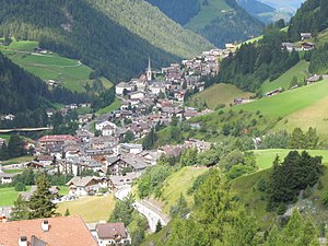
Urtijëi (Ladin: [uʀtiˈʒɜi̯] ; German: St. Ulrich in Gröden [zaŋkt ˈʊlrɪç ɪn ˈɡrøːdn̩]; Italian: Ortisei [ortiˈzɛi]) is a town of 4,637 inhabitants in South Tyrol in northern Italy. It occupies the Val Gardena within the Dolomites, a mountain chain that is part of the Alps.
Santa Cristina Gherdëina
Comune in Trentino-Alto Adige/Südtirol, Italy
Distance: Approx. 3850 meters
Latitude and longitude: 46.56666667,11.71666667
Santa Cristina Gherdëina (Ladin: [ˈsanta kʀ̩̊ʃˈtina ɡʀ̩ˈdɜi̯na] ; Italian: Santa Cristina Valgardena [ˈsanta kriˈstiːna ˌvalɡarˈdeːna, - ˌvalɡarˈdɛːna]; German: St. Christina in Gröden [saŋkt krɪsˈtiˑna ɪn ˈɡrøːdn̩]) is a Ladin comune (municipality) and a village in Val Gardena in the South Tyrol of northern Italy. It is located about 30 kilometres (19 mi) east of Bolzano.
Gardena Ronda Express
Funicular in Italy
Distance: Approx. 3257 meters
Latitude and longitude: 46.56,11.70472222
The Gardena Ronda Express is a funicular situated in the Val Gherdëina near Santa Cristina Gherdëina, connecting the Col Raiser lifts to the Sasslong/Ruacia and Ciampinoi lifts in northern Italy.

Parish church of Urtijëi
Church in Urtijëi, Val Gardena, South Tyrol, Italy
Distance: Approx. 322 meters
Latitude and longitude: 46.5752,11.6716
The Parish Church of Urtijëi located in the town of Urtijëi in Val Gardena in South Tyrol, Italy is dedicated to the Epiphany and to Saint Ulrich. It was built in the years 1792–1796 in the Neoclassical style with some Baroque elements by the tyrolean master Joseph Abenthung and the interior domes painted by the Tyrolean brothers Franz Xaver and Josef Kirchebner. The structure of the church has the form of Latin cross with a central nave and two lateral chapels dedicated to the Sacred Heart of Jesus and to Our Lady of the Rosary.

Seiser Alm
Dolomite plateau and Alpine meadow in Italy
Distance: Approx. 4089 meters
Latitude and longitude: 46.54111111,11.64471944
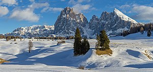
Seiser Alm (Italian: Alpe di Siusi, Ladin: Mont Sëuc) is a Dolomite plateau and the largest high-elevation Alpine meadow (German: Alm) in Europe. Located in Italy's South Tyrol province in the Dolomites mountain range, it is a major tourist attraction, notably for skiing and hiking.

Langkofel
Mountain in Italy
Distance: Approx. 7570 meters
Latitude and longitude: 46.52472222,11.73527778
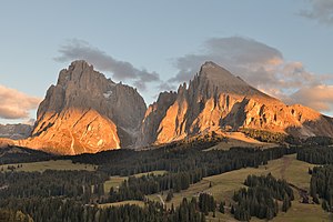
Langkofel ([laŋˈkofl]; Italian: Sassolungo [ˌsassoˈluŋɡo]; Ladin: Saslonch; 3,181 m) is the highest mountain of the Langkofel Group in the Dolomites in South Tyrol, Italy. The name translates to "long peak" / "long rock" in all three languages. It stands over the Ladin community of Val Gardena.

Plattkofel
Mountain in Italy
Distance: Approx. 7296 meters
Latitude and longitude: 46.51638889,11.71222222
The Plattkofel (Ladin: Sasplat; Italian: Sasso Piatto; German: Plattkofel) is a mountain in the Dolomites in South Tyrol, Italy.
Val Gardena Railway
Former railway in northern Italy
Distance: Approx. 124 meters
Latitude and longitude: 46.5753,11.6683
The Val Gardena Railway or Klausen-Plan (Italian: Ferrovia della Val Gardena, German: Grödner Bahn, Ladin: Ferata de Gherdëina) was a 760 mm (2 ft 5+15⁄16 in) narrow gauge railway operating in the Val Gardena in the Dolomites of northern Italy. It was constructed in 1915/6 when the region was part of the Austrian Empire. Construction was remarkably rapid: begun in September 1915, the line was completed and opened on 6 February 1916.

Museum Gherdëina
Museum in Urtijëi, Italy
Distance: Approx. 535 meters
Latitude and longitude: 46.573861,11.674556
The Gherdëina Local Heritage Museum was opened in the Cësa di Ladins in Urtijëi, in northernmost Italy, in 1960. The building is the seat of the Union di Ladins de Gherdëina a cultural organisation for the keeping of the Ladin language and heritage in Val Gherdëina. In addition to the museum, the building hosts a library specialized in Ladin language and culture.

Sterilgarda
Italian company producing dairy products
Distance: Approx. 296 meters
Latitude and longitude: 46.57341,11.66395
Sterilgarda Alimenti S.p.A. is an Italian dairy produce company, based in Castiglione delle Stiviere in the Province of Mantua.

Saslong
Distance: Approx. 5192 meters
Latitude and longitude: 46.556,11.73
Saslong is a World Cup downhill ski course in Italy just above Val Gardena/Gröden. Located on the Langkofel in the Dolomites, the race course made its World Cup debut in February 1969. The ski course is named after the mountain Saslonch (German: Langkofel, Italian: Sassolungo) with an adapted spelling.
Weather in this IP's area
clear sky
-10 Celsius
-13 Celsius
-14 Celsius
-10 Celsius
1027 hPa
73 %
1027 hPa
880 hPa
10000 meters
1.42 m/s
1.52 m/s
78 degree
1 %


