194.24.245.59 - IP Lookup: Free IP Address Lookup, Postal Code Lookup, IP Location Lookup, IP ASN, Public IP
Country:
Region:
City:
Location:
Time Zone:
Postal Code:
ISP:
ASN:
language:
User-Agent:
Proxy IP:
Blacklist:
IP information under different IP Channel
ip-api
Country
Region
City
ASN
Time Zone
ISP
Blacklist
Proxy
Latitude
Longitude
Postal
Route
db-ip
Country
Region
City
ASN
Time Zone
ISP
Blacklist
Proxy
Latitude
Longitude
Postal
Route
IPinfo
Country
Region
City
ASN
Time Zone
ISP
Blacklist
Proxy
Latitude
Longitude
Postal
Route
IP2Location
194.24.245.59Country
Region
zachodniopomorskie
City
kolobrzeg
Time Zone
Europe/Warsaw
ISP
Language
User-Agent
Latitude
Longitude
Postal
ipdata
Country
Region
City
ASN
Time Zone
ISP
Blacklist
Proxy
Latitude
Longitude
Postal
Route
Popular places and events near this IP address

Kołobrzeg
Place in West Pomeranian Voivodeship, Poland
Distance: Approx. 477 meters
Latitude and longitude: 54.17611111,15.57611111
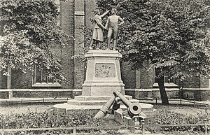
Kołobrzeg (Polish: [kɔˈwɔbʐɛk] ; Kashubian: Kòlbrzég; German: Kolberg [ˈkɔlbɛʁk] ) is a port and spa city in the West Pomeranian Voivodeship in north-western Poland with about 47,000 inhabitants (as of 2014). Kołobrzeg is located on the Parsęta River on the south coast of the Baltic Sea (in the middle of the section divided by the Oder and Vistula Rivers). It is the capital of Kołobrzeg County.

ORP Fala
Distance: Approx. 1555 meters
Latitude and longitude: 54.177431,15.559715
ORP Fala is a Polish patrol craft of the Project 912 class (NATO: Obluze Class). She was the first ship of a five-ship series, commissioned in 1965. Of a Polish design, they were built in Gdynia.

Kołobrzeg County
County in West Pomeranian Voivodeship, Poland
Distance: Approx. 1483 meters
Latitude and longitude: 54.16666667,15.56666667
Kołobrzeg County (Polish: powiat kołobrzeski) is a unit of territorial administration and local government (powiat) in West Pomeranian Voivodeship, north-western Poland, on the Baltic coast. It came into being on January 1, 1999, as a result of the Polish local government reforms passed in 1998. Its administrative seat is Kołobrzeg, which lies on the coast 106 kilometres (66 mi) north-east of the regional capital Szczecin.
Siege of Kolberg (Seven Years' War)
1758-61 Russian offensive during the Seven Years' War
Distance: Approx. 850 meters
Latitude and longitude: 54.183333,15.583333
During the Seven Years' War, the Prussian-held town of Kolberg in Brandenburg-Prussian Pomerania (now Kołobrzeg) was besieged by Russian forces three times. The first two sieges, in late 1758 and from 26 August to 18 September 1760, were unsuccessful. A final and successful siege took place from August to December 1761.
Battle of Kolberg (1945)
Taking of the city of Kolberg during World War II
Distance: Approx. 636 meters
Latitude and longitude: 54.17573694,15.57364306
The Battle of Kolberg or Battle of Kołobrzeg (also, battle for Festung Kolberg) was the taking of the city of Kolberg, now the city of Kołobrzeg, in Pomerania by the Soviet Army and its Polish allies from Nazi German forces during the World War II East Pomeranian Offensive. Between 4 and 18 March 1945 there was major urban fighting of the Soviet and Polish forces against the German army for the control over the city. The Germans succeeded in evacuating much of their military personnel and refugees from the city via sea before it was taken by the Poles on 18 March.
Gmina Kołobrzeg
Gmina in West Pomeranian Voivodeship, Poland
Distance: Approx. 1483 meters
Latitude and longitude: 54.16666667,15.56666667
Gmina Kołobrzeg is a rural gmina (administrative district) in Kołobrzeg County, West Pomeranian Voivodeship, in north-western Poland. Its seat is the town of Kołobrzeg, although the town is not part of the territory of the gmina. The gmina covers an area of 144.75 square kilometres (55.9 sq mi), and as of 2014 its total population is 10,424.

Siege of Kolberg (1807)
1807 Siege during the War of the Fourth Coalition
Distance: Approx. 482 meters
Latitude and longitude: 54.1775,15.57666667
The siege of Kolberg (also spelled Colberg or Kołobrzeg) took place from March to 2 July 1807 during the War of the Fourth Coalition, part of the Napoleonic Wars. An army of the First French Empire and several foreign auxiliaries (including Polish insurgents) of France besieged the fortified town of Kolberg, the only remaining Prussian-held fortress in the Province of Pomerania. The siege was not successful and was lifted upon the announcement of the Peace of Tilsit.

Budzistowo
Village in West Pomeranian Voivodeship, Poland
Distance: Approx. 1658 meters
Latitude and longitude: 54.16083333,15.58194444
Budzistowo [bud͡ʑisˈtɔvɔ] (German: Altstadt) is a village in the administrative district of Gmina Kołobrzeg, within Kołobrzeg County, West Pomeranian Voivodeship, in north-western Poland. It lies approximately 2 kilometres (1 mi) south-east of Kołobrzeg and 106 km (66 mi) north-east of the regional capital Szczecin. From the 9th century to 1255, modern Budzistowo was the site of Salsa Cholbergensis, a Slavic Pomeranian burgh with a suburbium, located within medieval Poland.

Kolberg-Körlin District
Distance: Approx. 850 meters
Latitude and longitude: 54.183333,15.583333
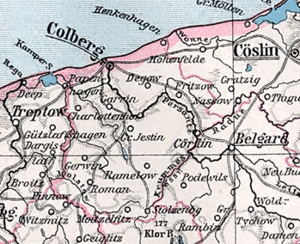
Kolberg-Körlin (earlier spelling Colberg-Cörlin) was a Landkreis (county) in the Prussian Province of Pomerania between 1872 and 1945. Its territory roughly corresponds with modern Kołobrzeg County (Polish: Powiat Kołobrzeski) and the western parts of modern Białogard County (Polish: Powiat Białogardzki) with Karlino, the former Körlin.

Kołobrzeg Lighthouse
Lighthouse in Poland
Distance: Approx. 2241 meters
Latitude and longitude: 54.18638889,15.55425
Kołobrzeg Lighthouse (Polish: Latarnia morska Kołobrzeg) is a lighthouse in Kołobrzeg on the Polish coast of the Baltic Sea. The lighthouse in located in Kołobrzeg, West Pomeranian Voivodeship; in Poland. The lighthouse is located in between the lighthouse in Niechorze (about 34 km to the west) and the lighthouse in Gąski (22 km to the east).

Kołobrzeg Cathedral
Church in Kołobrzeg, Poland
Distance: Approx. 557 meters
Latitude and longitude: 54.1762,15.5749
The Co-Cathedral Basilica of the Assumption of the Blessed Virgin Mary (Polish: Bazylika konkatedralna Wniebowzięcia Najświętszej Maryi Panny w Kołobrzegu) also called Kołobrzeg Cathedral is a religious building of the Catholic Church which is located in the city of Kołobrzeg in Poland. It is a temple built in the fourteenth century in the Gothic style, which has five naves. It has the status of parish church, minor basilica and since 1972 is the co-cathedral of the Diocese of Koszalin-Kołobrzeg (Dioecesis Coslinensis-Colubreganus or Diecezja koszalińsko-kołobrzeska).

Kołobrzeg railway station
Railway station in West Pomerania, Poland
Distance: Approx. 1164 meters
Latitude and longitude: 54.1821568,15.5693384
Kołobrzeg railway station is a railway station in Kołobrzeg, Poland. As of 2022, it is served by Polregio (local and InterRegio services) and PKP Intercity (EIP, InterCity, and TLK services).
Weather in this IP's area
scattered clouds
4 Celsius
0 Celsius
4 Celsius
4 Celsius
1035 hPa
83 %
1035 hPa
1033 hPa
10000 meters
5.67 m/s
9.59 m/s
243 degree
33 %
