194.208.121.2 - IP Lookup: Free IP Address Lookup, Postal Code Lookup, IP Location Lookup, IP ASN, Public IP
Country:
 Austria
Region:
City:
Location:
Time Zone:
Postal Code:
ISP:
ASN:
language:
User-Agent:
Proxy IP:
Blacklist:
IP information under different IP Channel
ip-api
Country
Region
City
ASN
Time Zone
ISP
Blacklist
Proxy
Latitude
Longitude
Postal
Route
db-ip
Country
Region
City
ASN
Time Zone
ISP
Blacklist
Proxy
Latitude
Longitude
Postal
Route
IPinfo
Country
Region
City
ASN
Time Zone
ISP
Blacklist
Proxy
Latitude
Longitude
Postal
Route
IP2Location
194.208.121.2Country
atRegion
vorarlberg
City
sulzberg
Time Zone
Europe/Vienna
ISP
Language
User-Agent
Latitude
Longitude
Postal
ipdata
Country
Region
City
ASN
Time Zone
ISP
Blacklist
Proxy
Latitude
Longitude
Postal
Route
Popular places and events near this IP address

County of Nellenburg
German County
Distance: Approx. 4842 meters
Latitude and longitude: 47.492,9.847
Nellenburg was a county or landgraviate (Landgrafschaft) in southwestern Germany. Named after the Nellenburg, the county surrounded the town of Stockach. It passed to Austria in 1465, after the extinction of the original comital line.

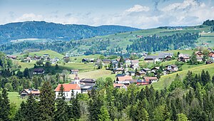
Krumbach, Vorarlberg
Municipality in Vorarlberg, Austria
Distance: Approx. 4614 meters
Latitude and longitude: 47.48305556,9.93583333
Krumbach is a village in the westernmost Austrian state of Vorarlberg, in the Bregenz district. The municipality has about 1,000 inhabitants.

Oberreute
Municipality in Bavaria, Germany
Distance: Approx. 6100 meters
Latitude and longitude: 47.56666667,9.93333333
Oberreute is a municipality in the district of Lindau in Bavaria in Germany and member of the municipal association of Stiefenhofen. It is an acknowledged air health resort.
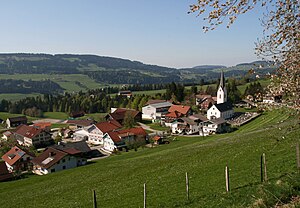
Buch, Austria
Municipality in Vorarlberg, Austria
Distance: Approx. 7259 meters
Latitude and longitude: 47.48194444,9.81833333
Buch is a municipality in the district of Bregenz in the Austrian state of Vorarlberg.

Doren
Municipality in Vorarlberg, Austria
Distance: Approx. 4481 meters
Latitude and longitude: 47.48333333,9.86666667
Doren is a municipality in the district of Bregenz in the western Austrian state of Vorarlberg.

Hittisau
Municipality in Vorarlberg, Austria
Distance: Approx. 7591 meters
Latitude and longitude: 47.46027778,9.95666667
Hittisau is a municipality in the district of Bregenz in the Austrian state of Vorarlberg. Hittisau has a surface area of 46.65 km2. It lies in the Bregenzerwald in the west of the country.

Langen bei Bregenz
Municipality in Vorarlberg, Austria
Distance: Approx. 5582 meters
Latitude and longitude: 47.50777778,9.82694444
Langen bei Bregenz is a municipality in the district of Bregenz in the Austrian state of Vorarlberg.
Langenegg
Municipality in Vorarlberg, Austria
Distance: Approx. 5420 meters
Latitude and longitude: 47.46805556,9.89694444
Langenegg is a municipality with approx. 1,200 inhabitants in the westernmost Austrian state, Vorarlberg.
Lingenau
Municipality in Vorarlberg, Austria
Distance: Approx. 7576 meters
Latitude and longitude: 47.45,9.92
Lingenau is a municipality in the district of Bregenz, in the westernmost Austrian state of Vorarlberg.
Riefensberg
Municipality in Vorarlberg, Austria
Distance: Approx. 4985 meters
Latitude and longitude: 47.50472222,9.96388889
Riefensberg is a municipality in the district of Bregenz in the westernmost Austrian state of Vorarlberg. The community of Riefensberg covers an area of 14.85 square kilometers. Riefensberg is located within the Nagelfluhkette Nature Park.

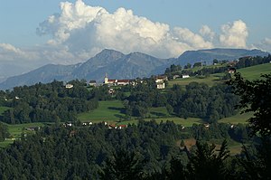
Sulzberg, Austria
Municipality in Vorarlberg, Austria
Distance: Approx. 4 meters
Latitude and longitude: 47.51666667,9.9
Sulzberg is a municipality in the district of Bregenz, in the westernmost Austrian state of Vorarlberg. It is a member of the German-Austrian community project Naturpark Nagelfluhkette.

Juppenwerkstatt Riefensberg
Craft museum, tracht museum in Vorarlberg, Austria
Distance: Approx. 4972 meters
Latitude and longitude: 47.5052,9.9639
The Juppenwerkstatt Riefensberg is a craft workshop and museum in Riefensberg in Vorarlberg (Austria). It is a non-profit association that pursues the goal of maintaining and caring for the Vorarlberg costumes, especially the Bregenz Forest women's costumes. It is the only manufacture in the Bregenz Forest that still produces the Bregenzerwälder tracht in the traditional way.
Weather in this IP's area
snow
1 Celsius
1 Celsius
0 Celsius
2 Celsius
1024 hPa
88 %
1024 hPa
931 hPa
10000 meters
0.82 m/s
1.27 m/s
221 degree
100 %