Country:
Region:
City:
Latitude and Longitude:
Time Zone:
Postal Code:
IP information under different IP Channel
ip-api
Country
Region
City
ASN
Time Zone
ISP
Blacklist
Proxy
Latitude
Longitude
Postal
Route
Luminati
Country
ASN
Time Zone
Europe/Moscow
ISP
PVimpelCom
Latitude
Longitude
Postal
IPinfo
Country
Region
City
ASN
Time Zone
ISP
Blacklist
Proxy
Latitude
Longitude
Postal
Route
db-ip
Country
Region
City
ASN
Time Zone
ISP
Blacklist
Proxy
Latitude
Longitude
Postal
Route
ipdata
Country
Region
City
ASN
Time Zone
ISP
Blacklist
Proxy
Latitude
Longitude
Postal
Route
Popular places and events near this IP address

Murmansk
City in Murmansk Oblast, Russia
Distance: Approx. 825 meters
Latitude and longitude: 68.97055556,33.075
Murmansk (Russian: Мурманск; Kildin Sami: Мурман ланнҍ; Skolt Sami: Muurman and Northern Sami: Murmánska) is a port city and the administrative center of Murmansk Oblast in the far northwest part of Russia. It sits on both slopes and banks of a modest ria or fjord, Kola Bay, an estuarine inlet of the Barents Sea, with its bulk on the east bank of the inlet. It is in the north of the rounded Kola Peninsula which covers most of the oblast.
Lenin (1957 icebreaker)
Soviet nuclear-powered icebreaker
Distance: Approx. 886 meters
Latitude and longitude: 68.97471667,33.05894722
Lenin (Russian: Ленин) is a Soviet nuclear-powered icebreaker, the first nuclear-powered icebreaker in the world. Launched in 1957, it is both the world's first nuclear-powered surface ship and the first nuclear-powered civilian vessel. Lenin entered operation in 1959 and worked clearing sea routes for cargo ships along Russia's northern coast.

Operation Silver Fox
1941 World War II military operation
Distance: Approx. 1249 meters
Latitude and longitude: 68.96666667,33.08333333
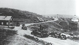
Operation Silver Fox (German: Silberfuchs; Finnish: Hopeakettu) from 29 June to 17 November 1941, was a joint German–Finnish military operation during the Continuation War on the Eastern Front of World War II against the Soviet Union. The objective of the offensive was to cut off and capture the key Soviet Port of Murmansk through attacks from Finnish and Norwegian territory. The operation had three stages.

Operation FB
Sailings by unescorted merchant ships during WWII
Distance: Approx. 1249 meters
Latitude and longitude: 68.96666667,33.08333333
Operation FB (29 October – 9 November 1942) took place as part of the Arctic Convoys of the Second World War. The operation consisted of independent sailings by unescorted merchant ships between Iceland and Murmansk. In late 1942, the Allies had taken the offensive against Germany but the dispatch of supplies to the USSR by convoy via the Arctic route was suspended, due to the demands of the Mediterranean campaign.

Tsentralnyi Profsoyuz Stadion (Murmansk)
Sports accommodation in Murmansk, Russia
Distance: Approx. 485 meters
Latitude and longitude: 68.97361111,33.08277778
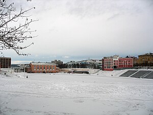
The Trade Unions Central Stadium is a multi-use stadium in Murmansk, Russia. It is currently used mostly for football matches. The stadium holds 13,400 people.

Five Corners, Murmansk
Main square of Murmansk, Russia
Distance: Approx. 795 meters
Latitude and longitude: 68.97083333,33.075
Five Corners Square (Russian: Площадь Пять Углов; tr. Ploshchad' Pyat' Uglov) is the main square of Murmansk, Russia. From 1977 until December 1990 it was formally named "Soviet Constitution Square", but this name never entered wide popular use.

Azimut Hotel Murmansk
High-rise hotel in Murmansk, Russia
Distance: Approx. 746 meters
Latitude and longitude: 68.97119722,33.07618333
The Azimut Hotel Murmansk is a high-rise hotel in the center of Murmansk, Russia. It opened in 1984, as the Hotel Arktika (Russian: Арктика) (Hotel Arctic) and was renamed the Azimut Hotel Murmansk in 2014, following major renovations. It is the tallest building in Murmansk and the tallest building located north of the Arctic Circle.

Port of Murmansk
Port in Russia
Distance: Approx. 962 meters
Latitude and longitude: 68.98,33.05611111
Murmansk Commercial Seaport (Russian: Мурманский морской торговый порт) is a seaport located on the eastern shore of the Kola Bay of the Barents Sea in the city of Murmansk. The port ranks fourth in Russia in terms of processed goods and is the second-largest port in northwest Russia (after the port of St. Petersburg).

Stroitel Stadium (Murmansk)
Distance: Approx. 1269 meters
Latitude and longitude: 68.9664,33.0786
Stroitel Stadium (Russian: Стадион «Строитель») is a bandy arena in Murmansk, Russia. Its audience capacity is 5,000 people. It is the home arena of bandy club Murman Murmansk.
Marine Station (Murmansk)
Building in Murmansk, Russia
Distance: Approx. 1245 meters
Latitude and longitude: 68.9667,33.0833
The Marine Station or Marine Terminal (Russian: Морской вокзал) is a maritime passenger terminal located in the city of Murmansk. Marine Station has two berths, one of which is a pontoon berth. There is a small embankment at the sea terminal.
Murmansk College of Arts
Distance: Approx. 1139 meters
Latitude and longitude: 68.9676,33.0818
The Murmansk College of Arts located in Murmansk, Russia, trains professional musicians in the region. The college was founded in 1958. The institute specializes in the field of culture and art of the Kola Peninsula.

Operation Zarin
1942 Mining operation in Arctic waters
Distance: Approx. 1249 meters
Latitude and longitude: 68.96666667,33.08333333
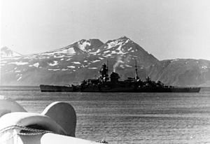
Operation Zarin ( English: Tsarina [Unternehmen Zarin]) was a German minelaying operation off the north-western coast of the islands of Novaya Zemlya in the Arctic Ocean. The operation was conducted between 24 September and 28 September 1942 by the German heavy cruiser Admiral Hipper escorted by the destroyers Z23, Z28, Z29 and Z30, because the British had sunk the specialist minelayer Ulm on 25 August. The mines laid during the operation had little effect.
Weather in this IP's area
overcast clouds
-3 Celsius
-7 Celsius
-3 Celsius
-3 Celsius
987 hPa
88 %
987 hPa
984 hPa
10000 meters
3.23 m/s
10.09 m/s
82 degree
100 %
10:34:13
14:31:53

