194.182.146.215 - IP Lookup: Free IP Address Lookup, Postal Code Lookup, IP Location Lookup, IP ASN, Public IP
Country:
Region:
City:
Location:
Time Zone:
Postal Code:
IP information under different IP Channel
ip-api
Country
Region
City
ASN
Time Zone
ISP
Blacklist
Proxy
Latitude
Longitude
Postal
Route
Luminati
Country
ASN
Time Zone
Europe/Copenhagen
ISP
TDC Holding A/S
Latitude
Longitude
Postal
IPinfo
Country
Region
City
ASN
Time Zone
ISP
Blacklist
Proxy
Latitude
Longitude
Postal
Route
IP2Location
194.182.146.215Country
Region
sjaelland
City
vordingborg
Time Zone
Europe/Copenhagen
ISP
Language
User-Agent
Latitude
Longitude
Postal
db-ip
Country
Region
City
ASN
Time Zone
ISP
Blacklist
Proxy
Latitude
Longitude
Postal
Route
ipdata
Country
Region
City
ASN
Time Zone
ISP
Blacklist
Proxy
Latitude
Longitude
Postal
Route
Popular places and events near this IP address

Vordingborg Municipality
Municipality in Zealand, Denmark
Distance: Approx. 42 meters
Latitude and longitude: 55.00833333,11.91027778
Vordingborg Municipality (Danish: Vordingborg Kommune, Danish pronunciation: [ˌvɒːte̝ŋˈpɒˀ]) is a kommune in the Sjælland Region, which is on the southeast coast of the island of Zealand in south Denmark. It was established in 2007. The municipality covers an area of 621 km2.

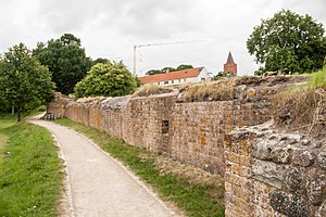
Vordingborg Castle
Distance: Approx. 149 meters
Latitude and longitude: 55.00722222,11.9125
The Vordingborg Castle ruins (Vordingborg Slotsruin) are located in the town of Vordingborg, Denmark and are the town's most famous attraction.
Masnedø
Island in Denmark
Distance: Approx. 2640 meters
Latitude and longitude: 54.98888889,11.88611111
Masnedø (Danish pronunciation: [mæsnð̩ˈøˀ]) is a Danish island between Zealand and Falster. The island covers an area of 1.68 km2 and has 156 inhabitants.

Masnedsund Bridge
Bridge
Distance: Approx. 1835 meters
Latitude and longitude: 54.99666667,11.88972222
The Masnedsund Bridge (Danish: Masnedsundbroen) is a bascule bridge that crosses Masnedsund between the islands Masnedø and Zealand (Danish: Sjælland) in Denmark. It carries road and railway traffic, as well as pedestrians and bicycles. Together with Storstrøm Bridge it connects Falster and Zealand and was the main road connection between the islands until the Farø Bridges were opened in 1985.

Storstrømmen
Strait in Denmark
Distance: Approx. 4617 meters
Latitude and longitude: 54.96666667,11.91666667
Storstrømmen (Danish pronunciation: [ˈstoɐ̯ˌstʁɶmˀm̩]; lit. The Great Stream) is a strait in Denmark separating the island Falster from the island Zealand.

Vordingborg
Place in Zealand, Denmark
Distance: Approx. 1119 meters
Latitude and longitude: 55,11.9
Vordingborg (Danish pronunciation: [ˌvɒːte̝ŋˈpɒˀ]) is a market town and old ferry town on the south coast of the island of Zealand in Denmark. Because of three large estates surrounding the town, a coherent urban development has not been possible, which is the reason why three satellite towns (former villages) have emerged around the town. Within the ring of estates, the town has a population of 12,397 (1 January 2024), and a population of 18,286 when including the three satellite towns of Ørslev, Nyråd, and Stensved, situated 1, 3 and 5 kilometres, respectively, from the town of Vordingborg.
Rosenfeldt
Manor house and estate in Denmark
Distance: Approx. 2404 meters
Latitude and longitude: 55.0168,11.8762
Rosenfeldt Manor is a manor house and estate located just west of Vordingborg, Vordingborg Municipality, some 90 km south of Copenhagen, Denmark. One of 12 new manors created when Vordingborg Cacalry District was dissolved in 1774, its first owner was Reinhard Iselin. The current main building was constructed for Oscar O'Neill Oxholm in 1870 to a design by Henrik Steffens Sibbern.

Iselingen
Manor house and estate in southeastern Denmark
Distance: Approx. 1393 meters
Latitude and longitude: 55.01611111,11.92722222
Iselingen is a manor house and estate located close to Vordingborg on the southern part of Zealand in southeastern Denmark. It takes its name after the Swiss-born merchant Reinhard Iselin who established it in the 1770s. The current main building was completed a hundred years later to design by Vilhelm Dahlerup.

Nyråd
Town in Denmark
Distance: Approx. 3792 meters
Latitude and longitude: 55.00333333,11.96944444
Nyråd is a town and satellite community to Vordingborg with a population of 2,518 (1 January 2024). It is located in Vordingborg Municipality 4 km east of central Vordingborg in Region Zealand in Denmark.

Marienlyst Manor
Manor house in Zealand, Denmark
Distance: Approx. 1358 meters
Latitude and longitude: 55.00167222,11.92879444
Marienlyst Manor is a manor house and estate located on the southernmost part of Zealand, overlooking the Færgestrøm, Vordingborg Municipality, in southeastern Denmark. Formerly a farm under Iselingen, it was incorporated as an independent manor in 1810. The main building dates from 1800 but owes its current appearance to a renovation undertaken after a fire in 1873.

Vordingborg railway station
Railway station in South Seeland, Denmark
Distance: Approx. 831 meters
Latitude and longitude: 55.01256111,11.90029444
Vordingborg railway station (Danish: Vordingborg Station or Vordingborg Banegård) is the main railway station serving the town of Vordingborg in southern Zealand, Denmark. It is located in the centre of the town, on the western edge of the historic town centre, and immediately adjacent to the Vordingborg bus station. Vordingborg station is located on the main line South Line which connects Copenhagen with southern Zealand and the islands of Falster and Lolland.

Siege of Vordingborg
Siege between the Hanseatic League and Denmark between 1368–1370
Distance: Approx. 149 meters
Latitude and longitude: 55.00722222,11.9125
The siege of Vordingborg (Danish: Belejringen af Vordingborg) was a siege between the Hanseatic and Danish forces at Vordingborg, Zealand during the Danish–Hanseatic War (1361–1370). The Danes managed to defend Vordingborg for two years until peace was settled at Stralsund.
Weather in this IP's area
overcast clouds
6 Celsius
2 Celsius
5 Celsius
6 Celsius
1024 hPa
82 %
1024 hPa
1023 hPa
10000 meters
4.57 m/s
7.34 m/s
217 degree
100 %
