194.165.52.128 - IP Lookup: Free IP Address Lookup, Postal Code Lookup, IP Location Lookup, IP ASN, Public IP
Country:
Region:
City:
Location:
Time Zone:
Postal Code:
IP information under different IP Channel
ip-api
Country
Region
City
ASN
Time Zone
ISP
Blacklist
Proxy
Latitude
Longitude
Postal
Route
Luminati
Country
ASN
Time Zone
Europe/Vienna
ISP
conova communications GmbH
Latitude
Longitude
Postal
IPinfo
Country
Region
City
ASN
Time Zone
ISP
Blacklist
Proxy
Latitude
Longitude
Postal
Route
IP2Location
194.165.52.128Country
Region
salzburg
City
neumarkt am wallersee
Time Zone
Europe/Vienna
ISP
Language
User-Agent
Latitude
Longitude
Postal
db-ip
Country
Region
City
ASN
Time Zone
ISP
Blacklist
Proxy
Latitude
Longitude
Postal
Route
ipdata
Country
Region
City
ASN
Time Zone
ISP
Blacklist
Proxy
Latitude
Longitude
Postal
Route
Popular places and events near this IP address

Irrsee
Lake In Austria
Distance: Approx. 6918 meters
Latitude and longitude: 47.91222222,13.30694444
Irrsee is a lake in the Salzkammergut, Austria, located at 47°54′44″N 13°18′25″E. Its surface is approximately 3.5 km2 (1.4 sq mi) and its maximum depth is 32 metres. It is a popular tourist destination, also thanks to the warmest water temperature of all lakes in Salzkammergut. It is drained by the Zeller Ache towards the Mondsee.

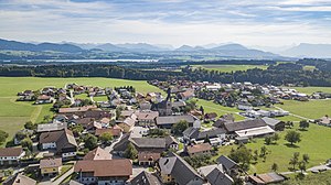
Neumarkt am Wallersee
Municipality in Salzburg, Austria
Distance: Approx. 828 meters
Latitude and longitude: 47.94527778,13.22472222
Neumarkt am Wallersee is a town in the district of Salzburg-Umgebung in the state of Salzburg in Austria.

Straßwalchen
Municipality in Salzburg, Austria
Distance: Approx. 3702 meters
Latitude and longitude: 47.98,13.25472222
Straßwalchen (Central Bavarian: Strosswoicher) is a market town in the district of Salzburg-Umgebung (Flachgau) in the state of Salzburg in Austria.

Schleedorf
Municipality in Salzburg, Austria
Distance: Approx. 6211 meters
Latitude and longitude: 47.95,13.15
Schleedorf is a municipality in the district of Salzburg-Umgebung in the state of Salzburg in Austria.

Köstendorf
Municipality in Salzburg, Austria
Distance: Approx. 2807 meters
Latitude and longitude: 47.95722222,13.19722222
Köstendorf is a municipality in the district of Salzburg-Umgebung in the state of Salzburg in Austria.

Lengau
Municipality in Upper Austria, Austria
Distance: Approx. 5702 meters
Latitude and longitude: 48,13.21666667
Lengau is a municipality in the district of Braunau am Inn in the Austrian state of Upper Austria.
Oberhofen am Irrsee
Municipality in Upper Austria, Austria
Distance: Approx. 5015 meters
Latitude and longitude: 47.95027778,13.30055556
Oberhofen am Irrsee is a municipality in the district of Vöcklabruck in the Austrian state of Upper Austria.

Zell am Moos
Municipality in Upper Austria, Austria
Distance: Approx. 8341 meters
Latitude and longitude: 47.90027778,13.31694444
Zell am Moos is a municipality in the district of Vöcklabruck in the Austrian state of Upper Austria.

Haidach gas storage
Natural gas storage in Haidach, Austria
Distance: Approx. 3979 meters
Latitude and longitude: 47.98569444,13.23055556
Haidach gas storage is an underground natural gas storage in the town of Haidach near Salzburg, Austria. As of the end of 2018 with a capacity of ~2.9 billion cubic meters (bcm) it is the third largest (after Rehden with volume of ~4.7bcm and Bergermeer of ~4.5bcm of capacity) gas storage facility in Central Europe.
Zeller Bach (Irrsee)
River in Upper Austria, Austria
Distance: Approx. 7902 meters
Latitude and longitude: 47.90204,13.31139
Zeller Bach is a small river in the Upper Austrian region Salzkammergut. It is a tributary of the Irrsee, which is drained by the Zeller Ache.

Wallersee
Distance: Approx. 5922 meters
Latitude and longitude: 47.91388889,13.175
Der Wallersee is a lake in the Austrian state of Salzburg northeast of the city of Salzburg in Salzburg-Umgebung District. Around the lake there is a hiking path of about 20 km (12 mi) length; at its southern part, it converges with the famous Camino de Santiago (Austrian route). There are two campsite resorts.

Salzburger Seengebiet
Distance: Approx. 6211 meters
Latitude and longitude: 47.95,13.15
Das Salzburger Seengebiet or Salzburger Seenland is a group of natural lakes northeasterly of the city of Salzburg in Salzburg-Umgebung District (Region Flachgau) and is part of Salzburg alpine foothills.
Weather in this IP's area
light snow
1 Celsius
-4 Celsius
0 Celsius
1 Celsius
1019 hPa
87 %
1019 hPa
944 hPa
4.73 m/s
11.5 m/s
261 degree
100 %

