194.165.29.64 - IP Lookup: Free IP Address Lookup, Postal Code Lookup, IP Location Lookup, IP ASN, Public IP
Country:
Region:
City:
Location:
Time Zone:
Postal Code:
IP information under different IP Channel
ip-api
Country
Region
City
ASN
Time Zone
ISP
Blacklist
Proxy
Latitude
Longitude
Postal
Route
Luminati
Country
Region
eng
City
southampton
ASN
Time Zone
Europe/London
ISP
Virgin Media
Latitude
Longitude
Postal
IPinfo
Country
Region
City
ASN
Time Zone
ISP
Blacklist
Proxy
Latitude
Longitude
Postal
Route
IP2Location
194.165.29.64Country
Region
england
City
gosport
Time Zone
Europe/London
ISP
Language
User-Agent
Latitude
Longitude
Postal
db-ip
Country
Region
City
ASN
Time Zone
ISP
Blacklist
Proxy
Latitude
Longitude
Postal
Route
ipdata
Country
Region
City
ASN
Time Zone
ISP
Blacklist
Proxy
Latitude
Longitude
Postal
Route
Popular places and events near this IP address

Haslar Marina
Distance: Approx. 803 meters
Latitude and longitude: 50.791739,-1.118907
Haslar Marina is located inside Portsmouth Harbour, on the south coast of England, just to the west of the entrance. It can be easily identified by the bright green lightvessel Mary Mouse II permanently moored to the outside of its breakwater. The lightship contains a small bar and restaurant, as well as one set of shower, toilet and laundry facilities.

St Vincent College
Sixth form college in Gosport, Hampshire, England
Distance: Approx. 735 meters
Latitude and longitude: 50.8,-1.136
St Vincent College is a co-educational sixth form (16-18) college located in Gosport, Hampshire, England. The majority of students come from the surrounding towns including Gosport, Fareham, Stubbington and Winchester. The nearby Gosport Ferry link with Portsmouth also allows students from that city to attend.

HMS Alliance (P417)
Amphion class submarine of the Royal Navy
Distance: Approx. 987 meters
Latitude and longitude: 50.78846389,-1.11970556
HMS Alliance (P417/S67) is a Royal Navy A-class, Amphion-class or Acheron-class submarine, laid down towards the end of the Second World War and completed in 1947. The submarine is the only surviving example of the class, having been a memorial and museum ship since 1981. The Amphion-class submarines were designed for use in the Far East, where the size of the Pacific Ocean made long-range, high surface speed and relative comfort for the crew important features to allow for much larger patrol areas and longer periods at sea than British submarines operating in the Atlantic or Mediterranean had to contend with.
Gosport railway station
Former railway station in England
Distance: Approx. 323 meters
Latitude and longitude: 50.7979,-1.1302
Gosport railway station was a terminus station designed by William Tite and opened to passenger and freight trains in 1841 by the London and South Western Railway (LSWR). It was closed in 1953 to passenger trains, and in 1969 to the remaining freight services. It is a Grade II* listed building.

HMS St Vincent (Gosport shore establishment)
Distance: Approx. 706 meters
Latitude and longitude: 50.7997,-1.1359
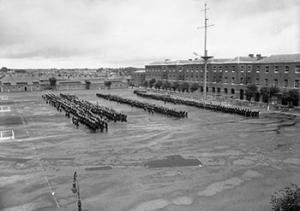
HMS St Vincent was a shore establishment of the Royal Navy, located in Gosport, Hampshire. The name was given to the Forton Barracks site in Gosport in 1927, after the one that been set up aboard the old first rate HMS St Vincent in 1862. The new HMS St Vincent was commissioned on 1 June 1927, originally like its predecessor as a training establishment for boys and juniors.

Forton Barracks
Distance: Approx. 735 meters
Latitude and longitude: 50.8,-1.136
Forton Barracks was a military installation near Gosport in Hampshire, which served first as an Army barracks and then as a divisional headquarters for the Royal Marines. It subsequently served as a Royal Navy training establishment. Today, the site is occupied by St Vincent College.

St George Barracks, Gosport
Distance: Approx. 400 meters
Latitude and longitude: 50.79835,-1.12659
St George Barracks (not St George's Barracks) was a military installation at Gosport, Hampshire. In addition to the guard house, barrack blocks, the sergeant's mess and the gymnasium all survive and are Grade II listed buildings.

Royal Clarence Yard
Victualling yard for the Royal Navy
Distance: Approx. 768 meters
Latitude and longitude: 50.7955,-1.1181
Royal Clarence Yard in Gosport, Hampshire, England was established in 1828 as one of the Royal Navy's two principal, purpose-built, provincial victualling establishments (the other being Royal William Yard in Plymouth, Devon). It was designed by George Ledwell Taylor, Civil Architect to the Navy Board and named after the then Duke of Clarence (later William IV, King of England). The new victualling yard was developed on approximately 20 hectares of land, some of which was already in use as a brewing establishment at Weevil on the west shore of Portsmouth Harbour, to the north of Gosport.

Gosport bus station
Bus station in Hampshire, England
Distance: Approx. 791 meters
Latitude and longitude: 50.794,-1.1179
Gosport bus station is a bus station in Gosport, England.
Gosport Road and Alverstoke railway station
Disused railway station in Gosport, Hampshire
Distance: Approx. 865 meters
Latitude and longitude: 50.7919,-1.1402
Gosport Road and Alverstoke railway station served the town of Gosport, Hampshire, England, from 1865 to 1915 on the Stokes Bay line.

Gosport Town Hall
Municipal building in Gosport, England
Distance: Approx. 339 meters
Latitude and longitude: 50.7948,-1.1242
Gosport Town Hall is a municipal structure in the High Street, Gosport, Hampshire, England. The structure currently serves as the headquarters of Gosport Borough Council.

Holy Trinity Church, Gosport
Church in Hampshire, United Kingdom
Distance: Approx. 698 meters
Latitude and longitude: 50.792721,-1.119817
Holy Trinity is a Church of England church in the Anglo-Catholic tradition in Gosport, Hampshire, within the Anglican Diocese of Portsmouth. It is the civic church for the Gosport deanery and hosts commemorative events and the annual mayor's carol service. The church is famous for its Grade II* listed organ, which was purchased in 1747 by the parishioners from the 1st Duke of Chandos and is believed to have been played by Handel.
Weather in this IP's area
overcast clouds
10 Celsius
9 Celsius
9 Celsius
11 Celsius
1026 hPa
95 %
1026 hPa
1022 hPa
10000 meters
2.05 m/s
3.45 m/s
285 degree
100 %
