Country:
Region:
City:
Latitude and Longitude:
Time Zone:
Postal Code:
IP information under different IP Channel
ip-api
Country
Region
City
ASN
Time Zone
ISP
Blacklist
Proxy
Latitude
Longitude
Postal
Route
Luminati
Country
Region
nw
City
sendenhorst
ASN
Time Zone
Europe/Berlin
ISP
BUNNYWAY, informacijske storitve d.o.o.
Latitude
Longitude
Postal
IPinfo
Country
Region
City
ASN
Time Zone
ISP
Blacklist
Proxy
Latitude
Longitude
Postal
Route
db-ip
Country
Region
City
ASN
Time Zone
ISP
Blacklist
Proxy
Latitude
Longitude
Postal
Route
ipdata
Country
Region
City
ASN
Time Zone
ISP
Blacklist
Proxy
Latitude
Longitude
Postal
Route
Popular places and events near this IP address

Drensteinfurt
Town in North Rhine-Westphalia, Germany
Distance: Approx. 7783 meters
Latitude and longitude: 51.79444444,7.73916667
Drensteinfurt (in low German Stewwert) is a town in the district of Warendorf, in North Rhine-Westphalia, Germany. It is situated approximately 15 km north of Hamm and 20 km south of Münster. The villages Rinkerode in the north and Walstedde in the south are part of Drensteinfurt.

Sendenhorst
Town in North Rhine-Westphalia, Germany
Distance: Approx. 2998 meters
Latitude and longitude: 51.84388889,7.82777778
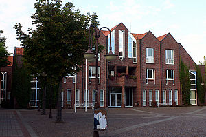
Sendenhorst is a town in the district of Warendorf, in North Rhine-Westphalia, Germany. It is situated approximately 20 km (12 mi) north of Hamm and 20 km (12 mi) south-east of Münster.

Everswinkel
Town in North Rhine-Westphalia, Germany
Distance: Approx. 8557 meters
Latitude and longitude: 51.925,7.84777778
Everswinkel is a municipality in Warendorf District, North Rhine-Westphalia, Germany. It is situated some 30 km north of Hamm and 15 km east of Münster.

Hiltruper See
Distance: Approx. 9635 meters
Latitude and longitude: 51.88722222,7.65833333
Hiltruper See is a lake in Münsterland, North Rhine-Westphalia, Germany. At an elevation of 58 m, its surface area is 15.8 ha. See the German page for more information.

Hoetmar
Ortsteil of Warendorf in North Rhine-Westphalia, Germany
Distance: Approx. 8393 meters
Latitude and longitude: 51.87083333,7.90972222
Hoetmar (German pronunciation: [ˈhoːtmar]) is a village that is located in North Rhine-Westphalia, Germany. More specifically, Hoetmar is nestled in between the towns of Sendenhorst, Everswinkel and Ennigerloh in agriculturally oriented Münsterland. Since 1974 it is under the administration of the town of Warendorf.

Angel (river)
River of North Rhine-Westphalia, Germany
Distance: Approx. 9843 meters
Latitude and longitude: 51.9256,7.6993
Angel [German pronunciation: [ˈaŋl̩]] is a river of North Rhine-Westphalia, Germany, a 38.1-kilometre (23.7 mi) tributary of the Werse.

Emmerbach
River in Germany
Distance: Approx. 8127 meters
Latitude and longitude: 51.90777778,7.70472222
Emmerbach is a river of North Rhine-Westphalia, Germany. It flows into the Werse in Münster-Wolbeck.
Weather in this IP's area
scattered clouds
9 Celsius
7 Celsius
9 Celsius
10 Celsius
1027 hPa
92 %
1027 hPa
1019 hPa
10000 meters
3.59 m/s
4 m/s
261 degree
45 %
07:48:46
16:38:26