Country:
Region:
City:
Latitude and Longitude:
Time Zone:
Postal Code:
IP information under different IP Channel
ip-api
Country
Region
City
ASN
Time Zone
ISP
Blacklist
Proxy
Latitude
Longitude
Postal
Route
Luminati
Country
Region
02
City
ypsonas
ASN
Time Zone
Asia/Nicosia
ISP
Primetel PLC
Latitude
Longitude
Postal
IPinfo
Country
Region
City
ASN
Time Zone
ISP
Blacklist
Proxy
Latitude
Longitude
Postal
Route
db-ip
Country
Region
City
ASN
Time Zone
ISP
Blacklist
Proxy
Latitude
Longitude
Postal
Route
ipdata
Country
Region
City
ASN
Time Zone
ISP
Blacklist
Proxy
Latitude
Longitude
Postal
Route
Popular places and events near this IP address
Kolossi Castle
Building in Limassol, Cyprus
Distance: Approx. 3815 meters
Latitude and longitude: 34.665273,32.933957
Kolossi Castle is a former Crusader stronghold on the south-west edge of Kolossi village 14 kilometres (9 mi) west of the city of Limassol on the island of Cyprus. It held great strategic importance in the Middle Ages, and contained large facilities for the production of sugar from the local sugarcane, one of Cyprus's main exports in the period. The original castle was possibly built in 1210 by the Frankish military, when the land of Kolossi was given by King Hugh I to the Knights of the Order of St John of Jerusalem (Hospitallers).

Kolossi
Village in Limassol District, Cyprus
Distance: Approx. 3353 meters
Latitude and longitude: 34.67055556,32.93361111
Kolossi (Greek: Κολόσσι [locally [koˈlosːi]]) is a village on the outskirts of Limassol, Cyprus. It lies partly in the Sovereign Base Areas of Akrotiri and Dhekelia. Its population in 2011 was 5,651.

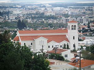
Ypsonas
Municipality in the Limassol District of Cyprus
Distance: Approx. 705 meters
Latitude and longitude: 34.68944444,32.96138889
Ypsonas or Ipsonas (Greek: Ύψωνας, romanized: Ypsōnas, Turkish: İpsona), is a municipality in the Limassol of Cyprus. It is one of the largest municipalities in the district and is located about 7 kilometres (4.3 mi) west of Limassol. The southern part of the municipality is within the administrative borders of the British sovereign base of Akrotiri - Episkopi.
Erimi
Place in Limassol District, Cyprus
Distance: Approx. 3824 meters
Latitude and longitude: 34.68333333,32.91666667
Erimi is a village lying partly in the Limassol District of Cyprus and partly in the British Overseas Territory of Akrotiri and Dhekelia. It has a population of 1,432 according to the 2001 census. It has recently increased in size with the addition of the district "Aphrodite Gardens", a new area just developed for expatriates of mainly British origin.

Trachoni, Limassol
Place in Limassol District, Cyprus
Distance: Approx. 4020 meters
Latitude and longitude: 34.65833333,32.96138889
Trachoni (Greek: Τραχώνι or Turkish: Trahon)( ancient greek for rugged/stony ground) is a large village lying partly in the Limassol District of Cyprus, and partly in the British Overseas Territory of Akrotiri and Dhekelia. As of 2011, it had a population of 3,952. Prior to 1974, Trachoni was inhabited both by Greek- and Turkish Cypriots.
Spyros Kyprianou Athletic Center
Indoor arena located in Limassol, Cyprus
Distance: Approx. 4499 meters
Latitude and longitude: 34.71415556,32.99904444
The Spyros Kyprianou Athletic Center or Spyros Kyprianou Sports Centre (Greek: Αθλητικό Κέντρο "Σπύρος Κυπριανού", romanized: Athlitikó Kéntro "Spýros Kyprianoú"), also known as Spyros Kyprianou Arena and Palais des sports, is an indoor arena located in the Kato Polemidia district of Limassol, Cyprus. Opened in late 2005, it is named after the late president of Cyprus, Spyros Kyprianou.

Kato Polemidia
Municipality in Limassol District, Cyprus
Distance: Approx. 3926 meters
Latitude and longitude: 34.69305556,32.99916667
Kato Polemidia (Greek: Κάτω Πολεμίδια; Turkish: Aşağı Binatlı) is a municipality of Cyprus, located in the district of Limassol. It has a population of 22,369 according to the 2011 census.
Pano Polemidia
Place in Limassol District, Cyprus
Distance: Approx. 3511 meters
Latitude and longitude: 34.70527778,32.99222222
Pano Polemidia (Greek: Πάνω Πολεμίδια; Turkish: Yukarı Binatlı) is a large village in the Limassol District of Cyprus. It has a population of 3443 according to the 2011 census. It is near Kato Polemidia.
Kantou, Cyprus
Place in Limassol District, Cyprus
Distance: Approx. 4564 meters
Latitude and longitude: 34.69027778,32.90666667
Kantou (Greek: Καντού; Turkish: Çanakkale) is a village in the Limassol District of Cyprus, located 2 km north of Erimi. Prior to 1960, the village was almost exclusively inhabited by Turkish Cypriots.
Agios Nikolaos (Kato Polemidia)
Quarter of Kato Polemidia Municipality
Distance: Approx. 2319 meters
Latitude and longitude: 34.69717534,32.98137719
Agios Nikolaos is a district of the Municipality of Kato Polemidia.
Panayias Evaggelistrias (Kato Polemidia)
District of the Municipality of Kato Polemidia
Distance: Approx. 4330 meters
Latitude and longitude: 34.69388889,33.00361111
Panagias Evangelistrias is a district of the municipality of Kato Polemidia in Cyprus.

Alphamega Stadium
Cypriot stadium
Distance: Approx. 1571 meters
Latitude and longitude: 34.69333333,32.93916667
The Alphamega Stadium, also known as Limassol Stadium for UEFA competitions, is a football stadium in Kolossi, Limassol District, Cyprus, and the home ground of the 3 biggest clubs of Limassol Apollon, AEL and Aris. With an all-seater capacity of 11,000, it is the second largest football-only stadium and the fifth largest football stadium overall in Cyprus.
Weather in this IP's area
clear sky
14 Celsius
14 Celsius
14 Celsius
15 Celsius
1019 hPa
67 %
1019 hPa
1005 hPa
10000 meters
1.54 m/s
310 degree
06:21:22
16:44:08


