194.152.143.69 - IP Lookup: Free IP Address Lookup, Postal Code Lookup, IP Location Lookup, IP ASN, Public IP
Country:
Region:
City:
Location:
Time Zone:
Postal Code:
ISP:
ASN:
language:
User-Agent:
Proxy IP:
Blacklist:
IP information under different IP Channel
ip-api
Country
Region
City
ASN
Time Zone
ISP
Blacklist
Proxy
Latitude
Longitude
Postal
Route
db-ip
Country
Region
City
ASN
Time Zone
ISP
Blacklist
Proxy
Latitude
Longitude
Postal
Route
IPinfo
Country
Region
City
ASN
Time Zone
ISP
Blacklist
Proxy
Latitude
Longitude
Postal
Route
IP2Location
194.152.143.69Country
Region
pest
City
toeroekbalint
Time Zone
Europe/Budapest
ISP
Language
User-Agent
Latitude
Longitude
Postal
ipdata
Country
Region
City
ASN
Time Zone
ISP
Blacklist
Proxy
Latitude
Longitude
Postal
Route
Popular places and events near this IP address

Érd
City with county rights in Pest, Hungary
Distance: Approx. 5692 meters
Latitude and longitude: 47.37837,18.922
Érd (Hungarian: [eːrd]; Ottoman Turkish: Hamzabey Palanka; German: Hanselbeck, Croatian: Andzabeg) is a town in Pest County, Budapest metropolitan area, Hungary. It is a city with county rights.
Diósd
Town in Pest, Hungary
Distance: Approx. 3686 meters
Latitude and longitude: 47.40416667,18.94583333
Diósd (German: Orasch) is a small town located between the larger cities of Budapest and Érd in the Budapest metropolitan area, Pest County, Hungary. Though many residents commute to work to the capital city Budapest, the largest employers in the town are a manufacturing plant named New MGM Zrt., that produces ball bearings and tapered roller bearing for worldwide OEM customers and dealers, an Interspar grocery store, and the International Christian School of Budapest, a school that serves missionary families, expatriates, and Hungarians.

Budaörs
Town in Pest, Hungary
Distance: Approx. 4835 meters
Latitude and longitude: 47.46072,18.95798
Budaörs (Hungarian: [ˈbudɒørʃ]; German: Wudersch; Croatian: Jerša, Erša or Vundeš; Latin: Vicus Teuto) is a town in Pest County, Budapest metropolitan area, Hungary.

Törökbálint
Place in Pest, Hungary
Distance: Approx. 840 meters
Latitude and longitude: 47.43666667,18.91222222
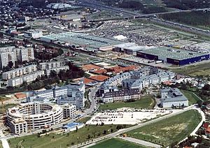
Törökbálint [ˈtørøɡbaːlint] is a town in Pest county, Hungary. Törökbálint received town status on 1 July 2007. The city also has a German name, Großturwall, which originates from the times of the Swabian immigration after the Ottoman times of Hungary.
International Christian School of Budapest
Private international school in Diósd, Pest, Hungary
Distance: Approx. 3788 meters
Latitude and longitude: 47.40916667,18.95444444
International Christian School of Budapest (ICSB) is a private, Christian, co-educational international school in Diósd, Pest, Hungary. It was established in 1994 and is the only ACT test center in Hungary. It is known to be a popular choice among Chinese parents.
Sóskút
Place in Central Hungary, Hungary
Distance: Approx. 6915 meters
Latitude and longitude: 47.40626,18.82849
Sóskút is a village in Pest County, Hungary.
Memento Park
Open-air museum in Budapest, Hungary
Distance: Approx. 6416 meters
Latitude and longitude: 47.42638889,18.99888889
Memento Park (Hungarian: Szoborpark) is an open-air museum in Budapest, Hungary, dedicated to monumental statues and sculpted plaques from Hungary's Communist period (1949–1989). There are statues of Lenin, Marx, and Engels, as well as several Hungarian Communist leaders. The park was designed by Hungarian architect Ákos Eleőd, who won the competition announced by the Budapest General Assembly (Fővárosi Közgyűlés) in 1991.

Nagytétény Palace
Distance: Approx. 6988 meters
Latitude and longitude: 47.39083333,18.98722222
Nagytétény Palace or Száraz-Rudnyánszky Palace is today the furniture museum of the Museum of Applied Arts in Budapest established in 1949. It is located at 9-11 Kastélypark Street in the 22nd District of Budapest.

Budakeszi District
Districts of Hungary in Pest
Distance: Approx. 5769 meters
Latitude and longitude: 47.4667,18.9667
Budakeszi (Hungarian: Budakeszi járás) is a district in western part of Pest County. Budakeszi is also the name of the town where the district seat is found. The district is located in the Central Hungary Statistical Region.

Érd District
Districts of Hungary in Pest
Distance: Approx. 4602 meters
Latitude and longitude: 47.38793696,18.91014691
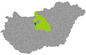
Érd (Hungarian: Érdi járás) is a district in south-western part of Pest County. Érd is also the name of the town where the district seat is found. The district is located in the Central Hungary Statistical Region.

Budaörs Airport
Airport in Hungary
Distance: Approx. 5573 meters
Latitude and longitude: 47.45083333,18.98055556
Budaörs Airport (Hungarian: Budaörsi Repülőtér), (ICAO: LHBS) is an airport located in the 11th district of Budapest, Hungary and was named after the neighboring town Budaörs. Now serving general aviation, it was once Hungary's only international airport.
Érd minaret
Minaret tower in Érd, Hungary
Distance: Approx. 7829 meters
Latitude and longitude: 47.36088,18.93843
The Érd minaret (Hungarian: Érdi minaret) is an Ottoman era minaret tower situated in Érd near capital Budapest in Hungary. It is one of only three Ottoman era minarets still surviving in Hungary. The other two are the Eger minaret and the minaret of Yakovalı Hasan Paşa Mosque in Pécs.
Weather in this IP's area
overcast clouds
-2 Celsius
-2 Celsius
-3 Celsius
-2 Celsius
1023 hPa
95 %
1023 hPa
1001 hPa
10000 meters
0.45 m/s
1.34 m/s
149 degree
100 %


