194.15.192.207 - IP Lookup: Free IP Address Lookup, Postal Code Lookup, IP Location Lookup, IP ASN, Public IP
Country:
Region:
City:
Location:
Time Zone:
Postal Code:
ISP:
ASN:
language:
User-Agent:
Proxy IP:
Blacklist:
IP information under different IP Channel
ip-api
Country
Region
City
ASN
Time Zone
ISP
Blacklist
Proxy
Latitude
Longitude
Postal
Route
db-ip
Country
Region
City
ASN
Time Zone
ISP
Blacklist
Proxy
Latitude
Longitude
Postal
Route
IPinfo
Country
Region
City
ASN
Time Zone
ISP
Blacklist
Proxy
Latitude
Longitude
Postal
Route
IP2Location
194.15.192.207Country
Region
podkarpackie
City
wolka podlesna
Time Zone
Europe/Warsaw
ISP
Language
User-Agent
Latitude
Longitude
Postal
ipdata
Country
Region
City
ASN
Time Zone
ISP
Blacklist
Proxy
Latitude
Longitude
Postal
Route
Popular places and events near this IP address
Gmina Czarna, Łańcut County
Gmina in Subcarpathian Voivodeship, Poland
Distance: Approx. 5086 meters
Latitude and longitude: 50.11666667,22.18333333
Gmina Czarna is a rural gmina (administrative district) in Łańcut County, Subcarpathian Voivodeship, in south-eastern Poland. Its seat is the village of Czarna, which lies approximately 7 kilometres (4 mi) north-west of Łańcut and 16 km (10 mi) north-east of the regional capital Rzeszów. The gmina covers an area of 78.11 square kilometres (30.2 sq mi), and as of 2006 its total population is 10,779 (11,177 in 2011).
Medynia Głogowska
Village in Subcarpathian Voivodeship, Poland
Distance: Approx. 4924 meters
Latitude and longitude: 50.15888889,22.13805556
Medynia Głogowska [mɛˈdɨɲa ɡwɔˈɡɔfska] is a village in the administrative district of Gmina Czarna, within Łańcut County, Subcarpathian Voivodeship, in south-eastern Poland. It lies approximately 13 kilometres (8 mi) north-west of Łańcut and 17 km (11 mi) north-east of the regional capital Rzeszów.
Medynia Łańcucka
Village in Podkarpackie Voivodeship, Poland
Distance: Approx. 2537 meters
Latitude and longitude: 50.13055556,22.14166667
Medynia Łańcucka (Polish pronunciation: [mɛˈdɨɲa waj̃ˈt͡sut͡ska]) is a village in the administrative district of Gmina Czarna, within Łańcut County, Podkarpackie Voivodeship, in south-eastern Poland.
Pogwizdów, Podkarpackie Voivodeship
Village in Subcarpathian Voivodeship, Poland
Distance: Approx. 2709 meters
Latitude and longitude: 50.11666667,22.15
Pogwizdów [pɔɡˈvizduf] is a village in the administrative district of Gmina Czarna, within Łańcut County, Subcarpathian Voivodeship, in south-eastern Poland. It lies approximately 3 kilometres (2 mi) west of Czarna, 9 km (6 mi) north-west of Łańcut, and 14 km (9 mi) north-east of the regional capital Rzeszów.

Czarna, Łańcut County
Village in Subcarpathian Voivodeship, Poland
Distance: Approx. 5086 meters
Latitude and longitude: 50.11666667,22.18333333
Czarna [ˈt͡ʂarna] is a village in Łańcut County, Subcarpathian Voivodeship, in south-eastern Poland. It is the seat of the gmina (administrative district) called Gmina Czarna. It lies approximately 7 kilometres (4 mi) north-west of Łańcut and 16 km (10 mi) north-east of the regional capital Rzeszów.
Palikówka
Village in Subcarpathian Voivodeship, Poland
Distance: Approx. 4704 meters
Latitude and longitude: 50.08333333,22.15
Palikówka [paliˈkufka] is a village in the administrative district of Gmina Krasne, within Rzeszów County, Subcarpathian Voivodeship, in south-eastern Poland. It lies approximately 6 kilometres (4 mi) north-east of Krasne and 12 km (7 mi) north-east of the regional capital Rzeszów.
Jasionka, Rzeszów County
Village in Subcarpathian Voivodeship, Poland
Distance: Approx. 4069 meters
Latitude and longitude: 50.115,22.05527778
Jasionka [jaˈɕɔnka] is a village in the administrative district of Gmina Trzebownisko, within Rzeszów County, Subcarpathian Voivodeship, in south-eastern Poland. It lies approximately 4 kilometres (2 mi) north of Trzebownisko and 10 km (6 mi) north of the regional capital Rzeszów.
Łąka, Podkarpackie Voivodeship
Village in Subcarpathian Voivodeship, Poland
Distance: Approx. 3742 meters
Latitude and longitude: 50.08583333,22.09638889
Łąka [ˈwɔŋka] is a village in the administrative district of Gmina Trzebownisko, within Rzeszów County, Subcarpathian Voivodeship, in south-eastern Poland. It lies approximately 4 kilometres (2 mi) east of Trzebownisko and 9 km (6 mi) north-east of the regional capital Rzeszów.
Łukawiec, Rzeszów County
Village in Subcarpathian Voivodeship, Poland
Distance: Approx. 875 meters
Latitude and longitude: 50.11666667,22.1
Łukawiec [wuˈkavʲɛt͡s] is a village in the administrative district of Gmina Trzebownisko, within Rzeszów County, Subcarpathian Voivodeship, in south-eastern Poland. It lies approximately 6 kilometres (4 mi) north-east of Trzebownisko and 12 km (7 mi) north-east of the regional capital Rzeszów.
Stobierna, Rzeszów County
Village in Subcarpathian Voivodeship, Poland
Distance: Approx. 3670 meters
Latitude and longitude: 50.13333333,22.06666667
Stobierna [stɔˈbjɛrna] is a village in the administrative district of Gmina Trzebownisko, within Rzeszów County, Subcarpathian Voivodeship, in south-eastern Poland. It lies approximately 6 kilometres (4 mi) north of Trzebownisko and 12 km (7 mi) north of the regional capital Rzeszów.

Terliczka
Village in Subcarpathian Voivodeship, Poland
Distance: Approx. 2862 meters
Latitude and longitude: 50.1,22.08333333
Terliczka [tɛrˈlit͡ʂka] is a village in the administrative district of Gmina Trzebownisko, within Rzeszów County, Subcarpathian Voivodeship, in south-eastern Poland. It lies approximately 4 kilometres (2 mi) north-east of Trzebownisko and 10 km (6 mi) north-east of the regional capital Rzeszów.
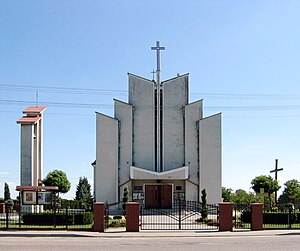
Wólka Podleśna
Village in Subcarpathian Voivodeship, Poland
Distance: Approx. 21 meters
Latitude and longitude: 50.11805556,22.11194444
Wólka Podleśna [ˈvulka pɔdˈlɛɕna] is a village in the administrative district of Gmina Trzebownisko, within Rzeszów County, Subcarpathian Voivodeship, in south-eastern Poland.
Weather in this IP's area
few clouds
-1 Celsius
-6 Celsius
-1 Celsius
-1 Celsius
1038 hPa
94 %
1038 hPa
1007 hPa
10000 meters
3.51 m/s
7.55 m/s
251 degree
17 %