194.15.188.216 - IP Lookup: Free IP Address Lookup, Postal Code Lookup, IP Location Lookup, IP ASN, Public IP
Country:
Region:
City:
Location:
Time Zone:
Postal Code:
ISP:
ASN:
language:
User-Agent:
Proxy IP:
Blacklist:
IP information under different IP Channel
ip-api
Country
Region
City
ASN
Time Zone
ISP
Blacklist
Proxy
Latitude
Longitude
Postal
Route
db-ip
Country
Region
City
ASN
Time Zone
ISP
Blacklist
Proxy
Latitude
Longitude
Postal
Route
IPinfo
Country
Region
City
ASN
Time Zone
ISP
Blacklist
Proxy
Latitude
Longitude
Postal
Route
IP2Location
194.15.188.216Country
Region
dolnoslaskie
City
uciechow
Time Zone
Europe/Warsaw
ISP
Language
User-Agent
Latitude
Longitude
Postal
ipdata
Country
Region
City
ASN
Time Zone
ISP
Blacklist
Proxy
Latitude
Longitude
Postal
Route
Popular places and events near this IP address

Dzierżoniów
Place in Lower Silesian Voivodeship, Poland
Distance: Approx. 3684 meters
Latitude and longitude: 50.72805556,16.65111111
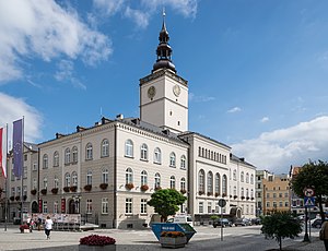
Dzierżoniów (Polish: [d͡ʑɛrˈʐɔɲuf] ; until 1946 Polish: Rychbach; German: Reichenbach im Eulengebirge [ˈʁaɪçn̩bax]) is a town located at the foot of the Owl Mountains in southwestern Poland, within the Lower Silesian Voivodeship. It is the seat of Dzierżoniów County, and of Gmina Dzierżoniów (although it is not part of the territory of the latter, since the town forms a separate urban gmina). Established in the 13th century, Dzierżoniów is a historical Lower Silesian town that covers an area of 20.1 square kilometres (7.8 sq mi), and as of December 2021 it has a population of 32,346.
Albinów, Lower Silesian Voivodeship
Village in Lower Silesian Voivodeship, Poland
Distance: Approx. 2694 meters
Latitude and longitude: 50.77805556,16.67055556
Albinów [alˈbinuf] is a village in the administrative district of Gmina Dzierżoniów, within Dzierżoniów County, Lower Silesian Voivodeship, in south-western Poland.
Borowica, Lower Silesian Voivodeship
Village in Lower Silesian Voivodeship, Poland
Distance: Approx. 1421 meters
Latitude and longitude: 50.76666667,16.67388889
Borowica [bɔrɔˈvʲit͡sa] is a village in the administrative district of Gmina Dzierżoniów, within Dzierżoniów County, Lower Silesian Voivodeship, in south-western Poland. It lies approximately 11 km (7 mi) north-east of Dzierżoniów, and 48 km (30 mi) south-west of the regional capital Wrocław.
Dębowa Góra, Lower Silesian Voivodeship
Village in Lower Silesian Voivodeship, Poland
Distance: Approx. 3961 meters
Latitude and longitude: 50.76861111,16.73361111
Dębowa Góra [dɛmˈbɔva ˈɡura] is a village in the administrative district of Gmina Dzierżoniów, within Dzierżoniów County, Lower Silesian Voivodeship, in south-western Poland.
Kołaczów
Village in Lower Silesian Voivodeship, Poland
Distance: Approx. 3079 meters
Latitude and longitude: 50.76388889,16.72305556
Kołaczów [kɔˈwat͡ʂuf] is a village in the administrative district of Gmina Dzierżoniów, within Dzierżoniów County, Lower Silesian Voivodeship, in south-western Poland. Prior to 1945 it was in Germany. It lies approximately 14 km (9 mi) north-east of Dzierżoniów, and 46 km (29 mi) south-west of the regional capital Wrocław.
Marianówek, Lower Silesian Voivodeship
Village in Lower Silesian Voivodeship, Poland
Distance: Approx. 4379 meters
Latitude and longitude: 50.72083333,16.71277778
Marianówek [marjaˈnuvɛk] is a village in the administrative district of Gmina Dzierżoniów, within Dzierżoniów County, Lower Silesian Voivodeship, in south-western Poland. Prior to 1945 it was in Germany. It lies approximately 12 km (7 mi) east of Dzierżoniów, and 51 km (32 mi) south-west of the regional capital Wrocław.

Dobrocin, Lower Silesian Voivodeship
Village in Lower Silesian Voivodeship, Poland
Distance: Approx. 2944 meters
Latitude and longitude: 50.73166667,16.70166667
Dobrocin [dɔˈbrɔt͡ɕin] is a village in the administrative district of Gmina Dzierżoniów, within Dzierżoniów County, Lower Silesian Voivodeship, in south-western Poland. It lies approximately 11 km (7 mi) east of Dzierżoniów, and 50 km (31 mi) south-west of the regional capital Wrocław.

Roztocznik
Village in Lower Silesian Voivodeship, Poland
Distance: Approx. 3677 meters
Latitude and longitude: 50.75,16.73333333
Roztocznik [rɔsˈtɔt͡ʂnik] is a village in the administrative district of Gmina Dzierżoniów, within Dzierżoniów County, Lower Silesian Voivodeship, in south-western Poland. It lies approximately 14 km (9 mi) east of Dzierżoniów, and 47 km (29 mi) south-west of the regional capital Wrocław.
Uciechów, Lower Silesian Voivodeship
Village in Lower Silesian Voivodeship, Poland
Distance: Approx. 1191 meters
Latitude and longitude: 50.75,16.66666667
Uciechów [uˈt͡ɕɛxuf] is a village in the administrative district of Gmina Dzierżoniów, within Dzierżoniów County, Lower Silesian Voivodeship, in south-western Poland. Prior to 1945 it was in Germany. It lies approximately 10 km (6 mi) north-east of Dzierżoniów, and 50 km (31 mi) south-west of the regional capital Wrocław.
Włóki, Lower Silesian Voivodeship
Village in Lower Silesian Voivodeship, Poland
Distance: Approx. 3873 meters
Latitude and longitude: 50.78333333,16.65
Włóki [ˈvwuki] is a village in the administrative district of Gmina Dzierżoniów, within Dzierżoniów County, Lower Silesian Voivodeship, in south-western Poland. Prior to 1945 it was in Germany. It lies approximately 11 kilometres (7 mi) north-east of Dzierżoniów and 47 km (29 mi) south-west of the regional capital Wrocław.

Jaźwina
Village in Lower Silesian Voivodeship, Poland
Distance: Approx. 4810 meters
Latitude and longitude: 50.79611111,16.70222222
Jaźwina [jaʑˈvina] is a village in the administrative district of Gmina Łagiewniki, within Dzierżoniów County, Lower Silesian Voivodeship, in south-western Poland. It lies approximately 14 km (9 mi) north-east of Dzierżoniów, and 44 km (27 mi) south-west of the regional capital Wrocław.
Stoszów
Village in Lower Silesian Voivodeship, Poland
Distance: Approx. 4238 meters
Latitude and longitude: 50.78222222,16.72361111
Stoszów [ˈstɔʂuf] is a village in the administrative district of Gmina Łagiewniki, within Dzierżoniów County, Lower Silesian Voivodeship, in south-western Poland. It lies approximately 9 kilometres (6 mi) west of Łagiewniki, 15 km (9 mi) north-east of Dzierżoniów, and 45 km (28 mi) south-west of the regional capital Wrocław.
Weather in this IP's area
scattered clouds
-1 Celsius
-3 Celsius
-1 Celsius
-1 Celsius
1035 hPa
88 %
1035 hPa
994 hPa
10000 meters
2.15 m/s
1.82 m/s
227 degree
47 %