194.15.137.139 - IP Lookup: Free IP Address Lookup, Postal Code Lookup, IP Location Lookup, IP ASN, Public IP
Country:
Region:
City:
Location:
Time Zone:
Postal Code:
ISP:
ASN:
language:
User-Agent:
Proxy IP:
Blacklist:
IP information under different IP Channel
ip-api
Country
Region
City
ASN
Time Zone
ISP
Blacklist
Proxy
Latitude
Longitude
Postal
Route
db-ip
Country
Region
City
ASN
Time Zone
ISP
Blacklist
Proxy
Latitude
Longitude
Postal
Route
IPinfo
Country
Region
City
ASN
Time Zone
ISP
Blacklist
Proxy
Latitude
Longitude
Postal
Route
IP2Location
194.15.137.139Country
Region
bayern
City
schweinfurt
Time Zone
Europe/Berlin
ISP
Language
User-Agent
Latitude
Longitude
Postal
ipdata
Country
Region
City
ASN
Time Zone
ISP
Blacklist
Proxy
Latitude
Longitude
Postal
Route
Popular places and events near this IP address

Schweinfurt
Town in Bavaria, Germany
Distance: Approx. 827 meters
Latitude and longitude: 50.05,10.23333333
Schweinfurt ( SHVYNE-foort, German: [ˈʃvaɪnfʊʁt] ; lit. 'Swine Ford') is a city in the district of Lower Franconia in Bavaria, Germany. It is the administrative centre of the surrounding district (Landkreis) of Schweinfurt and a major industrial, cultural and educational hub. The urban agglomeration has 100,200 (2018) and the city's catchment area, including the Main-Rhön region and parts of South Thuringia, 759,000 inhabitants.
1. FC Schweinfurt 05
German association football club
Distance: Approx. 1358 meters
Latitude and longitude: 50.05127778,10.20302778
1. Fussball-Club Schweinfurt 1905, Verein für Leibesübungen e.V., called 1. FC Schweinfurt 05, Schweinfurt 05, or simply FC 05, is a German association football club established in Schweinfurt (Bavaria) in 1905.

Niederwerrn
Municipality in Bavaria, Germany
Distance: Approx. 3832 meters
Latitude and longitude: 50.06333333,10.17277778
Niederwerrn is a municipality in the district of Schweinfurt in Bavaria, Germany.
Schweinfurt Hauptbahnhof
Railway station in Schweinfurt, Germany
Distance: Approx. 1703 meters
Latitude and longitude: 50.03555556,10.21166667
Schweinfurt Hauptbahnhof is the largest railway station in the Lower Franconian city of Schweinfurt and its transfer hub to the majority of regional buses. In addition to the Hauptbahnhof, the Schweinfurt Mitte (Schweinfurt Central) and Schweinfurt Stadt (Schweinfurt Town) stations also lie within the city, closer to the centre, on the Bamberg–Würzburg railway.

Alexander-von-Humboldt-Gymnasium, Schweinfurt
Public school in Bavaria, Germany
Distance: Approx. 1578 meters
Latitude and longitude: 50.04423056,10.20123889
The Alexander-von-Humboldt-Gymnasium (English: Alexander von Humboldt Gymnasium) is a Gymnasium in Schweinfurt, Bavaria, Germany. The eponym is Alexander von Humboldt (1769–1859). The school has approximately 100 teachers and 1,200 students.

Museum Georg Schäfer
German museum
Distance: Approx. 1192 meters
Latitude and longitude: 50.0439,10.2361
The Museum Georg Schäfer is a German art museum in Schweinfurt, Bavaria. Based on the private art collection of German industrialist Georg Schäfer (1896–1975), the museum primarily collects 19th-century paintings by artists from German-speaking countries.

Technical University of Applied Sciences Würzburg-Schweinfurt
Technical university in Germany
Distance: Approx. 958 meters
Latitude and longitude: 50.045,10.21027778
The Technical University of Applied Sciences Würzburg-Schweinfurt (Technische Hochschule Würzburg Schweinfurt, abbreviated: THWS) is a technical university in Germany, which was founded originally in 1807, and was restructured during 1971. The university is among the applied sciences universities in Germany with over 150 partner universities worldwide. The university is located in Bavaria with campuses in Würzburg and Schweinfurt.

Schweinfurt Mitte station
Railway halt in Schweinfurt, Germany
Distance: Approx. 1144 meters
Latitude and longitude: 50.040549,10.229922
Schweinfurt Mitte (German for Schweinfurt Central) is a railway station in the Lower Franconian city of Schweinfurt, Germany. It is located close to the city centre, and is served by regional trains.

Schweinfurt Stadt station
Railway station in Schweinfurt, Germany
Distance: Approx. 1563 meters
Latitude and longitude: 50.04611111,10.24305556
Schweinfurt Stadt (German for Schweinfurt Town) is a railway station in the Lower Franconian city of Schweinfurt, Germany. It is situated east of the old town, on the Bamberg to Rottendorf line.
VfR 07 Schweinfurt
Football club
Distance: Approx. 1497 meters
Latitude and longitude: 50.03863889,10.23436111
Verein für Rasenspiele 1907 Schweinfurt e.V., called VfR 07 Schweinfurt, VfR Schweinfurt, or simply VfR 07, was a German association football club established in Schweinfurt (Bavaria) in 1907. The club dissolved in 2015 after it had gone bankrupt. VfR Schweinfurt experienced a number of successful years from the late 1930s to the early 1940s.

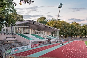
Sachs-Stadion
Distance: Approx. 1358 meters
Latitude and longitude: 50.05127778,10.20302778
Sachs-Stadion (formerly known as Willy-Sachs-Stadion) is a multi-functional football stadium in Schweinfurt, Germany. Since 1936, it has been home stadium to the German football club 1. FC Schweinfurt 05.

Stadion am Hutrasen
Distance: Approx. 1497 meters
Latitude and longitude: 50.03863889,10.23436111
Stadion am Hutrasen was a football stadium and is now a sports ground in Schweinfurt, Germany. It was the venue of 1. FC Schweinfurt 05 and VfR 07 Schweinfurt, and is today used by Türkiyemspor SV-12 Schweinfurt for its home games.
Weather in this IP's area
clear sky
-1 Celsius
-1 Celsius
-1 Celsius
-1 Celsius
1018 hPa
78 %
1018 hPa
984 hPa
10000 meters
1.11 m/s
1.07 m/s
95 degree
