194.147.225.213 - IP Lookup: Free IP Address Lookup, Postal Code Lookup, IP Location Lookup, IP ASN, Public IP
Country:
Region:
City:
Location:
Time Zone:
Postal Code:
ISP:
ASN:
language:
User-Agent:
Proxy IP:
Blacklist:
IP information under different IP Channel
ip-api
Country
Region
City
ASN
Time Zone
ISP
Blacklist
Proxy
Latitude
Longitude
Postal
Route
db-ip
Country
Region
City
ASN
Time Zone
ISP
Blacklist
Proxy
Latitude
Longitude
Postal
Route
IPinfo
Country
Region
City
ASN
Time Zone
ISP
Blacklist
Proxy
Latitude
Longitude
Postal
Route
IP2Location
194.147.225.213Country
Region
tirol
City
mayrhofen
Time Zone
Europe/Vienna
ISP
Language
User-Agent
Latitude
Longitude
Postal
ipdata
Country
Region
City
ASN
Time Zone
ISP
Blacklist
Proxy
Latitude
Longitude
Postal
Route
Popular places and events near this IP address

Mayrhofen
Municipality in Tyrol, Austria
Distance: Approx. 4 meters
Latitude and longitude: 47.16666667,11.86666667
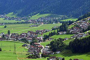
Mayrhofen is a town in the Zillertal (Ziller river valley) in the Austrian state of Tyrol. It is located approximately an hour from the Tyrolean capital city of Innsbruck.
Penken
Distance: Approx. 5079 meters
Latitude and longitude: 47.16894444,11.79966667
The Penken is a mountain area in the Ziller Valley located in the Austrian Tyrol. The Penken can be reached by modern cable car from the village of Mayrhofen.

Brandberg, Tyrol
Municipality in Tyrol, Austria
Distance: Approx. 2520 meters
Latitude and longitude: 47.16666667,11.9
Brandberg is a municipality in the Schwaz district of in the Austrian state of Tyrol.

Schwendau
Municipality in Tyrol, Austria
Distance: Approx. 3466 meters
Latitude and longitude: 47.1975,11.86
Schwendau (Pronunciation:shven-dau) is a municipality and a village in the Schwaz district in the Austrian state of Tyrol. It was first mentioned in 1200 as “Swentowe” (clearing of a pasture). The original meaning of this name is also illustrated on the emblem of the village in the form of an axe.

Ramsau im Zillertal
Municipality in Tyrol, Austria
Distance: Approx. 3707 meters
Latitude and longitude: 47.2,11.86666667
Ramsau im Zillertal is a municipality in the Schwaz district in the Austrian state of Tyrol.
Hippach
Municipality in Tyrol, Austria
Distance: Approx. 3707 meters
Latitude and longitude: 47.2,11.86666667
Hippach is a municipality in the Schwaz district in the Austrian state of Tyrol.

Hainzenberg
Municipality in Tyrol, Austria
Distance: Approx. 6106 meters
Latitude and longitude: 47.21666667,11.9
Hainzenberg is a municipality in the Schwaz district in the Austrian state of Tyrol.

Gerlosberg
Municipality in Tyrol, Austria
Distance: Approx. 6725 meters
Latitude and longitude: 47.21666667,11.91666667
Gerlosberg is a municipality in the Schwaz district in the Austrian state of Tyrol.
Finkenberg
Municipality in Tyrol, Austria
Distance: Approx. 3744 meters
Latitude and longitude: 47.15277778,11.82166667
Finkenberg is a municipality in the Schwaz district in the Austrian state of Tyrol.
Dristner
Mountain in Tyrol, Austria
Distance: Approx. 6395 meters
Latitude and longitude: 47.112362,11.839311
Dristner is a mountain in the Zillertal valley of Austria. The summit can be reached by starting in the village of Ginzling.

Harakiri (ski piste)
Ski piste in Tyrol, Austria
Distance: Approx. 4691 meters
Latitude and longitude: 47.1725,11.8053
The Harakiri is a slope in the ski resort of Mayrhofen Ski Zillertal 3000. It is named after the Japanese vulgar term for seppuku, ritual suicide by samurai. With incline of up to 78% (38 degrees), vertical drop of 375 metres and a length of about 1500 metres, it is the steepest groomed slope in Austria.

Garnet Chapel
Catholic chapel in Austria
Distance: Approx. 4728 meters
Latitude and longitude: 47.171052,11.804551
The Garnet Chapel, also known as the Capella Granata (German: Granatkapelle), is a Catholic chapel situated at the Penken saddle (German: the Penkenjoch) near the Penken. It is northeast of an artificial lake and forms part of the community of Finkenberg in the Zillertal valley. The valley in the district of Schwaz is in the state (Bundesland) of Tyrol.
Weather in this IP's area
overcast clouds
7 Celsius
4 Celsius
7 Celsius
7 Celsius
1004 hPa
92 %
1004 hPa
789 hPa
10000 meters
5.27 m/s
6.14 m/s
166 degree
85 %

