194.145.150.99 - IP Lookup: Free IP Address Lookup, Postal Code Lookup, IP Location Lookup, IP ASN, Public IP
Country:
Region:
City:
Location:
Time Zone:
Postal Code:
IP information under different IP Channel
ip-api
Country
Region
City
ASN
Time Zone
ISP
Blacklist
Proxy
Latitude
Longitude
Postal
Route
Luminati
Country
ASN
Time Zone
Europe/Berlin
ISP
GeFoekoM e.V.
Latitude
Longitude
Postal
IPinfo
Country
Region
City
ASN
Time Zone
ISP
Blacklist
Proxy
Latitude
Longitude
Postal
Route
IP2Location
194.145.150.99Country
Region
bayern
City
kitzingen
Time Zone
Europe/Berlin
ISP
Language
User-Agent
Latitude
Longitude
Postal
db-ip
Country
Region
City
ASN
Time Zone
ISP
Blacklist
Proxy
Latitude
Longitude
Postal
Route
ipdata
Country
Region
City
ASN
Time Zone
ISP
Blacklist
Proxy
Latitude
Longitude
Postal
Route
Popular places and events near this IP address
Kitzingen (district)
District in Bavaria, Germany
Distance: Approx. 1801 meters
Latitude and longitude: 49.75,10.17
Kitzingen is a Landkreis (district) in Bavaria, Germany. It is bounded by (from the north and clockwise) the districts of Schweinfurt, Bamberg, Neustadt (Aisch)-Bad Windsheim and Würzburg.

Kitzingen
Town in Bavaria, Germany
Distance: Approx. 1350 meters
Latitude and longitude: 49.73333333,10.16666667
Kitzingen (German: [ˈkɪt͡sɪŋən] ) is a town in the German state of Bavaria, capital of the district Kitzingen. It is part of the Franconia geographical region and has around 21,000 inhabitants. Surrounded by vineyards, Kitzingen County is the largest wine producer in Bavaria.
Repperndorf
Distance: Approx. 2360 meters
Latitude and longitude: 49.75083333,10.12277778
Repperndorf is a village in the district of Kitzingen, Regierungsbezirk Lower Franconia, Bavaria, Germany. Formerly an independent municipality, it became part of the town of Kitzingen in January 1978.
Hohenfeld
Distance: Approx. 2810 meters
Latitude and longitude: 49.71666667,10.16666667
Hohenfeld is a village in the rural district of Kitzingen, in the Regierungsbezirk of Lower Franconia, Bavaria, Germany. It is part of the town of Kitzingen.

Buchbrunn
Municipality in Bavaria, Germany
Distance: Approx. 3251 meters
Latitude and longitude: 49.76666667,10.13333333
Buchbrunn is a municipality in the district of Kitzingen, Lower Franconia, Bavaria, Germany. It is placed in the Bayrische Planungsregion 2.

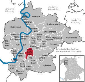
Mainbernheim
Town in Bavaria, Germany
Distance: Approx. 6486 meters
Latitude and longitude: 49.7,10.21666667
Mainbernheim (German pronunciation: [maɪnˈbɛʁnhaɪm]) is a municipality in Bavaria, Germany,4 kilometers to the south of Kitzingen (Landkreis, district of Kitzingen) in the direction of Nürnberg. It was first recorded in the chronicles of 889, during the reign of King Arnulf, the church being recognized by the influential bishopric of nearby Würzburg. The town was the site of a tariff house of the dukes of Ansbach and in thrall until 1397 to the duchy in the south, during the reign of King Wenceslaus.

Marktsteft
Town in Bavaria, Germany
Distance: Approx. 5053 meters
Latitude and longitude: 49.7,10.11666667
Marktsteft (German: [maʁktˈʃtɛft] ) is a town in the district of Kitzingen, in Bavaria, Germany. It is situated on the left bank of the Main, 5 km (3 mi) southwest of Kitzingen. It was the birthplace (1885) of the well-known Second World War general Albert Kesselring.

Albertshofen
Municipality in Bavaria, Germany
Distance: Approx. 3214 meters
Latitude and longitude: 49.76666667,10.16666667
Albertshofen is a municipality in the district of Kitzingen in Bavaria in Germany.

Biebelried
Municipality in Bavaria, Germany
Distance: Approx. 5700 meters
Latitude and longitude: 49.76666667,10.08333333
Biebelried is a municipality in the district of Kitzingen in Bavaria in Germany.

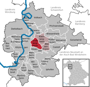
Großlangheim
Municipality in Bavaria, Germany
Distance: Approx. 6054 meters
Latitude and longitude: 49.75,10.23333333
Großlangheim is a municipality in the district of Kitzingen in Bavaria in Germany.

Mainstockheim
Municipality in Bavaria, Germany
Distance: Approx. 3214 meters
Latitude and longitude: 49.76666667,10.16666667
Mainstockheim is a municipality in the district of Kitzingen in Bavaria in Germany. It is famous for its choir, the Choir of Mainstockheim.

Sulzfeld am Main
Municipality in Bavaria, Germany
Distance: Approx. 5053 meters
Latitude and longitude: 49.7,10.11666667
Sulzfeld am Main is a municipality in the district of Kitzingen in Bavaria in Germany.
Weather in this IP's area
broken clouds
1 Celsius
-1 Celsius
1 Celsius
1 Celsius
1038 hPa
69 %
1038 hPa
1003 hPa
10000 meters
1.35 m/s
1.25 m/s
110 degree
78 %
