Country:
Region:
City:
Latitude and Longitude:
Time Zone:
Postal Code:
IP information under different IP Channel
ip-api
Country
Region
City
ASN
Time Zone
ISP
Blacklist
Proxy
Latitude
Longitude
Postal
Route
Luminati
Country
ASN
Time Zone
Europe/Stockholm
ISP
Telenor Norge AS
Latitude
Longitude
Postal
IPinfo
Country
Region
City
ASN
Time Zone
ISP
Blacklist
Proxy
Latitude
Longitude
Postal
Route
db-ip
Country
Region
City
ASN
Time Zone
ISP
Blacklist
Proxy
Latitude
Longitude
Postal
Route
ipdata
Country
Region
City
ASN
Time Zone
ISP
Blacklist
Proxy
Latitude
Longitude
Postal
Route
Popular places and events near this IP address

Stenungsund Municipality
Municipality in Västra Götaland County, Sweden
Distance: Approx. 4503 meters
Latitude and longitude: 58.08333333,11.81666667
Stenungsund Municipality (Stenungsunds kommun) is a municipality in Västra Götaland County in western Sweden. Its seat is located in the town of Stenungsund. The municipality is situated by the sea inside the islands Orust and Tjörn and traversed by the European route E6 and Bohus Line, in which it has three stops (Stora Höga, Stenungsund and Svenshögen).
Stenungsund
Place in Bohuslän, Sweden
Distance: Approx. 4503 meters
Latitude and longitude: 58.08333333,11.81666667
Stenungsund (Swedish pronunciation: [stɛnɵŋˈsɵnːd]) is a locality and the seat of Stenungsund Municipality, Västra Götaland County, Sweden with 9,987 inhabitants in 2010.

Tjörn Bridge
Bridge
Distance: Approx. 2020 meters
Latitude and longitude: 58.059722,11.785
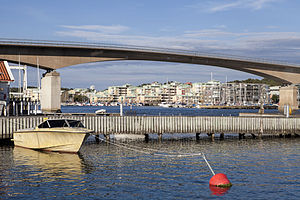
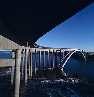
The Tjörn Bridge (Swedish: Tjörnbron) is a cable-stayed bridge which together with two smaller bridges connects Stenungsund on mainland Sweden with the island Tjörn on the western coast of the country. The length is 664 m (2,178 ft), the span width is 366 m (1,201 ft), and the height above the water is 45.7 m (150 ft). Inaugurated in 1981, the bridge was built in record time after its predecessor, the Almö Bridge, which was inaugurated in June 1960, collapsed after the bulk carrier MS Star Clipper collided with its span at 1:30 a.m.

Almö Bridge
Bridge
Distance: Approx. 2020 meters
Latitude and longitude: 58.059722,11.785
The Almö Bridge (Swedish: Almöbron) stood from 1960, when it was built to connect the island of Tjörn to the Swedish mainland, until 1980, when it collapsed after a ship hit it. Built after a suggestion from Krupp, the arch bridge type was cheap to build but it also had narrow roadways that slowed traffic. Below it was the busy shipping lane leading to the town of Uddevalla, which sported a large shipyard and bulk harbor at the time.
Varekilsnäs
Distance: Approx. 5145 meters
Latitude and longitude: 58.1,11.7
Varekilsnäs is a community located on the island of Orust in Bohuslän, on the Swedish west coast. It is the first village you meet when you enter Orust on road 160 from Tjörn. Varekilsnäs has records from 14th century, but is today more known for its scenic location and beautiful views over the archipelago.
Nösnäsvallen
Sports venue in Stenungsund, Sweden
Distance: Approx. 4365 meters
Latitude and longitude: 58.05492,11.82382
Nösnäsvallen is a soccer and track and field athletics stadium in Stenungsund, Sweden. It is the home ground of Stenungsunds IF. The Swedish national team practiced at Nösnäsvallen before both the 1990 FIFA World Cup and the Euro 2008. Team Brazil also practiced there before the 1990 FIFA World Cup.

Stenungsön
Place in Bohuslän, Sweden
Distance: Approx. 2917 meters
Latitude and longitude: 58.06666667,11.8
Stenungsön is an island and a locality situated in Stenungsund Municipality, Västra Götaland County, Sweden with 264 inhabitants in 2010. Stenungsön is separate from the main town Stenungsund by a narrow strait. The distance to central Gothenburg is about 47 kilometers.
Höviksnäs
Place in Bohuslän, Sweden
Distance: Approx. 3374 meters
Latitude and longitude: 58.03333333,11.76666667
Höviksnäs is a locality situated in Tjörn Municipality, Västra Götaland County, Sweden with 1,309 inhabitants in 2010.
Hallerna
Place in Bohuslän, Sweden
Distance: Approx. 5039 meters
Latitude and longitude: 58.05,11.83333333
Hallerna is a locality situated in Stenungsund Municipality, Västra Götaland County, Sweden with 668 inhabitants in 2010.
Strandnorum
Place in Bohuslän, Sweden
Distance: Approx. 5039 meters
Latitude and longitude: 58.05,11.83333333
Strandnorum is a locality situated in Stenungsund Municipality, Västra Götaland County, Sweden with 1,251 inhabitants in 2010.
Myggenäs
Place in Bohuslän, Sweden
Distance: Approx. 1741 meters
Latitude and longitude: 58.05,11.73333333
Myggenäs is a locality situated in Tjörn Municipality, Västra Götaland County, Sweden with 1,230 inhabitants in 2010.

Sundsby
Distance: Approx. 3764 meters
Latitude and longitude: 58.07027778,11.68888889
Sundsby is a protected area located on the island of Mjörn at Tjörn Municipality in Bohuslän, Sweden. This is the site of Sundsby Manor (Sundsby säteri).
Weather in this IP's area
light rain
3 Celsius
1 Celsius
3 Celsius
5 Celsius
991 hPa
67 %
991 hPa
989 hPa
10000 meters
2.7 m/s
3.17 m/s
263 degree
94 %
08:05:03
15:51:16

