Country:
 Great Britain
Region:
City:
Latitude and Longitude:
Time Zone:
Postal Code:
IP information under different IP Channel
ip-api
Country
Region
City
ASN
Time Zone
ISP
Blacklist
Proxy
Latitude
Longitude
Postal
Route
IPinfo
Country
Region
City
ASN
Time Zone
ISP
Blacklist
Proxy
Latitude
Longitude
Postal
Route
MaxMind
Country
Region
City
ASN
Time Zone
ISP
Blacklist
Proxy
Latitude
Longitude
Postal
Route
Luminati
Country
 VU
VUASN
Time Zone
Pacific/Efate
ISP
Misaka Network, Inc.
Latitude
Longitude
Postal
db-ip
Country
Region
City
ASN
Time Zone
ISP
Blacklist
Proxy
Latitude
Longitude
Postal
Route
ipdata
Country
Region
City
ASN
Time Zone
ISP
Blacklist
Proxy
Latitude
Longitude
Postal
Route
Popular places and events near this IP address

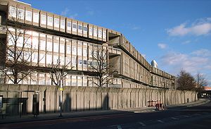
Balfron Tower
Residential building in the London Borough of Tower Hamlets
Distance: Approx. 138 meters
Latitude and longitude: 51.51363889,-0.00880556
Balfron Tower is a 26-storey residential building in Poplar, located in the London Borough of Tower Hamlets, London. Built in a Brutalist style, it forms part of the Brownfield Estate, an area of social housing between Chrisp Street Market and the A12 northern approach to the Blackwall Tunnel. It was designed by Ernő Goldfinger in 1963 for the London County Council, built 1965–67 by the GLC, and has been a listed building since 1996 (Grade II*, originally Grade II).

All Saints DLR station
Docklands Light Railway station
Distance: Approx. 341 meters
Latitude and longitude: 51.5108,-0.013
All Saints is a Docklands Light Railway (DLR) station in Poplar in East London. The station is named after nearby All Saints, a Church of England parish church dating from 1821 to 1823. The station entrance is on the East India Dock Road, the high street of Poplar and is opposite Chrisp Street Market while adjacent to the Poplar Baths, it also has two rail sidings directly west of the station forming part of Poplar DLR depot.
Robin Hood Gardens
Residential estate in Poplar, London
Distance: Approx. 331 meters
Latitude and longitude: 51.50944,-0.00843
Robin Hood Gardens is a residential estate in Poplar, London, designed in the late 1960s by architects Alison and Peter Smithson and completed in 1972. It was built as a council housing estate with homes spread across 'streets in the sky': social housing characterised by broad aerial walkways in long concrete blocks, much like the Park Hill estate in Sheffield; it was informed by, and a reaction against, Le Corbusier's Unité d'Habitation. The estate was built by the Greater London Council, but subsequently the London Borough of Tower Hamlets became the landlord.

Glenkerry House
Housing block in Poplar, London
Distance: Approx. 235 meters
Latitude and longitude: 51.51411111,-0.01077778
Glenkerry House is a housing block on the Brownfield Estate in Poplar, London, England, designed by the studio of the controversial Brutalist architect Ernő Goldfinger and finished in 1977. 14 storeys high, it stands in proximity to and complements the appearance of Balfron Tower and Carradale House, which were designed by Goldfinger himself and are now Grade II listed. There are four four-bedroom maisonettes on the ground floor, 18 one-bedroom, 45 two-bedroom and 12 three-bedroom flats; 79 flats in all.
Poplar (East India Road) railway station
Former railway station in England
Distance: Approx. 336 meters
Latitude and longitude: 51.511,-0.0131
Poplar (East India Road) was a railway station located on the East India Dock Road in Poplar, London. It was opened in 1866 by the North London Railway. It was the southern passenger terminus of the NLR, although goods trains ran on to connect to the London and Blackwall Railway (LBR) for the East India Docks or to the LBR's Millwall Extension Railway for the West India Docks.
Elevator Gallery
Art gallery in London, England
Distance: Approx. 138 meters
Latitude and longitude: 51.51363889,-0.00880556
Elevator Gallery is a contemporary art venue in Balfron Tower. The gallery first opened in 2007 in Hackney Wick, London, and has since been on location at various venues around London. Besides regular exhibitions of contemporary art, the gallery has a varied programme of live art, cinema and musical events.
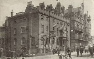
Poplar Hospital
Former hospital in London, England
Distance: Approx. 140 meters
Latitude and longitude: 51.51176667,-0.00705
Poplar Hospital was a medical facility opened in East India Dock Road in London, England, in 1855. It was opened under the patronage of Samuel Gurney, MP, to treat people who had suffered injuries in the docks. The premises which were leased for the hospital were originally those of the East India Dock Tavern and then subsequently the Custom House.

East India Dock House
Listed building in Tower Hamlets, London
Distance: Approx. 253 meters
Latitude and longitude: 51.5111,-0.0058
East India Dock House is a Grade II* listed building in Poplar and is in the London Borough of Tower Hamlets. It was originally built in 1988 as a printworks for the Financial Times.

Aberfeldy Village
Area of Poplar, London
Distance: Approx. 205 meters
Latitude and longitude: 51.513,-0.006
Aberfeldy Village is an urban village in Poplar, London, England, which is in the process of being redeveloped in a joint venture between Poplar HARCA and Willmott Dixon. It was known as the Aberfeldy Estate, a housing estate but has expanded. It is sometimes referred to as Aberfeldy New Village in planning documents.

East India Dock Road
Major arterial route in London
Distance: Approx. 289 meters
Latitude and longitude: 51.51123,-0.01252
East India Dock Road is a major arterial route from Limehouse to Canning Town in London. The road takes its name from the former East India Docks in the Port of London. To the west it becomes Commercial Road and to the east Newham Way.

Mulberry Place
Municipal building in London, England
Distance: Approx. 322 meters
Latitude and longitude: 51.51,-0.0062
Mulberry Place, formerly Tower Hamlets Town Hall, is a building in Nutmeg Lane, Blackwall, London. It was the headquarters of Tower Hamlets London Borough Council from 1992 to 2023, before their relocation to the new Tower Hamlets Town Hall in Whitechapel Road.

Chrisp Street Market Clock Tower
Clock tower in London
Distance: Approx. 362 meters
Latitude and longitude: 51.51245,-0.01402
Chrisp Street Market Clock Tower is a Grade II listed landmark located in Market Square, Chrisp Street, Poplar. It was designed by the architect Frederick Gibberd as part of the Lansbury Estate for the Festival of Britain, 1951. The clock tower is an example of early post-war architecture, and an aesthetic that became known as the "Festival Style".
Weather in this IP's area
broken clouds
16 Celsius
15 Celsius
15 Celsius
17 Celsius
1021 hPa
63 %
1021 hPa
1020 hPa
10000 meters
1.54 m/s
75 %
07:05:57
18:31:08