Country:
Region:
City:
Latitude and Longitude:
Time Zone:
Postal Code:
IP information under different IP Channel
ip-api
Country
Region
City
ASN
Time Zone
ISP
Blacklist
Proxy
Latitude
Longitude
Postal
Route
Luminati
Country
ASN
Time Zone
Europe/Berlin
ISP
Claranet Limited
Latitude
Longitude
Postal
IPinfo
Country
Region
City
ASN
Time Zone
ISP
Blacklist
Proxy
Latitude
Longitude
Postal
Route
db-ip
Country
Region
City
ASN
Time Zone
ISP
Blacklist
Proxy
Latitude
Longitude
Postal
Route
ipdata
Country
Region
City
ASN
Time Zone
ISP
Blacklist
Proxy
Latitude
Longitude
Postal
Route
Popular places and events near this IP address
Groß-Gerau (district)
District in Hesse, Germany
Distance: Approx. 2807 meters
Latitude and longitude: 49.912646,8.478189
Groß-Gerau is a Kreis (district) in the south of Hesse (Hessen in German), Germany. Neighboring districts are Main-Taunus, district-free Frankfurt, Darmstadt-Dieburg, Bergstraße, Alzey-Worms, Mainz-Bingen, and the district-free cities Mainz and Wiesbaden.

Groß-Gerau
Town in Hesse, Germany
Distance: Approx. 2992 meters
Latitude and longitude: 49.91916667,8.485
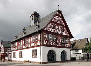
Groß-Gerau (German: [ɡʁoːsˈɡeːʁaʊ]) is the district seat of the Groß-Gerau district, lying in the southern Frankfurt Rhein-Main Region in Hesse, Germany, and serving as a hub for the surrounding area. In 1994, the town hosted the 34th Hessentag state festival.

Griesheim, Hesse
Town in Hesse, Germany
Distance: Approx. 5403 meters
Latitude and longitude: 49.86388889,8.56388889
Griesheim (German pronunciation: [ˈɡʁiːsˌhaɪ̯m] ) is the largest town in the Darmstadt-Dieburg district of Darmstadt in the southern state of Hesse. It has just over 28,000 inhabitants as of December 2023. Griesheim is known for being the location of the first German airfield, which was founded in 1908.
Weiterstadt
Town in Hesse, Germany
Distance: Approx. 6513 meters
Latitude and longitude: 49.9,8.6
Weiterstadt (German pronunciation: [ˈvaɪtɐʃtat] ) is a town in the Darmstadt-Dieburg district, in Hesse, Germany. It is situated directly northwest of Darmstadt.

Riedstadt
Town in Hesse, Germany
Distance: Approx. 6697 meters
Latitude and longitude: 49.83722222,8.50444444
Riedstadt, with its municipal area of 73.76 km2 is Groß-Gerau district's biggest town by land area. It lies in Hesse, Germany, about 12 km southwest of Darmstadt.

Büttelborn
Municipality in Hesse, Germany
Distance: Approx. 610 meters
Latitude and longitude: 49.9,8.51666667
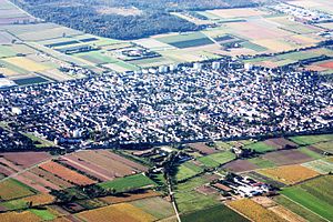
Büttelborn is a municipality in Groß-Gerau district in Hesse, Germany.

Nauheim
Municipality in Hesse, Germany
Distance: Approx. 6791 meters
Latitude and longitude: 49.95055556,8.46305556
Nauheim is a municipality in Groß-Gerau district in Hesse, Germany. It is located southwest of Frankfurt am Main and is part of the metropolitan region of Frankfurt. It lies in the Hessian Ried.
Braunshardt Airfield
Former German military airfield
Distance: Approx. 2720 meters
Latitude and longitude: 49.91,8.541667
Braunshardt Airfield is a former military airfield in Germany, about 2.7 miles (4.3 kilometers) east-southeast of the center of Groß-Gerau (Hesse) into Worfelden district, and approximately 275 miles (440 kilometers) southwest of Berlin.

Mühlbach (Schwarzbach)
River in Germany
Distance: Approx. 6111 meters
Latitude and longitude: 49.93027778,8.44111111
Mühlbach (in its upper course: Ruthsenbach) is a river of Hesse, Germany. It is a tributary of the Schwarzbach near Groß Gerau.

Groß Gerau station
Railway station in Groß-Gerau, Germany
Distance: Approx. 3490 meters
Latitude and longitude: 49.924925,8.486252
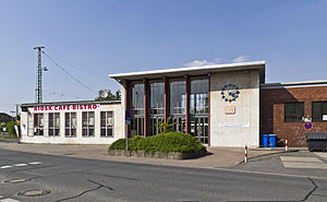
Groß Gerau station is located approximately 500 metres north of the centre of the town of Groß-Gerau in the German state of Hesse on the Rhine-Main Railway, running from Wiesbaden and Mainz to Darmstadt and Aschaffenburg. A curve branches off near the station connecting to the nearby Groß-Gerau-Dornberg station on the Mannheim–Frankfurt railway. The station is classified by Deutsche Bahn as a category 5 station.

Weiterstadt prison bombing
Distance: Approx. 3901 meters
Latitude and longitude: 49.89397,8.56342
The Weiterstadt prison bombing occurred on 27 March 1993, when the Red Army Faction (RAF) Command Katharina Hammerschmidt bombed and destroyed a newly built prison in Weiterstadt, near Frankfurt am Main in Germany. It was the RAF's "last anticapitalist attack" before it dissolved. Nobody was harmed in the explosion of the empty prison.
Worfelden
Ortsteil of Büttelborn in Hesse, Germany
Distance: Approx. 4508 meters
Latitude and longitude: 49.92888889,8.54861111
Worfelden is a village in the municipality of Büttelborn, which is located in the triangle formed by the cities of Frankfurt, Mainz and Darmstadt, within the Rhine-Main region.
Weather in this IP's area
light rain
7 Celsius
4 Celsius
6 Celsius
8 Celsius
1012 hPa
97 %
1012 hPa
1002 hPa
10000 meters
3.09 m/s
200 degree
40 %
07:43:46
16:38:56

