Country:
 Switzerland
Region:
City:
Latitude and Longitude:
Time Zone:
Postal Code:
IP information under different IP Channel
ip-api
Country
Region
City
ASN
Time Zone
ISP
Blacklist
Proxy
Latitude
Longitude
Postal
Route
IPinfo
Country
Region
City
ASN
Time Zone
ISP
Blacklist
Proxy
Latitude
Longitude
Postal
Route
MaxMind
Country
Region
City
ASN
Time Zone
ISP
Blacklist
Proxy
Latitude
Longitude
Postal
Route
Luminati
Country
CHASN
Time Zone
Europe/Zurich
ISP
Netcetera AG
Latitude
Longitude
Postal
db-ip
Country
Region
City
ASN
Time Zone
ISP
Blacklist
Proxy
Latitude
Longitude
Postal
Route
ipdata
Country
Region
City
ASN
Time Zone
ISP
Blacklist
Proxy
Latitude
Longitude
Postal
Route
Popular places and events near this IP address

Neue Zürcher Zeitung
Swiss German-language daily newspaper
Distance: Approx. 1148 meters
Latitude and longitude: 47.388,8.521
The Neue Zürcher Zeitung (NZZ; "New Journal of Zürich") is a Swiss, German-language daily newspaper, published by NZZ Mediengruppe in Zürich. The paper was founded in 1780. It has a reputation as a high-quality newspaper, as the Swiss-German newspaper of record, and for detailed reports on international affairs.

Langstrasse
Quarter of the city of Zurich, Switzerland
Distance: Approx. 963 meters
Latitude and longitude: 47.37626944,8.52667222
Langstrasse (literally "long street") is a street and quarter in district 4 in Zürich. Langstrasse begins near the district courts and extends north-northeast to the train tracks of Zürich Hauptbahnhof. The following short segment of Langstrasse leads towards Limmatplatz in district 5.
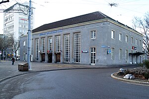
Zürich Wiedikon railway station
Urban railway station in western Zürich, Switzerland
Distance: Approx. 1049 meters
Latitude and longitude: 47.3715,8.52338889
Zürich Wiedikon railway station (German: Bahnhof Zürich Wiedikon) is a railway station on the Zürich S-Bahn system in Wiedikon in the western part of the Swiss city of Zürich. It is the only railway station in Switzerland where the ticket office building is located on a bridge above the tracks – in German, this is known as Reiterbahnhof. The station is served by S-Bahn trains on the Lake Zürich left bank line approaching the city from the south and south-east directions.
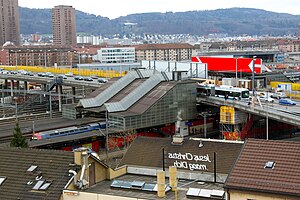
Zürich Hardbrücke railway station
Railway station in Zürich, Switzerland
Distance: Approx. 727 meters
Latitude and longitude: 47.385,8.51694444
Zürich Hardbrücke railway station (German: Bahnhof Zürich Hardbrücke) is a railway station in the central part of the Swiss city of Zürich. It is situated below Hardbrücke, a road bridge that lends its name to the station. Hardbrücke station is only 1.9 kilometres (1.2 mi) away from Zürich HB (main station) and situated near the business and entertainment district Zürich West, next to the Prime Tower.

Aussersihl
District in Zürich, Switzerland
Distance: Approx. 1035 meters
Latitude and longitude: 47.375,8.527
Aussersihl is a district in the Swiss city of Zürich. Known officially as District number 4, the district is known as colloquially Chreis Cheib, cheib being the Zürich German word for an animal cadaver. It earned the name as the area historically contained pits for the deposition of dead animals.

Hard (Zürich)
Distance: Approx. 157 meters
Latitude and longitude: 47.37960833,8.51601111
Hard is a quarter in the district 4 of Zürich. It was formerly a part of Aussersihl municipality, which was incorporated into Zürich in 1893. The quarter has a population of 12,715 distributed on an area of 1.46 km2 (as of 2009).

Sihlfeld
Distance: Approx. 723 meters
Latitude and longitude: 47.372575,8.51759167
Sihlfeld is a quarter in the district 3 of Zürich. It was formerly a part of Wiedikon municipality, which was incorporated into Zürich in 1893. The quarter has a population of 20,554 distributed on an area of 1.64 km2 (0.63 sq mi).
Helvetiaplatz (Zürich)
Distance: Approx. 985 meters
Latitude and longitude: 47.37613,8.52691
The Helvetiaplatz in Zürich is located in the District 4 (ger.: Kreis 4) at the corner Langstrasse and Stauffacherstrasse. The first project of pastor Ernst Sieber's Sozialwerke Pfarrer Sieber for homeless people started at Helvetiaplatz in winter 1963; the foundation is still based in Zürich-Aussersihl. The place is well known because of the demonstrations on 1 May and against the World Economic Forum.

Prime Tower
Skyscraper in Zurich, Switzerland
Distance: Approx. 839 meters
Latitude and longitude: 47.386,8.5172
The Prime Tower, also named "Maag-Tower" in an earlier stage of planning, is a skyscraper in Zürich, Switzerland. At a height of 126 metres (413 ft), it was the tallest building in Switzerland from 2011 until 2015, when the Roche Tower in Basel (standing at 178 m (584 ft)) was completed. The building is located near the Hardbrücke railway station in Zürich West of the Industriequartier.
Gefängnis Zürich
Distance: Approx. 1016 meters
Latitude and longitude: 47.374732,8.526542
The Gefängnis Zürich (Zürich Prison) is a prison in the city of Zürich, Switzerland, located at the Rotwandstrasse.
Volkshaus
Distance: Approx. 1027 meters
Latitude and longitude: 47.37555556,8.52722222
The Volkshaus is a 1,200-seat concert hall located in Zürich, Switzerland. The building construction began in June 1909 and publicly opened the following year.

Hardbrücke
Bridge in Canton of Zürich, Switzerland
Distance: Approx. 746 meters
Latitude and longitude: 47.38514,8.51717
The Hardbrücke (Swiss German: Hardbrugg) is a 1,350 metres (4,430 ft) long road bridge and important north–south connection in the Swiss city of Zürich. As of 2009, 70,000 vehicles use the bridge daily. From north to south, the bridge crosses Wipkingerplatz in the Wipkingen quarter, the River Limmat, a couple of roads of the Industriequartier (including Escher-Wyss-Platz), the railway tracks of the Zürich–Baden and Käferberg lines (including a railway station), numerous holding tracks of the track field preceding Zürich HB, the former goods station (mostly removed) and a road (Hohlstrasse) in Zürich's District 4.
Weather in this IP's area
few clouds
20 Celsius
20 Celsius
18 Celsius
21 Celsius
1015 hPa
59 %
1015 hPa
968 hPa
10000 meters
3.09 m/s
100 degree
20 %
07:09:02
19:30:22