Country:
 Greece
Region:
City:
Latitude and Longitude:
Time Zone:
Postal Code:
IP information under different IP Channel
ip-api
Country
Region
City
ASN
Time Zone
ISP
Blacklist
Proxy
Latitude
Longitude
Postal
Route
IPinfo
Country
Region
City
ASN
Time Zone
ISP
Blacklist
Proxy
Latitude
Longitude
Postal
Route
MaxMind
Country
Region
City
ASN
Time Zone
ISP
Blacklist
Proxy
Latitude
Longitude
Postal
Route
Luminati
Country
GRASN
Time Zone
Europe/Athens
ISP
OTEnet S\.A\.
Latitude
Longitude
Postal
db-ip
Country
Region
City
ASN
Time Zone
ISP
Blacklist
Proxy
Latitude
Longitude
Postal
Route
ipdata
Country
Region
City
ASN
Time Zone
ISP
Blacklist
Proxy
Latitude
Longitude
Postal
Route
Popular places and events near this IP address

Athens
Capital and largest city of Greece
Distance: Approx. 122 meters
Latitude and longitude: 37.98416667,23.72805556
Athens ( ATH-inz) is the capital and largest city of Greece. A major coastal urban area in the Mediterranean, Athens is also the capital of the Attica region and is the southernmost capital on the European mainland. With its urban area's population numbering over three and a quarter million, it is the eighth largest urban area in the European Union.
Athens–Piraeus Electric Railways
Distance: Approx. 185 meters
Latitude and longitude: 37.9831,23.72755
The Athens–Piraeus Electric Railways (Greek: Ηλεκτρικοί Σιδηρόδρομοι Αθηνών Πειραιώς, romanized: Ilektrikoi Sidirodromoi Athinon Peiraios, ΗΣΑΠ), commonly abbreviated as ISAP, was a company which operated the Piraeus - Kifissia line from 1 January 1976 to 17 June 2011. Piraeus - Kifissia line was the oldest urban rapid transit system of Athens metropolitan area. The line opened in 1869 as a suburban railway line connecting Athens with its port of Piraeus and it was gradually converted to full rapid transit operations, making it one of the oldest metro lines in the world.

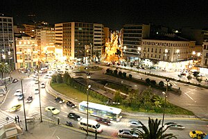
Omonoia Square
Square in Athens, Greece
Distance: Approx. 145 meters
Latitude and longitude: 37.98416667,23.72777778
Omonoia Square (Greek: Πλατεία Ομονοίας, Plateía Omonoías, pronounced [plaˈtia omoˈnias], "Concord Square", often simply referred to as Omónoia [oˈmonia]) is a central square in Athens. Forming the centre of Omonoia. It marks the northern corner of the downtown area defined by the city plans of the 19th century, and is one of the city's principal traffic hubs.

Omonia metro station
Athens Metro station
Distance: Approx. 126 meters
Latitude and longitude: 37.98403,23.72797
Omonia (Greek: Ομόνοια, Omonoia) is an underground station under the Omonoia square of Athens, used by Athens Metro Lines 1 and 2. The first station opened 1895, but was relocated underground and redesigned by the Hellenic Electric Railways (which operated Line 1 at the time) in 1930. In January 2000 the additional platforms for Line 2 were opened.
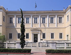
Council of State (Greece)
Supreme administrative court in Greece
Distance: Approx. 317 meters
Latitude and longitude: 37.98138889,23.73111111
The Council of State (Greek: Συμβούλιο της Επικρατείας) is the Supreme Administrative Court of Greece.

German Archaeological Institute at Athens
Distance: Approx. 272 meters
Latitude and longitude: 37.9825,23.73194444
The German Archaeological Institute at Athens (German: Deutsches Archäologisches Institut (DAI), Abteilung Athen; Greek: Γερμανικό Αρχαιολογικό Ινστιτούτο Αθηνών) is one of the 19 foreign archaeological institutes operating in Athens, Greece.
Omonoia, Athens
Neighborhood in Athens, Attica, Greece
Distance: Approx. 142 meters
Latitude and longitude: 37.98388889,23.72777778
Omonoia (Greek: Ομόνοια pronounced [oˈmo.ni.a]) is a neighborhood in downtown Athens, Greece, centered on the square of the same name and served by the Omonoia station of the Athens Metro. Historically the heart of the city, it has experienced serious urban decay in recent years, becoming plagued by drug dealing, prostitution and theft, especially in its western part. Despite that, it is still a focal point for commercial and social life in Athens.

Kotzia Square
Open square in Athens, Greece
Distance: Approx. 286 meters
Latitude and longitude: 37.98166667,23.72777778
Kotzia Square (Greek: Πλατεία Κοτζιά) is a square in central Athens, Greece. The square retains several characteristics of 19th-century local neoclassical architecture, such as the City Hall of the Municipality of Athens and the National Bank of Greece Cultural Center. It is named after Konstantinos Kotzias, former Mayor of Athens.
Athens Liosion Bus Station
Distance: Approx. 167 meters
Latitude and longitude: 37.9838,23.7275
Athens "Liosion" Bus Station also known as KTEL Liosion Bus Station is the second busiest bus station in Athens. It is located in Patisia in Athens Municipality. There are routes to Central Greece, Thessaly, Pieria.
STASY
Operator of metro and tram services in Athens
Distance: Approx. 185 meters
Latitude and longitude: 37.9831,23.72755
Urban Rail Transport S.A. (Greek: Σταθερές Συγκοινωνίες, romanized: Statheres Synkoinonies, ΣΤΑΣΥ), commonly abbreviated as STASY, is a Greek public transport operator of the Athens Metro and the Athens Tram. It is the metro and tram subsidiary of Transport for Athens (OASA S.A.), and is responsible for the operation and maintenance of the metro and tram network, including rolling stock, 59 tram stops, and 62 of the 66 metro stations. STASY was created in 2011, as a merger of the Athens–Piraeus Electric Railways (ISAP), the Attiko Metro Operation Company (AMEL), and Tram S.A., and its logo is an amalgamation of the oval-shaped format of ISAP's logo, and the blue and green colours from AMEL's logo.

Achaemenid destruction of Athens
Part of the Greco-Persian Wars
Distance: Approx. 140 meters
Latitude and longitude: 37.983972,23.727806
During the second Persian invasion of Greece, which took place between 480 and 479 BCE, Athens was captured and subsequently destroyed by the Achaemenid Empire. A prominent Greek city-state, it was attacked by the Persians in a two-phase offensive, amidst which the Persian king Xerxes the Great had issued an order calling for it to be torched. The Persian army commander Mardonius oversaw the razing of several structures of political and religious significance throughout the city, including the Acropolis, the Old Temple of Athena, and the Older Parthenon.

Athens metropolitan area
Main metropolitan area in Greece
Distance: Approx. 122 meters
Latitude and longitude: 37.98416667,23.72805556
The Athens metropolitan area (Greek: Μητροπολιτική Περιοχή της Αθήνας) spans 2,928.717 km2 (1,131 sq mi) within the Attica region and consists of 58 municipalities plus areas of East Attica and West Attica, having reached a population of 3,638,281 according to the 2021 census. Municipalities of Athens and Piraeus both serve as the two metropolitan centres of the Athens metropolitan area. According to the Hellenic Telecommunications and Post Commission, the Athens metropolitan area consists of all areas with a dialing code of 21 and includes areas such as Salamina, Elefsina, Kifissia, Mandra, Aspropyrgos, Pallini, Agios Stefanos, Dionysos, Koropi, Vari, Vouliagmeni, Voula, Dafni, Chalandri and the Athens International Airport.
Weather in this IP's area
few clouds
23 Celsius
23 Celsius
20 Celsius
24 Celsius
1011 hPa
59 %
1011 hPa
1001 hPa
10000 meters
1.34 m/s
3.13 m/s
28 degree
20 %
07:08:46
19:30:25