Country:
 Austria
Region:
City:
Latitude and Longitude:
Time Zone:
Postal Code:
IP information under different IP Channel
ip-api
Country
Region
City
ASN
Time Zone
ISP
Blacklist
Proxy
Latitude
Longitude
Postal
Route
Luminati
Country
ATASN
Time Zone
Europe/Vienna
ISP
eww ag
Latitude
Longitude
Postal
IPinfo
Country
Region
City
ASN
Time Zone
ISP
Blacklist
Proxy
Latitude
Longitude
Postal
Route
db-ip
Country
Region
City
ASN
Time Zone
ISP
Blacklist
Proxy
Latitude
Longitude
Postal
Route
ipdata
Country
Region
City
ASN
Time Zone
ISP
Blacklist
Proxy
Latitude
Longitude
Postal
Route
Popular places and events near this IP address

St. Leopold's Church, Donaufeld
Distance: Approx. 1034 meters
Latitude and longitude: 48.25305556,16.40833333
Saint Leopold's Church (German: Kirche zum Heiligen Leopold, "Donaufelder Kirche") is the Roman Catholic parish church of Donaufeld in Floridsdorf, the 21st district of Vienna, Austria. Located at Kinzerplatz, it stands at a height of 96 m (315 feet), which makes it the third tallest church in Vienna. Construction was completed in 1914, ten years after the death of its architect, Franz Neumann.
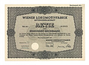
Lokomotivfabrik Floridsdorf
Distance: Approx. 776 meters
Latitude and longitude: 48.26722222,16.39833333
Lokomotivfabrik Floridsdorf (Floridsdorf locomotive factory) was an Austrian locomotive works founded on 6 September 1869 that achieved a pre-eminent place amongst European locomotive builders thanks to the quality and diversity of its designs. Common abbreviations for the company include Flor, WLF (Wiener Lokomotivfabrik Floridsdorf) and LOFAG (Lokomotivfabrik Floridsdorf AG). Lokomotivfabrik Floridsdorf was the third factory of its type to emerge in Austria following the Lokomotivfabrik der Staatseisenbahngesellschaft (StEG, Vienna) and that of Georg Sigl, the Wiener Neustädter Lokomotivfabrik, both based in Vienna.
Schwimmtor
Distance: Approx. 2246 meters
Latitude and longitude: 48.260291,16.369296
The Schwimmtor (Floating gate), also known as the Sperrschiff (Blocking ship), was a floating barrier designed to protect the areas along the Donaukanal in Vienna from flooding and ice.

Nussdorf weir and lock
Hydraulic engineering works in Nussdorf, Vienna, Austria
Distance: Approx. 2259 meters
Latitude and longitude: 48.25916667,16.36916667
The Nussdorf weir and lock are works of hydraulic engineering located in the Viennese suburb of Nussdorf at the point where the Donaukanal leaves the Danube. Designed by Austrian architect Otto Wagner, The weir and lock were built following the adoption of a new law in July 1892, which also authorised the construction of the Vienna Stadtbahn and the transformation of the Donaukanal into a winter harbour. The weir and lock in Nussdorf are commonly confused with one another, although they are actually two separate constructions built to serve the same purpose.

Vienna Islamic Centre
Mosque in Floridsdorf, Vienna, Austria
Distance: Approx. 1710 meters
Latitude and longitude: 48.245,16.3975
The Vienna Islamic Centre (German: Islamisches Zentrum Wien) is the largest mosque in Austria, located in Vienna's 21st district Floridsdorf.

Floridsdorf station
Vienna U-Bahn station
Distance: Approx. 468 meters
Latitude and longitude: 48.2561,16.3998
Floridsdorf is a station on U6 of the Vienna U-Bahn. It is located in the Floridsdorf District, underneath Wien Floridsdorf railway station, which is also served by Vienna S-Bahn lines S1, S2, S3 and S7. It opened in 1996.

Neue Donau station
Vienna U-Bahn station
Distance: Approx. 1575 meters
Latitude and longitude: 48.2465,16.3949
Neue Donau is a station on U6 of the Vienna U-Bahn. It is located in the Floridsdorf District. It opened in 1996.

Handelskai station
Vienna U-Bahn station
Distance: Approx. 2300 meters
Latitude and longitude: 48.2419,16.3855
Handelskai is a station on U6 of the Vienna U-Bahn. It combines with Wien Handelskai railway station, which is operated by the Austrian Federal Railways (ÖBB), to form a multistorey interchange station. The U6 platforms at Handelskai are at a high level, alongside the ÖBB platforms served by regional trains and by Vienna S-Bahn lines S1, S2, S3 and S7.

Wien Floridsdorf railway station
Railway station in Vienna, Austria
Distance: Approx. 436 meters
Latitude and longitude: 48.25638889,16.4
Wien Floridsdorf (German for Vienna Floridsdorf) is a railway station located in the Floridsdorf district of Vienna, Austria. Opened in 1961, it is owned and operated by the Austrian Federal Railways (ÖBB), and is served by both regional and S-Bahn trains. Underneath the station is the Floridsdorf U-Bahn station, which is the northeastern terminus of U6 of the Vienna U-Bahn.

Northern Railway Bridge
Bridge in Vienna
Distance: Approx. 2059 meters
Latitude and longitude: 48.2434,16.3883
The Northern Railway Bridge (German: Nordbahnbrücke) is a Truss bridge over the Danube in Vienna, Austria. It is one of two railway crossings within the city, the other being the Stadtlauer Eastern Railway Bridge. The bridge is a double track Parker truss bridge with 4 spans connecting the municipalities of Brigittenau and Floridsdorf.
Jedlesee
Distance: Approx. 1973 meters
Latitude and longitude: 48.27305556,16.38111111
Jedlesee (German pronunciation: [ˌjeːdləˈzeː] ; sometimes spelled Jedlersee) is a suburb of Floridsdorf, the 21st district of Vienna. An independent community until 1894, it was joined along with Leopoldau, Donaufeld, Floridsdorf and Neu Jedlesdorf to the greater Floridsdorf municipality, becoming part of Vienna in 1904. Jedlesee is most notable for being the site of the estate of Countess Anna Maria Erdődy, close friend and patron of Beethoven, who stayed there with her on numerous occasions between 1805 and 1818.

Wien Handelskai railway station
Railway station in Vienna, Austria
Distance: Approx. 2303 meters
Latitude and longitude: 48.24194444,16.38527778
Wien Handelskai is a railway and metro interchange station serving Brigittenau, the twentieth district of Vienna. The platform for the S45 are on the lower level while platforms for the S1, S2, S3, S4, and S7 are on the upper level, adjacent to the U-Bahn platforms.
Weather in this IP's area
overcast clouds
2 Celsius
1 Celsius
1 Celsius
3 Celsius
1030 hPa
86 %
1030 hPa
1009 hPa
10000 meters
1.34 m/s
2.68 m/s
16 degree
99 %
06:58:58
16:18:40