Country:
 Austria
Region:
City:
Latitude and Longitude:
Time Zone:
Postal Code:
IP information under different IP Channel
ip-api
Country
Region
City
ASN
Time Zone
ISP
Blacklist
Proxy
Latitude
Longitude
Postal
Route
IPinfo
Country
Region
City
ASN
Time Zone
ISP
Blacklist
Proxy
Latitude
Longitude
Postal
Route
MaxMind
Country
Region
City
ASN
Time Zone
ISP
Blacklist
Proxy
Latitude
Longitude
Postal
Route
Luminati
Country
ATASN
Time Zone
Europe/Vienna
ISP
eww ag
Latitude
Longitude
Postal
db-ip
Country
Region
City
ASN
Time Zone
ISP
Blacklist
Proxy
Latitude
Longitude
Postal
Route
ipdata
Country
Region
City
ASN
Time Zone
ISP
Blacklist
Proxy
Latitude
Longitude
Postal
Route
Popular places and events near this IP address
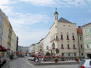
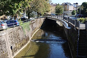
Ried im Innkreis
Place in Upper Austria, Austria
Distance: Approx. 499 meters
Latitude and longitude: 48.21,13.48944444
Ried im Innkreis (Central Bavarian: Riad) is a town in the Austrian state of Upper Austria, approximately 70 km (43 mi) west of Linz and 60 km (37 mi) north of Salzburg. It is the capital of the district of Ried im Innkreis, and it serves as the administrative centre for the Innviertel region.

Josko Arena
Distance: Approx. 708 meters
Latitude and longitude: 48.20777778,13.47833333
The Josko Arena, formerly Fill Metallbau Stadion, is a football stadium in Ried im Innkreis, Austria. It is the home ground of SV Ried. The stadium holds 7,680 spectators and was built in 2003.
Ried District
District in Upper Austria, Austria
Distance: Approx. 4813 meters
Latitude and longitude: 48.241,13.435
Bezirk Ried is a district of the state of Upper Austria in Austria.
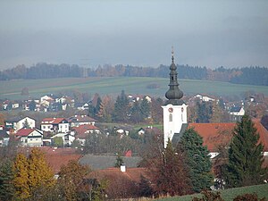
Hohenzell
Place in Upper Austria, Austria
Distance: Approx. 4928 meters
Latitude and longitude: 48.19416667,13.54444444
Hohenzell is a municipality in Upper Austria. It is situated in the district of Ried im Innkreis in the Innviertel and has 2,002 inhabitants. The responsible jurisdiction is Ried im Innkreis.
Neuhofen im Innkreis
Place in Upper Austria, Austria
Distance: Approx. 3529 meters
Latitude and longitude: 48.18333333,13.46666667
Neuhofen im Innkreis is a municipality in Upper Austria in the district of Ried im Innkreis.
Mehrnbach
Place in Upper Austria, Austria
Distance: Approx. 3573 meters
Latitude and longitude: 48.20888889,13.43638889
Mehrnbach is a municipality in Upper Austria. It is situated in the district of Ried im Innkreis in the Innviertel.
Aurolzmünster
Place in Upper Austria, Austria
Distance: Approx. 4451 meters
Latitude and longitude: 48.24833333,13.45666667
Aurolzmünster is a municipality in the district of Ried im Innkreis in the Austrian state of Upper Austria.
Peterskirchen
Place in Upper Austria, Austria
Distance: Approx. 5505 meters
Latitude and longitude: 48.23833333,13.54777778
Peterskirchen is a municipality in the district of Ried im Innkreis in the Austrian state of Upper Austria.

Tumeltsham
Place in Upper Austria, Austria
Distance: Approx. 2357 meters
Latitude and longitude: 48.23194444,13.49777778
Tumeltsham is a municipality in the district of Ried im Innkreis in the Austrian state of Upper Austria.
Oberach
River in Upper Austria, Austria
Distance: Approx. 2307 meters
Latitude and longitude: 48.2311,13.4696
Oberach is a river in the Innviertel of the Austrian state of Upper Austria. It is a tributary of the Antiesen. Its source is in the municipality of Pramet.

Learning and memorial site Charlotte Taitl House
Holocaust museum in Ried im Innkreis, Austria
Distance: Approx. 366 meters
Latitude and longitude: 48.21066,13.48794
The Learning and memorial site Charlotte Taitl House (German: Lern- und Gedenkort Charlotte-Taitl-Haus) in Ried im Innkreis, Austria is dedicated to the victims of National Socialism and fascism in the district of Ried im Innkreis. It is an extension of the historical exhibition of the Innviertler Volkskundehaus museum. The initiative for this project came from the ARGE Lern- und Gedenkort.
Battle of Mehrnbach
1805 battle during the War of the Third Coalition
Distance: Approx. 3573 meters
Latitude and longitude: 48.20888889,13.43638889
The Battle of Mehrnbach (also known as the Battle of Ried) on 30 October 1805 saw the French vanguard commanded by Marc Antoine de Beaumont engaging an Austro-Russian rearguard detachment during the War of the Third Coalition.
Weather in this IP's area
clear sky
12 Celsius
11 Celsius
11 Celsius
14 Celsius
1020 hPa
88 %
1020 hPa
969 hPa
10000 meters
4.62 m/s
11.88 m/s
107 degree
8 %
06:50:15
19:08:39