194.107.88.230 - IP Lookup: Free IP Address Lookup, Postal Code Lookup, IP Location Lookup, IP ASN, Public IP
Country:
Region:
City:
Location:
Time Zone:
Postal Code:
IP information under different IP Channel
ip-api
Country
Region
City
ASN
Time Zone
ISP
Blacklist
Proxy
Latitude
Longitude
Postal
Route
Luminati
Country
ASN
Time Zone
Europe/Vienna
ISP
Telekom Austria
Latitude
Longitude
Postal
IPinfo
Country
Region
City
ASN
Time Zone
ISP
Blacklist
Proxy
Latitude
Longitude
Postal
Route
IP2Location
194.107.88.230Country
Region
salzburg
City
hallein
Time Zone
Europe/Vienna
ISP
Language
User-Agent
Latitude
Longitude
Postal
db-ip
Country
Region
City
ASN
Time Zone
ISP
Blacklist
Proxy
Latitude
Longitude
Postal
Route
ipdata
Country
Region
City
ASN
Time Zone
ISP
Blacklist
Proxy
Latitude
Longitude
Postal
Route
Popular places and events near this IP address

Hallein
Municipality in Salzburg, Austria
Distance: Approx. 231 meters
Latitude and longitude: 47.68305556,13.09694444
Hallein (German pronunciation: [ˈhalaɪ̯n] ) is a historic town in the Austrian state of Salzburg. It is the capital of Hallein district.

Adnet
Municipality in Salzburg, Austria
Distance: Approx. 2713 meters
Latitude and longitude: 47.69666667,13.13027778
Adnet is a town in the district of Hallein, in the Austrian state of Salzburg. It is famous for its marble and there is a marble museum in the middle of the town.

Bad Vigaun
Municipality in Salzburg, Austria
Distance: Approx. 3110 meters
Latitude and longitude: 47.66666667,13.13333333
Bad Vigaun is a municipality and spa town in the district of Hallein, in the Austrian state of Salzburg.

Krispl
Municipality in Salzburg, Austria
Distance: Approx. 6224 meters
Latitude and longitude: 47.71666667,13.16666667
Krispl is a municipality in the Hallein district in the Austrian state of Salzburg.

Oberalm
Municipality in Salzburg, Austria
Distance: Approx. 1859 meters
Latitude and longitude: 47.7,13.1
Oberalm is a market town in the Hallein district in the Austrian state of Salzburg. It is the burial town of volksmusik singer Karl Moik, the longtime presenter of ORF Musikantenstadl.
Puch bei Hallein
Municipality in Salzburg, Austria
Distance: Approx. 3738 meters
Latitude and longitude: 47.71666667,13.09444444
Puch bei Hallein (Central Bavarian: Buach) is a municipality in the Hallein District (Tennengau) of the Austrian state of Salzburg.

Almbach (Salzach)
River in Salzburg, Austria
Distance: Approx. 492 meters
Latitude and longitude: 47.6856,13.0944
The Almbach is a river of the state Salzburg, Austria. The Almbach is approximately 17 km (11 mi) long. It drains the lake Hintersee.

Hallein Salt Mine
Distance: Approx. 1949 meters
Latitude and longitude: 47.667049,13.090339
The Hallein Salt Mine, also known as Salzbergwerk Dürrnberg, is an underground salt mine located in the Dürrnberg plateau above Hallein, Austria. The mine has been worked for over 2600 years since the time of the Celtic tribes and earlier. It helped ensure nearby Salzburg would become a powerful trading community.

Burgruine Gutrat
Distance: Approx. 4041 meters
Latitude and longitude: 47.70805556,13.06055556
Burgruine Gutrat is a ruined castle near Hallein in the state of Salzburg, Austria.

Barmsteine
Distance: Approx. 2136 meters
Latitude and longitude: 47.68667,13.07194
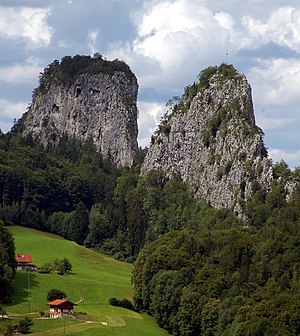
The Barmsteine are two rock towers, 841 and 851 metres above sea level, in the northernmost part of the Hasel Mountains in the Bavarian Alps. They rise above the Austrian town of Hallein, and lie on the border between Salzburger Land in Austria and Berchtesgadener Land in Germany.

Berchtesgadener Ache
River in Germany
Distance: Approx. 5523 meters
Latitude and longitude: 47.7314,13.0819
The Berchtesgadener Ache is a river of Bavaria, Germany and of Salzburg, Austria. It is formed at the confluence of the Ramsauer Ache and the Königsseer Ache in Berchtesgaden. It flows into the Salzach near Anif.

Dürrnberg
Village in Salzburg, Austria
Distance: Approx. 2055 meters
Latitude and longitude: 47.66611111,13.09
Dürrnberg, also named Bad Dürrnberg, is an Austrian village part of the municipality of Hallein, in Hallein District (Tennengau), Salzburg State. It is the location of the Hallein Salt Mine (Salzbergwerk Dürrnberg).
Weather in this IP's area
few clouds
-2 Celsius
-5 Celsius
-4 Celsius
-1 Celsius
1040 hPa
80 %
1040 hPa
984 hPa
10000 meters
2.57 m/s
160 degree
15 %
