Country:
Region:
City:
Latitude and Longitude:
Time Zone:
Postal Code:
IP information under different IP Channel
ip-api
Country
Region
City
ASN
Time Zone
ISP
Blacklist
Proxy
Latitude
Longitude
Postal
Route
Luminati
Country
Region
1
City
morbischamsee
ASN
Time Zone
Europe/Vienna
ISP
kabelplus GmbH
Latitude
Longitude
Postal
IPinfo
Country
Region
City
ASN
Time Zone
ISP
Blacklist
Proxy
Latitude
Longitude
Postal
Route
db-ip
Country
Region
City
ASN
Time Zone
ISP
Blacklist
Proxy
Latitude
Longitude
Postal
Route
ipdata
Country
Region
City
ASN
Time Zone
ISP
Blacklist
Proxy
Latitude
Longitude
Postal
Route
Popular places and events near this IP address

Rust, Burgenland
Statutory city in Burgenland, Austria
Distance: Approx. 5569 meters
Latitude and longitude: 47.8,16.66666667
Rust (German pronunciation: [ʁʊst] ; Croatian: Rušta; Hungarian: Ruszt) is a city in the Austrian state of Burgenland, located on the western shore of Lake Neusiedl near the border with Hungary. With only about 1,900 inhabitants, it is the country's smallest statutory city, as it was endowed with the rights of a royal free city by the Hungarian crown in 1681. As a Statutarstadt, it also forms an administrative district (Bezirk) in its own right.

Fertőrákos
Place in Győr-Moson-Sopron, Hungary
Distance: Approx. 3449 meters
Latitude and longitude: 47.72017,16.65197
Fertőrákos (German: Kroisbach) is a village in the county of Győr-Moson-Sopron in Hungary. In 2001 it had a population of 2,182. It is located at 47°43′15″N 16°39′0″E, about 10 km (6 mi) from Sopron, near Lake Fertő (German: Neusiedler See) and the Austrian border.

Sankt Margarethen im Burgenland
Place in Burgenland, Austria
Distance: Approx. 7362 meters
Latitude and longitude: 47.8,16.6
Sankt Margarethen im Burgenland (Hungarian: Szentmargitbánya) is a town in Burgenland near the state capital of Eisenstadt, in Austria. It is home to a large 1st-century Roman quarry. A passion play has been presented in St Margarethen each summer for over seventy years.

Káposztás utcai Stadion
Distance: Approx. 8868 meters
Latitude and longitude: 47.69171,16.583691
The Káposztás utcai Stadion is a multi-use stadium in Sopron, Hungary. It is currently used mostly for football matches and is the home stadium of MFC Sopron. The stadium is able to hold 5,300 people and was reconstructed in 2003.

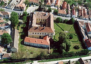
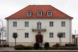
Mörbisch am See
Place in Burgenland, Austria
Distance: Approx. 170 meters
Latitude and longitude: 47.75,16.66666667
Mörbisch am See (Croatian: Merbiš, Hungarian: Fertőmeggyes) is a town on the shore of Lake Neusiedl in the district of Eisenstadt-Umgebung in the Austrian state of Burgenland.
Pan-European Picnic
1989 peace demonstration held on the Austrian-Hungarian border near Sopron, Hungary
Distance: Approx. 3257 meters
Latitude and longitude: 47.75722222,16.62222222
The Pan-European Picnic (German: Paneuropäisches Picknick; Hungarian: Páneurópai piknik; Slovak: Paneurópsky piknik; Czech: Panevropský piknik) was a peace demonstration held on the Austrian-Hungarian border near Sopron, Hungary on 19 August 1989. The opening of the border gate between Austria and Hungary at the Pan-European Picnic was an event in the chain reaction, at the end of which Germany reunified, the Iron Curtain fell apart, and the Eastern Bloc disintegrated. The communist governments and the Warsaw Pact subsequently dissolved, ending the Cold War.

Fertő-Hanság National Park
National park of Hungary
Distance: Approx. 6407 meters
Latitude and longitude: 47.75,16.75
Fertő-Hanság National Park (Hungarian: Fertő-Hanság Nemzeti Park) is a national Park in North-West Hungary in Győr-Moson-Sopron county. It was created in 1991, and officially opened together with the connecting Austrian Neusiedler See-Seewinkel National Park the same year (both parks are attached to Lake Neusiedl/Lake Fertő). The park covers 235.88 km2, and consists of two main areas.
Fertőrákos mithraeum
Museum in Fertőrákos, Hungary
Distance: Approx. 1114 meters
Latitude and longitude: 47.74142,16.65674
The Fertőrákos Mithraeum is a temple to the Roman god Mithras at Fertőrákos in Hungary. The temple (known as a mithraeum), follows a typical plan of a narthex followed by the shrine proper that consists of a sunken central nave with podium benches on either side.

Sopronkőhida
Village in northwestern Hungary
Distance: Approx. 4413 meters
Latitude and longitude: 47.72329167,16.62083333
Sopronkőhida is a village in northwestern Hungary, 4 km north of the city Sopron and 5 km south of the border with Austria.

Aréna Sopron
Distance: Approx. 8826 meters
Latitude and longitude: 47.6926,16.5831
Aréna Sopron (official sponsored name Novomatic Musical Aréna Sopron, previously MKB Aréna) is a multi-purpose indoor arena in Sopron, Hungary. Its best known tenant is the women's basketball club UNIQA Sopron, one of the top teams of the Hungarian championship. They also play in the EuroLeague Women where they have reached the Final Four in 2009.

National Park Neusiedler See-Seewinkel
National park in Austria
Distance: Approx. 8201 meters
Latitude and longitude: 47.72,16.76444444
The Neusiedler See-Seewinkel National Park (German: Nationalpark Neusiedler See-Seewinkel) is a national park in eastern Austria. The park extends over an area of 97 square kilometres of the province of Burgenland and protects parts of the westernmost lake of the Eurasian Steppe.

Seefestspiele Mörbisch
Austrian operetta festival
Distance: Approx. 2617 meters
Latitude and longitude: 47.75388889,16.69888889
The Seefestspiele Mörbisch, originally: Seespiele Mörbisch, is an annual operetta festival in Mörbisch am See (Austria). With around 150,000 visitors, the Mörbisch Lake Festival is the world's largest festival of the operetta genre. In addition to operettas, classical musicals are also performed on an irregular basis.
Weather in this IP's area
overcast clouds
8 Celsius
5 Celsius
6 Celsius
8 Celsius
1031 hPa
73 %
1031 hPa
1014 hPa
10000 meters
3.9 m/s
6.73 m/s
170 degree
86 %
06:48:44
16:25:32

