Country:
 Austria
Region:
City:
Latitude and Longitude:
Time Zone:
Postal Code:
IP information under different IP Channel
ip-api
Country
Region
City
ASN
Time Zone
ISP
Blacklist
Proxy
Latitude
Longitude
Postal
Route
IPinfo
Country
Region
City
ASN
Time Zone
ISP
Blacklist
Proxy
Latitude
Longitude
Postal
Route
MaxMind
Country
Region
City
ASN
Time Zone
ISP
Blacklist
Proxy
Latitude
Longitude
Postal
Route
Luminati
Country
ATRegion
1
City
morbischamsee
ASN
Time Zone
Europe/Vienna
ISP
kabelplus GmbH
Latitude
Longitude
Postal
db-ip
Country
Region
City
ASN
Time Zone
ISP
Blacklist
Proxy
Latitude
Longitude
Postal
Route
ipdata
Country
Region
City
ASN
Time Zone
ISP
Blacklist
Proxy
Latitude
Longitude
Postal
Route
Popular places and events near this IP address

Rust, Burgenland
Statutory city in Burgenland, Austria
Distance: Approx. 4576 meters
Latitude and longitude: 47.8,16.66666667
Rust (German pronunciation: [ʁʊst] ; Croatian: Rušta; Hungarian: Ruszt) is a city in the Austrian state of Burgenland, located on the western shore of Lake Neusiedl near the border with Hungary. With only about 1,900 inhabitants, it is the country's smallest statutory city, as it was endowed with the rights of a royal free city by the Hungarian crown in 1681. As a Statutarstadt, it also forms an administrative district (Bezirk) in its own right.
Eisenstadt-Umgebung District
District in Burgenland, Austria
Distance: Approx. 6369 meters
Latitude and longitude: 47.838,16.54
The Bezirk Eisenstadt-Umgebung (Croatian: Kotar Željezno-okolica; Hungarian: Kismarton Járás) is an administrative district (Bezirk) in the federal state of Burgenland, Austria. The area of the district is 455.5 km2, with a population of 44,787 (2024), and a population density of 99 persons per km2. The administrative center of the district is Eisenstadt (Croatian: Željezno), itself a statutory city outside of the district.
Oslip
Place in Burgenland, Austria
Distance: Approx. 3651 meters
Latitude and longitude: 47.83333333,16.61666667
Oslip (German pronunciation: [ˈɔslɪp] ; Hungarian: Oszlop, Croatian: Uzlop) is a town in Burgenland, Austria, known for its viticulture. It lies in the Eisenstadt-Umgebung district in the state of Burgenland. Oslip is located about 60 km south of Vienna.
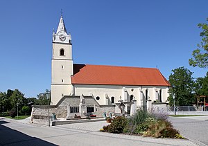
Sankt Margarethen im Burgenland
Place in Burgenland, Austria
Distance: Approx. 440 meters
Latitude and longitude: 47.8,16.6
Sankt Margarethen im Burgenland (Hungarian: Szentmargitbánya) is a town in Burgenland near the state capital of Eisenstadt, in Austria. It is home to a large 1st-century Roman quarry. A passion play has been presented in St Margarethen each summer for over seventy years.
Schützen am Gebirge
Place in Burgenland, Austria
Distance: Approx. 5474 meters
Latitude and longitude: 47.85,16.61666667
Schützen am Gebirge (Hungarian: Sérc, Croatian: Česno) is a municipality in the Eisenstadt-Umgebung district in the Austrian state of Burgenland.

Mörbisch am See
Place in Burgenland, Austria
Distance: Approx. 7327 meters
Latitude and longitude: 47.75,16.66666667
Mörbisch am See (Croatian: Merbiš, Hungarian: Fertőmeggyes) is a town on the shore of Lake Neusiedl in the district of Eisenstadt-Umgebung in the Austrian state of Burgenland.

Oggau am Neusiedler See
Place in Burgenland, Austria
Distance: Approx. 5792 meters
Latitude and longitude: 47.83333333,16.66666667
Oggau am Neusiedler See (Croatian: Cokula, Hungarian: Oka) is a town in the district of Eisenstadt-Umgebung in the Austrian state of Burgenland.

Siegendorf
Place in Burgenland, Austria
Distance: Approx. 5760 meters
Latitude and longitude: 47.78333333,16.53333333
Siegendorf (Croatian: Cindrof, Hungarian: Cinfalva) is a town in the district of Eisenstadt-Umgebung in the Austrian state of Burgenland.

Trausdorf an der Wulka
Place in Burgenland, Austria
Distance: Approx. 4484 meters
Latitude and longitude: 47.81666667,16.55
Trausdorf an der Wulka (Burgenland Croatian: Trajštof, Hungarian: Darázsfalu) is a town in the district of Eisenstadt-Umgebung in the Austrian state of Burgenland. It is on the Wulka river.

Pan-European Picnic
1989 peace demonstration held on the Austrian-Hungarian border near Sopron, Hungary
Distance: Approx. 5074 meters
Latitude and longitude: 47.75722222,16.62222222
The Pan-European Picnic (German: Paneuropäisches Picknick; Hungarian: Páneurópai piknik; Slovak: Paneurópsky piknik; Czech: Panevropský piknik) was a peace demonstration held on the Austrian-Hungarian border near Sopron, Hungary on 19 August 1989. The opening of the border gate between Austria and Hungary at the Pan-European Picnic was an event in the chain reaction, at the end of which Germany reunified, the Iron Curtain fell apart, and the Eastern Bloc disintegrated. The communist governments and the Warsaw Pact subsequently dissolved, ending the Cold War.
Trausdorf Airport
Airport in Austria
Distance: Approx. 3574 meters
Latitude and longitude: 47.79930556,16.55780556
Trausdorf Airport (ICAO: LOAT) was a public use airstrip located 1 km south of Trausdorf an der Wulka, Burgenland, Austria.
St. Georgen am Leithagebirge
Town in Burgenland, Austria
Distance: Approx. 7189 meters
Latitude and longitude: 47.85305556,16.54777778
St. Georgen am Leithagebirge (Lajtaszentgyörgy; Svetojurje) is a town in Burgenland, Austria. It is one of the three districts of Eisenstadt.
Weather in this IP's area
clear sky
15 Celsius
14 Celsius
13 Celsius
16 Celsius
1021 hPa
83 %
1021 hPa
1003 hPa
10000 meters
1.83 m/s
2.32 m/s
335 degree
6 %
06:36:31
18:58:10