Country:
Region:
City:
Latitude and Longitude:
Time Zone:
Postal Code:
IP information under different IP Channel
ip-api
Country
Region
City
ASN
Time Zone
ISP
Blacklist
Proxy
Latitude
Longitude
Postal
Route
Luminati
Country
Region
1
City
gols
ASN
Time Zone
Europe/Vienna
ISP
kabelplus GmbH
Latitude
Longitude
Postal
IPinfo
Country
Region
City
ASN
Time Zone
ISP
Blacklist
Proxy
Latitude
Longitude
Postal
Route
db-ip
Country
Region
City
ASN
Time Zone
ISP
Blacklist
Proxy
Latitude
Longitude
Postal
Route
ipdata
Country
Region
City
ASN
Time Zone
ISP
Blacklist
Proxy
Latitude
Longitude
Postal
Route
Popular places and events near this IP address
Neusiedl am See
Place in Burgenland, Austria
Distance: Approx. 7040 meters
Latitude and longitude: 47.95,16.85
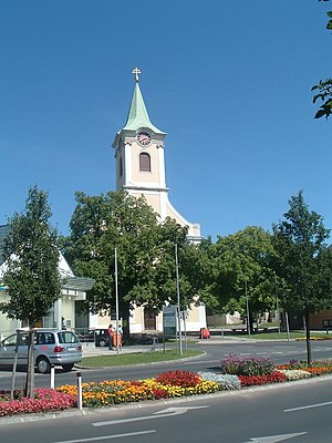
Neusiedl am See (Austrian German: [ˈnɔʏˌsiːdl̩ am ˈseː] ; Czech: Nezider; Croatian: Niuzalj; Hungarian: Nezsider; Slovak: Nezider) is a town in Burgenland, Austria, and administrative center of the district of Neusiedl am See. Neusiedl am See is located on the northern shore of Lake Neusiedl.
Neusiedl am See District
District in Burgenland, Austria
Distance: Approx. 3731 meters
Latitude and longitude: 47.928,16.934
Bezirk Neusiedl am See (Hungarian: Nezsideri járás; Croatian: Kotar Niuzal) is a district of the state of Burgenland in Austria.
Frauenkirchen
Place in Burgenland, Austria
Distance: Approx. 7422 meters
Latitude and longitude: 47.83333333,16.91666667
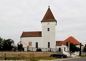
Frauenkirchen (Hungarian: Boldogasszony, Fertőboldogasszony, Fertő-Boldogasszony) is an Austrian town in the district of Neusiedl am See, Burgenland.
Gols (town)
Place in Burgenland, Austria
Distance: Approx. 707 meters
Latitude and longitude: 47.9,16.91666667
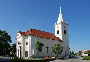
Gols (German pronunciation: [ɡɔls] ; Hungarian: Gálos, Croatian: Gojza, Central Bavarian: Guis or Guüs) is a town in the district of Neusiedl am See in the Austrian state of Burgenland.

Halbturn
Place in Burgenland, Austria
Distance: Approx. 5765 meters
Latitude and longitude: 47.86666667,16.96666667
Halbturn (Hungarian: Féltorony) is a town in the district of Neusiedl am See in the Austrian state of Burgenland. It borders Hungary to the east and is near Andau, Gols, and Mönchof.

Jois
Place in Burgenland, Austria
Distance: Approx. 9762 meters
Latitude and longitude: 47.95,16.8
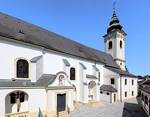
Jois (German pronunciation: [jɔɪ̯s] ; Hungarian: Nyulas) is a small town in the district of Neusiedl am See in Burgenland in Eastern Austria. It is on the northern shore of Lake Neusiedl, which straddles the border with Hungary. The picturesque wine-producing area is popular with tourists, who visit Jois's parish church with its Baroque statues dating back to 1757, the local heritage museum with the district's school museum, wayside shrines, cycling trails, and the wine trail.
Mönchhof
Place in Burgenland, Austria
Distance: Approx. 3678 meters
Latitude and longitude: 47.88333333,16.95
Mönchhof (Hungarian: Barátudvar) is a town in the district of Neusiedl am See in the Austrian state of Burgenland.

Parndorf
Place in Burgenland, Austria
Distance: Approx. 8589 meters
Latitude and longitude: 47.96666667,16.85
Parndorf (Hungarian: Pándorfalu, Croatian: Pandrof) is a town in the district of Neusiedl am See in the Austrian state of Burgenland. Its original ancient name Perun is derived from the Slavic deity Perun.
Podersdorf am See
Place in Burgenland, Austria
Distance: Approx. 7812 meters
Latitude and longitude: 47.85,16.83333333
Podersdorf am See (Hungarian: Pátfalu) is a market town in the district of Neusiedl am See in Burgenland in the east of Austria on the shore of the Neusiedler See. It is home to a windmill and lake (pictured below). The town is a local center of tourism with generous bathing facilities.

Weiden am See
Place in Burgenland, Austria
Distance: Approx. 3566 meters
Latitude and longitude: 47.91666667,16.86666667
Weiden am See (Hungarian: Védeny) is a town in the district of Neusiedl am See in the Austrian state of Burgenland.
Parndorf Plain
Distance: Approx. 5929 meters
Latitude and longitude: 47.95,16.93333333
Parndorf Plain (German: Parndorfer Platte, Hungarian: Parndorfi-fennsík, Pándorfalvi-fennsík, Slovak: Parndorfská plošina), also called Parndorf Heath (German: Parndorfer Heide) in the northern part of Burgenland, Austria, at an altitude of 160–180 m, area approx. 200 square kilometres (77 sq mi), with terraced gravel deposited by the River Danube during the Ice Age, situated between Lake Neusiedl and the Leitha Mountains in the southwest and Lower Leitha in the northeast. An almost treeless plain, it is about 30 metres (98 ft) higher than its surroundings, without any rivers or streams.

Kalvarienberg (nature reserve)
Distance: Approx. 5939 meters
Latitude and longitude: 47.943073,16.860842
Kalvarienberg is a nature monument in Neusiedl am See in the state of Burgenland, Austria. The nature monument covers the steep south-eastern slope of the Parndorf Plain, the Wagram.
Weather in this IP's area
overcast clouds
8 Celsius
5 Celsius
6 Celsius
8 Celsius
1031 hPa
54 %
1031 hPa
1015 hPa
10000 meters
3.2 m/s
4.67 m/s
157 degree
100 %
06:48:10
16:24:10


