Country:
 Austria
Region:
City:
Latitude and Longitude:
Time Zone:
Postal Code:
IP information under different IP Channel
ip-api
Country
Region
City
ASN
Time Zone
ISP
Blacklist
Proxy
Latitude
Longitude
Postal
Route
IPinfo
Country
Region
City
ASN
Time Zone
ISP
Blacklist
Proxy
Latitude
Longitude
Postal
Route
MaxMind
Country
Region
City
ASN
Time Zone
ISP
Blacklist
Proxy
Latitude
Longitude
Postal
Route
Luminati
Country
ATRegion
1
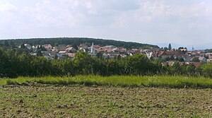
City
oberwart
ASN
Time Zone
Europe/Vienna
ISP
kabelplus GmbH
Latitude
Longitude
Postal
db-ip
Country
Region
City
ASN
Time Zone
ISP
Blacklist
Proxy
Latitude
Longitude
Postal
Route
ipdata
Country
Region
City
ASN
Time Zone
ISP
Blacklist
Proxy
Latitude
Longitude
Postal
Route
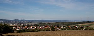
Popular places and events near this IP address
Klingenbach
Place in Burgenland, Austria
Distance: Approx. 3111 meters
Latitude and longitude: 47.75,16.53333333
Klingenbach (Hungarian: Kelénpatak, Croatian: Klimpuh) is a town in the Eisenstadt-Umgebung district in the Austrian state of Burgenland. It is located near the border with Hungary with a border crossing into Sopron.
Eisenstadt-Umgebung District
District in Burgenland, Austria
Distance: Approx. 6759 meters
Latitude and longitude: 47.838,16.54
The Bezirk Eisenstadt-Umgebung (Croatian: Kotar Željezno-okolica; Hungarian: Kismarton Járás) is an administrative district (Bezirk) in the federal state of Burgenland, Austria. The area of the district is 455.5 km2, with a population of 44,787 (2024), and a population density of 99 persons per km2. The administrative center of the district is Eisenstadt (Croatian: Željezno), itself a statutory city outside of the district.
Sankt Margarethen im Burgenland
Place in Burgenland, Austria
Distance: Approx. 5007 meters
Latitude and longitude: 47.8,16.6
Sankt Margarethen im Burgenland (Hungarian: Szentmargitbánya) is a town in Burgenland near the state capital of Eisenstadt, in Austria. It is home to a large 1st-century Roman quarry. A passion play has been presented in St Margarethen each summer for over seventy years.

Siegendorf
Place in Burgenland, Austria
Distance: Approx. 944 meters
Latitude and longitude: 47.78333333,16.53333333
Siegendorf (Croatian: Cindrof, Hungarian: Cinfalva) is a town in the district of Eisenstadt-Umgebung in the Austrian state of Burgenland.

Trausdorf an der Wulka
Place in Burgenland, Austria
Distance: Approx. 4421 meters
Latitude and longitude: 47.81666667,16.55
Trausdorf an der Wulka (Burgenland Croatian: Trajštof, Hungarian: Darázsfalu) is a town in the district of Eisenstadt-Umgebung in the Austrian state of Burgenland. It is on the Wulka river.

Wulkaprodersdorf
Place in Burgenland, Austria
Distance: Approx. 3929 meters
Latitude and longitude: 47.79388889,16.49583333
Wulkaprodersdorf (Croatian: Vulkaprodrštof, Hungarian: Vulkapordány, Vulka-Pordány) is a town in the district of Eisenstadt-Umgebung in the Austrian state of Burgenland.
Zagersdorf
Place in Burgenland, Austria
Distance: Approx. 2247 meters
Latitude and longitude: 47.76666667,16.51666667
Zagersdorf (Croatian: Cogrštof, Hungarian: Zárány) is a town in the district of Eisenstadt-Umgebung in the Austrian state of Burgenland.

Antau
Place in Burgenland, Austria
Distance: Approx. 4560 meters
Latitude and longitude: 47.76666667,16.48333333
Antau (German pronunciation: [ˈantaʊ̯] , Hungarian: Selegszántó, Seleg-Szántó, Croatian: Otava) is a town in the district of Mattersburg in the Austrian state of Burgenland.
Baumgarten, Burgenland
Place in Burgenland, Austria
Distance: Approx. 5825 meters
Latitude and longitude: 47.73333333,16.5
Baumgarten (Hungarian: Sopronkertes, Sopron-Kertes, Croatian: Pajngrt) is a town in the district of Mattersburg in the Austrian state of Burgenland.
Draßburg
Place in Burgenland, Austria
Distance: Approx. 5351 meters
Latitude and longitude: 47.75,16.48333333
Draßburg (Hungarian: Darufalva, Daru-Falva, Croatian: Rasporak) is a town in the district of Mattersburg in the Austrian state of Burgenland. There are numerous members of the Burgenland-Croatian minority in the village.

Pan-European Picnic
1989 peace demonstration held on the Austrian-Hungarian border near Sopron, Hungary
Distance: Approx. 6391 meters
Latitude and longitude: 47.75722222,16.62222222
The Pan-European Picnic (German: Paneuropäisches Picknick; Hungarian: Páneurópai piknik; Slovak: Paneurópsky piknik; Czech: Panevropský piknik) was a peace demonstration held on the Austrian-Hungarian border near Sopron, Hungary on 19 August 1989. The opening of the border gate between Austria and Hungary at the Pan-European Picnic was an event in the chain reaction, at the end of which Germany reunified, the Iron Curtain fell apart, and the Eastern Bloc disintegrated. The communist governments and the Warsaw Pact subsequently dissolved, ending the Cold War.
Trausdorf Airport
Airport in Austria
Distance: Approx. 2713 meters
Latitude and longitude: 47.79930556,16.55780556
Trausdorf Airport (ICAO: LOAT) was a public use airstrip located 1 km south of Trausdorf an der Wulka, Burgenland, Austria.
Weather in this IP's area
clear sky
14 Celsius
14 Celsius
13 Celsius
16 Celsius
1021 hPa
86 %
1021 hPa
1001 hPa
10000 meters
1.67 m/s
1.93 m/s
316 degree
6 %
06:36:46
18:58:25