Country:
Region:
City:
Latitude and Longitude:
Time Zone:
Postal Code:
IP information under different IP Channel
ip-api
Country
Region
City
ASN
Time Zone
ISP
Blacklist
Proxy
Latitude
Longitude
Postal
Route
Luminati
Country
Region
1
City
oberwart
ASN
Time Zone
Europe/Vienna
ISP
kabelplus GmbH
Latitude
Longitude
Postal
IPinfo
Country
Region
City
ASN
Time Zone
ISP
Blacklist
Proxy
Latitude
Longitude
Postal
Route
db-ip
Country
Region
City
ASN
Time Zone
ISP
Blacklist
Proxy
Latitude
Longitude
Postal
Route
ipdata
Country
Region
City
ASN
Time Zone
ISP
Blacklist
Proxy
Latitude
Longitude
Postal
Route
Popular places and events near this IP address
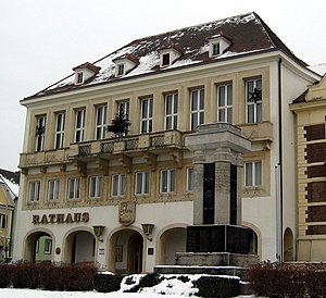
Oberwart
Place in Burgenland, Austria
Distance: Approx. 7221 meters
Latitude and longitude: 47.28333333,16.2
Oberwart (German pronunciation: [ˈoːbɐˌvaʁt] ; Hungarian: Felsőőr; Croatian: Gornja Borta) is a town in Burgenland in southeast Austria on the banks of the Pinka River, and the capital of the district of the same name. With almost 8,000 inhabitants it’s the third largest town in Burgenland, after Eisenstadt and Neusiedl am See. Oberwart is the cultural capital of the small ethnic Hungarian minority in Burgenland, living in the Upper Őrség or Wart microregion.

Pinkafeld
Place in Burgenland, Austria
Distance: Approx. 6669 meters
Latitude and longitude: 47.36666667,16.11666667
Pinkafeld (Hungarian: Pinkafő, Croatian: Pinkafelj, Slovene: Pinkafel, Romani: Pinkafa) is a city in Burgenland in Austria and the second largest settlement (after Oberwart) in the district Oberwart.
Oberwart District
District in Burgenland, Austria
Distance: Approx. 6822 meters
Latitude and longitude: 47.294,16.243
Bezirk Oberwart (Croatian: Kotar Borta; Hungarian: Felsőőr Járás) is a district in the state of Burgenland in Austria. The population of the district, as of 2022, is 54,353. The largest settlements in the district are Oberwart, Pinkafeld and Großpetersdorf.
Bad Tatzmannsdorf
Place in Burgenland, Austria
Distance: Approx. 2960 meters
Latitude and longitude: 47.33333333,16.23333333
Bad Tatzmannsdorf (Hungarian: Tarcsafürdő, Croatian: Tarča) is a municipality in Burgenland in the district of Oberwart in Austria.
Bernstein im Burgenland
Place in Burgenland, Austria
Distance: Approx. 6856 meters
Latitude and longitude: 47.4,16.25
Bernstein (Hungarian: Borostyánkő) is a municipality in Burgenland in the district Oberwart in Austria.
Riedlingsdorf
Place in Burgenland, Austria
Distance: Approx. 5092 meters
Latitude and longitude: 47.35,16.13333333
Riedlingsdorf (Hungarian: Rödöny) is a municipality in Burgenland in the district Oberwart in Austria.

Mariasdorf
Place in Burgenland, Austria
Distance: Approx. 3201 meters
Latitude and longitude: 47.36666667,16.23333333
Mariasdorf (Hungarian: Máriafalva) is a town in the district of Oberwart in the Austrian state of Burgenland.

Oberschützen
Place in Burgenland, Austria
Distance: Approx. 1213 meters
Latitude and longitude: 47.35,16.21666667
Oberschützen (Hungarian: Felsőlövő, Felső-Lövő derived from "Felső"=upper, "Lövő"=shooter) is a town in the district of Oberwart in the Austrian state of Burgenland.

Stadtschlaining
Place in Burgenland, Austria
Distance: Approx. 6084 meters
Latitude and longitude: 47.31666667,16.26666667
Stadtschlaining (Hungarian: Városszalónak, Város-Szalónak) is a town in the district of Oberwart in the Austrian state of Burgenland. The Burg Schlaining, built by Henry I Kőszegi, is located there, which hosts the Austrian Study Centre for Peace and Conflict Resolution (ASPR) and the Peace Museum.
Wiesfleck
Place in Burgenland, Austria
Distance: Approx. 5474 meters
Latitude and longitude: 47.38333333,16.15
Wiesfleck (Hungarian: Újrétfalu) is a town in the district of Oberwart in the Austrian state of Burgenland.
Burg Schlaining
Distance: Approx. 6657 meters
Latitude and longitude: 47.32222222,16.28027778
Burg Schlaining is a castle in Stadtschlaining in the Austrian state of Burgenland. Burg Schlaining is 378 metres (1,240 ft) above sea level. Today, Burg Schlaining is home to the Austrian Study Centre for Peace and Conflict Resolution.

South-east wall
Nazi German fortification and forced labor
Distance: Approx. 7221 meters
Latitude and longitude: 47.28333333,16.2
The South-east wall (German: Südostwall) (also known as Reichsschutzstellung) was a system of fortifications planned by Nazi Germany in the late stages of World War II to extend along the Little Carpathians and Lake Neusiedl southwards to the River Drau. Not a wall in the true sense of the word, the South-east wall was rather a series of German batteries and anti-tank ditches built at strategic locations alongside the southeastern border of the German Reich in 1944/45 with the intention of stopping the Red Army. Thousands of enslaved Hungarian Jews were forced to work on the project.
Weather in this IP's area
scattered clouds
4 Celsius
4 Celsius
2 Celsius
4 Celsius
1032 hPa
70 %
1032 hPa
984 hPa
10000 meters
1.15 m/s
1.22 m/s
246 degree
29 %
06:49:31
16:28:27


