Country:
Region:
City:
Latitude and Longitude:
Time Zone:
Postal Code:
IP information under different IP Channel
ip-api
Country
Region
City
ASN
Time Zone
ISP
Blacklist
Proxy
Latitude
Longitude
Postal
Route
Luminati
Country
Region
1
City
zurndorf
ASN
Time Zone
Europe/Vienna
ISP
kabelplus GmbH
Latitude
Longitude
Postal
IPinfo
Country
Region
City
ASN
Time Zone
ISP
Blacklist
Proxy
Latitude
Longitude
Postal
Route
db-ip
Country
Region
City
ASN
Time Zone
ISP
Blacklist
Proxy
Latitude
Longitude
Postal
Route
ipdata
Country
Region
City
ASN
Time Zone
ISP
Blacklist
Proxy
Latitude
Longitude
Postal
Route
Popular places and events near this IP address
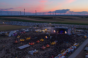
Nova Rock Festival
Music festival in Austria
Distance: Approx. 9911 meters
Latitude and longitude: 47.91205,17.08471
The Nova Rock Festival, also just Nova Rock, is an Austrian rock festival that has existed since 2005 and takes place each year in June. It is located in Burgenland, the easternmost federal state of Austria, near Nickelsdorf and the Hungarian and Slovak borders. It is organized by Nova Music Entertainment, a cooperation between Musicnet, FKP Scorpio and several former employees/bookers of Wiesen, who left Wiesen in 2004.
Neusiedl am See District
District in Burgenland, Austria
Distance: Approx. 8840 meters
Latitude and longitude: 47.928,16.934
Bezirk Neusiedl am See (Hungarian: Nezsideri járás; Croatian: Kotar Niuzal) is a district of the state of Burgenland in Austria.
Kittsee
Place in Burgenland, Austria
Distance: Approx. 9711 meters
Latitude and longitude: 48.06666667,17.06666667
Kittsee (German pronunciation: [kiˈt͡seː] ; Slovak: Kopčany, Hungarian: Köpcsény, Croatian: Gijeca) is an Austrian municipality in the District of Neusiedl am See, Burgenland.
Nickelsdorf
Place in Burgenland, Austria
Distance: Approx. 7191 meters
Latitude and longitude: 47.93333333,17.06666667
Nickelsdorf (Hungarian: Miklóshalma or Miklóshalom, Croatian: Mikištrof) is a town in the district of Neusiedl am See in the Austrian state of Burgenland.

Deutsch Jahrndorf
Place in Burgenland, Austria
Distance: Approx. 7255 meters
Latitude and longitude: 48.01666667,17.1
Deutsch Jahrndorf (German pronunciation: [ˌdɔʏtʃ ˈjaːɐ̯ndɔʁf]; Hungarian: Németjárfalu, Német-Járfalu, Slovak: Nemecké Jarovce) is a municipality in the district of Neusiedl am See, in the Austrian state of Burgenland. It is within a few kilometres of the borders of both Hungary and Slovakia. Deutsch Jahrndorf is the easternmost municipality of Austria, at 17th meridian east, and the easternmost commune of the German Sprachraum since 1945 and the expulsions of the Germans.

Neudorf bei Parndorf
Place in Burgenland, Austria
Distance: Approx. 7908 meters
Latitude and longitude: 48.01666667,16.91666667
Neudorf bei Parndorf (Croatian: Novo Selo, Hungarian: Mosonújfalu) is a village in the district of Neusiedl am See in the Austrian state of Burgenland.

Pama, Austria
Place in Burgenland, Austria
Distance: Approx. 5153 meters
Latitude and longitude: 48.03333333,17.01666667
Pama (German pronunciation: [ˈpaːma] ; Hungarian: Lajtakörtvélyes, Croatian: Bijelo Selo) is a town in the district of Neusiedl am See in the Austrian state of Burgenland.

Potzneusiedl
Place in Burgenland, Austria
Distance: Approx. 8436 meters
Latitude and longitude: 48.05,16.95
Potzneusiedl (Hungarian: Lajtafalu, Croatian: Lajtica) is the smallest village in the district of Neusiedl am See in Burgenland in Austria.
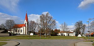
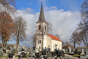
Zurndorf
Place in Burgenland, Austria
Distance: Approx. 2478 meters
Latitude and longitude: 47.96666667,17
Zurndorf (Hungarian: Zurány) is a town in the district of Neusiedl am See in the Austrian state of Burgenland.
Parndorf Plain
Distance: Approx. 7245 meters
Latitude and longitude: 47.95,16.93333333
Parndorf Plain (German: Parndorfer Platte, Hungarian: Parndorfi-fennsík, Pándorfalvi-fennsík, Slovak: Parndorfská plošina), also called Parndorf Heath (German: Parndorfer Heide) in the northern part of Burgenland, Austria, at an altitude of 160–180 m, area approx. 200 square kilometres (77 sq mi), with terraced gravel deposited by the River Danube during the Ice Age, situated between Lake Neusiedl and the Leitha Mountains in the southwest and Lower Leitha in the northeast. An almost treeless plain, it is about 30 metres (98 ft) higher than its surroundings, without any rivers or streams.
Weather in this IP's area
overcast clouds
7 Celsius
4 Celsius
5 Celsius
8 Celsius
1031 hPa
52 %
1031 hPa
1015 hPa
10000 meters
2.94 m/s
3.14 m/s
145 degree
100 %
06:47:59
16:23:30


