194.104.26.68 - IP Lookup: Free IP Address Lookup, Postal Code Lookup, IP Location Lookup, IP ASN, Public IP
Country:
Region:
City:
Location:
Time Zone:
Postal Code:
IP information under different IP Channel
ip-api
Country
Region
City
ASN
Time Zone
ISP
Blacklist
Proxy
Latitude
Longitude
Postal
Route
Luminati
Country
ASN
Time Zone
Europe/Amsterdam
ISP
KPN B.V.
Latitude
Longitude
Postal
IPinfo
Country
Region
City
ASN
Time Zone
ISP
Blacklist
Proxy
Latitude
Longitude
Postal
Route
IP2Location
194.104.26.68Country
Region
overijssel
City
zwolle
Time Zone
Europe/Amsterdam
ISP
Language
User-Agent
Latitude
Longitude
Postal
db-ip
Country
Region
City
ASN
Time Zone
ISP
Blacklist
Proxy
Latitude
Longitude
Postal
Route
ipdata
Country
Region
City
ASN
Time Zone
ISP
Blacklist
Proxy
Latitude
Longitude
Postal
Route
Popular places and events near this IP address

Zwolle
City and municipality in Overijssel, Netherlands
Distance: Approx. 604 meters
Latitude and longitude: 52.51666667,6.1
Zwolle (Dutch: [ˈzʋɔlə] ) is a city and municipality in the Northeastern Netherlands. It is the capital of the province of Overijssel and the province's second-largest municipality, after Enschede, and has a population of 132.441 as of December 2023. Zwolle borders the province of Gelderland and lies on the eastern side of the River IJssel.

Bouches-de-l'Yssel
Distance: Approx. 897 meters
Latitude and longitude: 52.5167,6.0833
Bouches-de-l'Yssel (French: [buʃ.də.li.sɛl]; "Mouths of the IJssel"; Dutch: Monden van de IJssel) was a department of the First French Empire in the present-day Netherlands. It was formed in 1810, when the Kingdom of Holland was annexed by France. Its territory corresponded with the present-day Dutch province of Overijssel.

Windesheim University of Applied Sciences
University in The Netherlands
Distance: Approx. 1694 meters
Latitude and longitude: 52.5,6.08
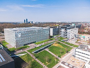
The Windesheim University of Applied Sciences is a public vocational university in Windesheim, The Netherlands. It was founded in 1986 and it's buildings are an example of modern architecture.

Zwollerkerspel
Former municipality in Overijssel, the Netherlands
Distance: Approx. 1329 meters
Latitude and longitude: 52.5086,6.0759
Zwollerkerspel (Low Saxon: Zwollerkärspel) is a former municipality in the province of Overijssel, Netherlands. It covered the countryside around the city of Zwolle. Zwollerkerspel was a separate municipality from 1802 until August 1, 1967, when it became a part of Zwolle, Hasselt, Heino, IJsselmuiden and Genemuiden.

De Librije
Restaurant in Zwolle, Netherlands
Distance: Approx. 400 meters
Latitude and longitude: 52.51538889,6.09777778
De Librije (Dutch pronunciation: [də liˈbrɛiə]) is a restaurant in Zwolle, Netherlands. It is a fine dining restaurant that has been awarded one or more Michelin stars since 1993. It carried one star in the period 1993–1998, two stars in the period 1999-2003 and three stars since 2004.

Zwolle railway station
Railway station in Zwolle, Netherlands
Distance: Approx. 837 meters
Latitude and longitude: 52.50527778,6.09055556
Zwolle is the main railway station of Zwolle in Overijssel, Netherlands. The station opened on 6 June 1864 and is on the Utrecht–Kampen railway, also known as the Centraalspoorweg, the Zwolle–Almelo railway, the Arnhem–Leeuwarden railway, the Zwolle–Stadskanaal railway and the Lelystad–Zwolle railway, also known as the Hanzelijn. The station is a major hub for the Northern Netherlands.

IJsselhallen
Distance: Approx. 970 meters
Latitude and longitude: 52.51138889,6.08027778
IJsselhallen is a convention center located in Zwolle, Netherlands, which has hosted many concerts. It hosted Legoland 2010. IJsselhallen has a floor space of 20,000 m2 and was built in 1972.
Librije's Zusje (Zwolle)
Restaurant in Zwolle, Netherlands
Distance: Approx. 380 meters
Latitude and longitude: 52.51524167,6.0976
Librije's Zusje (English:Librijes little sister) was a restaurant in Zwolle, Netherlands. It was a fine dining restaurant that was awarded one Michelin star in 2009 and retained that rating until 2011. In the period 2012-2014 the restaurant was awarded two stars.

Vrouwenhuis
Distance: Approx. 332 meters
Latitude and longitude: 52.5132,6.089775
The Vrouwenhuis on Melkmarkt 53 in the Dutch city of Zwolle is a former old age home for women. It is now rented as separate apartment units for students, while housing a small museum on the ground floor that is only accessible by special request.

Landstede Sportcentrum
Indoor sports complex in Zwolle, Netherlands
Distance: Approx. 607 meters
Latitude and longitude: 52.5167,6.1
The Landstede Sportcentrum is an indoor sports complex located in Zwolle, Netherlands, which is used as a sports arena and was opened in 2010. It is the home of basketball team Landstede Hammers. The "centre court", which is used by both the club has a capacity of 1,200 people.

Sassenpoort
Gatehouse in Zwolle, Netherlands
Distance: Approx. 303 meters
Latitude and longitude: 52.509722,6.095278
The Sassenpoort (English: Saxon Gate) is a gatehouse in the city wall of Zwolle, the Netherlands. It was built in 1409 out of dimension stone, mostly trachyte and tuff, and restoration work was done in 1893-1898. The gatehouse is a rijksmonument and is part of the Top 100 Dutch heritage sites.

Museum de Fundatie
Art museum in Heino/Wijhe, Netherlands
Distance: Approx. 317 meters
Latitude and longitude: 52.51027778,6.09138889
Museum de Fundatie (Dutch pronunciation: [myˌzeːjʏm də fʏnˈdaː(t)si]) is a museum for the visual arts in Zwolle, Netherlands. Museum de Fundatie forms part of the Hannema-de Stuers Foundation, to which Kasteel het Nijenhuis in Heino also belongs. Museum de Fundatie possesses a collection of visual arts, with works ranging from the end of the Middle Ages until the present day, collected by Dirk Hannema, former director of Museum Boijmans Van Beuningen.
Weather in this IP's area
moderate rain
5 Celsius
0 Celsius
5 Celsius
6 Celsius
1004 hPa
93 %
1004 hPa
1004 hPa
10000 meters
7.99 m/s
14.56 m/s
237 degree
100 %