194.1.2.151 - IP Lookup: Free IP Address Lookup, Postal Code Lookup, IP Location Lookup, IP ASN, Public IP
Country:
Region:
City:
Location:
Time Zone:
Postal Code:
ISP:
ASN:
language:
User-Agent:
Proxy IP:
Blacklist:
IP information under different IP Channel
ip-api
Country
Region
City
ASN
Time Zone
ISP
Blacklist
Proxy
Latitude
Longitude
Postal
Route
db-ip
Country
Region
City
ASN
Time Zone
ISP
Blacklist
Proxy
Latitude
Longitude
Postal
Route
IPinfo
Country
Region
City
ASN
Time Zone
ISP
Blacklist
Proxy
Latitude
Longitude
Postal
Route
IP2Location
194.1.2.151Country
Region
trnavsky kraj
City
velky meder
Time Zone
Europe/Bratislava
ISP
Language
User-Agent
Latitude
Longitude
Postal
ipdata
Country
Region
City
ASN
Time Zone
ISP
Blacklist
Proxy
Latitude
Longitude
Postal
Route
Popular places and events near this IP address
Baloň
Village in Trnava, Slovakia
Distance: Approx. 8109 meters
Latitude and longitude: 47.83333333,17.66666667
Baloň (Hungarian: Balony, pronounced [ˈbɒloɲ]) is a village and municipality in the Dunajská Streda District in the Trnava Region of south-west Slovakia.
Boheľov
Village in Trnava, Slovakia
Distance: Approx. 8308 meters
Latitude and longitude: 47.91666667,17.7
Boheľov (Hungarian: Bögellő, pronounced [ˈbøɡɛlːøː]) is a village and municipality in the Dunajská Streda District in the Trnava Region of south-west Slovakia.
Bodza
Municipality of Slovakia
Distance: Approx. 5534 meters
Latitude and longitude: 47.83,17.83
Bodza (Hungarian: Bogya, Hungarian pronunciation: [ˈboɟɒ]) is a village and municipality in the Komárno District in the Nitra Region of south-west Slovakia.
Holiare
Municipality in Slovakia
Distance: Approx. 4934 meters
Latitude and longitude: 47.83,17.82
Holiare, until 1948 Gelér (Hungarian: Gellér, Hungarian pronunciation:[ˈɡɛlleːr]) is a village and municipality in the Komárno District in the Nitra Region of south-west Slovakia.
Sokolce
Municipality in Slovakia
Distance: Approx. 4657 meters
Latitude and longitude: 47.85,17.83
Sokolce (Hungarian: Lakszakállas, Hungarian pronunciation:[ˈlɒksɒkaːllɒʃ]) is a village and municipality in the Komárno District in the Nitra Region of south-west Slovakia.
Tôň
Municipality in Slovakia
Distance: Approx. 7912 meters
Latitude and longitude: 47.8,17.83
Tôň (pronunciation: [tuoɲ], Hungarian: Tany, Hungarian pronunciation:[ˈtɒɲ]) is a village and municipality in the Komárno District in the Nitra Region of south-west Slovakia.
Lipové
Municipality in Slovakia
Distance: Approx. 6821 meters
Latitude and longitude: 47.83,17.85
Lipové (Hungarian: Zsemlékes, pronounced: [ˈʒɛmleːkɛʃ]), known from 1926 to 1950 as Hodžovo (Hungarian: Hodzsafalva), is a village and municipality in the Komárno District in the Nitra Region of south-west Slovakia.
Brestovec, Komárno District
Municipality in Slovakia
Distance: Approx. 3831 meters
Latitude and longitude: 47.86,17.82
Brestovec (na Ostrove) (Hungarian: Szilas) is a village and municipality in the Komárno District in the Nitra Region of southwest Slovakia.

Čiližská Radvaň
Village in Trnava, Slovakia
Distance: Approx. 6528 meters
Latitude and longitude: 47.83305556,17.68972222
Čiližská Radvaň (Hungarian: Csilizradvány, pronounced [ˈtʃilizrɒdvaːɲ]) is a village and municipality in the Dunajská Streda District in the Trnava Region of south-west Slovakia.
Kľúčovec
Village in Trnava, Slovakia
Distance: Approx. 8077 meters
Latitude and longitude: 47.79444444,17.71666667
Kľúčovec (Hungarian: Kulcsod, pronounced [ˈkultʃod]) is a village and municipality in the Dunajská Streda District in the Trnava Region of south-west Slovakia.
Okoč
Village in Slovakia
Distance: Approx. 4553 meters
Latitude and longitude: 47.88333333,17.81666667
Okoč (Hungarian: Ekecs, pronounced [ˈɛkɛtʃ]) is a village and municipality in the Dunajská Streda District in the Trnava Region of south-west Slovakia.
Veľký Meder
Town in Slovakia
Distance: Approx. 222 meters
Latitude and longitude: 47.85638889,17.77055556
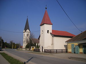
Veľký Meder (1948–1990 Čalovo, Hungarian: Nagymegyer, Yiddish: Magendorf) is a town in the Dunajská Streda District, Trnava Region in southwestern Slovakia.
Weather in this IP's area
clear sky
2 Celsius
1 Celsius
2 Celsius
2 Celsius
1034 hPa
62 %
1034 hPa
1020 hPa
10000 meters
1.57 m/s
1.51 m/s
208 degree
6 %


